

| Date: | Tuesday 8 March 2011 |
| Time: | 11:40 |
| Type: |  de Havilland Canada DHC-6 Twin Otter 100 |
| Owner/operator: | Desert Sand Aircraft Leasing |
| Registration: | N157KM |
| MSN: | 57 |
| Year of manufacture: | 1967 |
| Total airframe hrs: | 16541 hours |
| Cycles: | 20927 flights |
| Engine model: | Pratt & Whitney Canada PT6A-27 |
| Fatalities: | Fatalities: 2 / Occupants: 2 |
| Aircraft damage: | Destroyed, written off |
| Category: | Accident |
| Location: | 1,3 km SW of Clayton County Airport-Tara Field, GA -
 United States of America United States of America
|
| Phase: | Approach |
| Nature: | Test |
| Departure airport: | Clayton County Airport-Tara Field, GA |
| Clayton County Airport-Tara Field, GA | |
| Investigating agency: | NTSB |
| Confidence Rating: |
A DHC-6 Twin Otter skydiving plane was destroyed when it crashed during a local post-maintenance test flight from Clayton County Airport-Tara Field, GA.
The airplane came down in trees and broke up, killing both occupants.
The accident flight was the first flight after both of the airplane's Pratt & Whitney Canada PT6A-20, 550-horsepower engines, were replaced with PT6A-27, 680-horsepower engines. The airplane took off with a pilot and a pilot-rated mechanic on board. Two uneventful touch-and-go landings were completed.
The airplane was then observed flying in the traffic pattern for runway 6. An eyewitness reported that the airplane was "struggling to gain altitude and airspeed." As the airplane turned to line-up with the runway, it "stalled" and descended nose first toward the ground.
The airplane impacted trees in a wooded marsh area, short of the threshold, near the extended centerline of runway 6. The airplane came to rest about 80-degrees vertically and canted about 25-degrees on the right wing.
PROBABLE CAUSE: "The pilot did not maintain airspeed while maneuvering, which resulted in an aerodynamic stall."
Accident investigation:
 |
|
Sources:
NTSB
Location
Images:
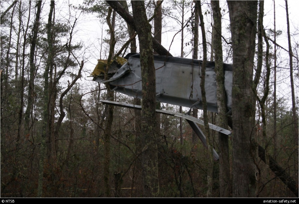
photo (c) NTSB; Clayton County Airport-Tara Field, GA; 08 March 2011; (publicdomain)
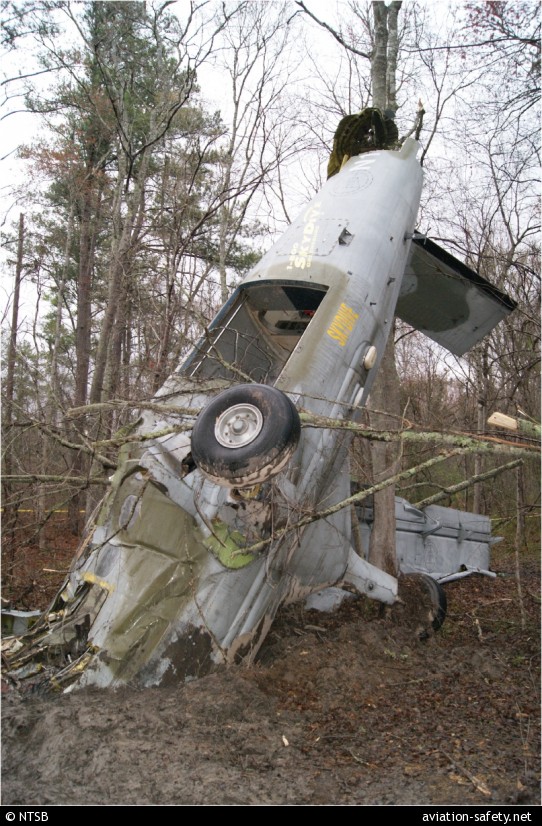
photo (c) NTSB; Clayton County Airport-Tara Field, GA; 08 March 2011; (publicdomain)
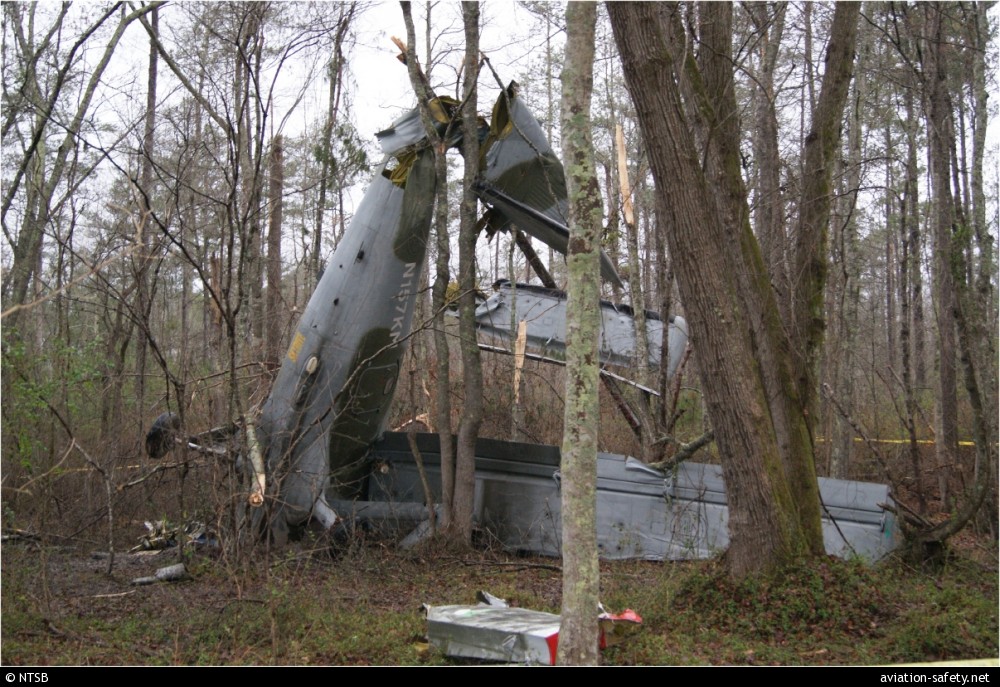
photo (c) NTSB; Clayton County Airport-Tara Field, GA; 08 March 2011; (publicdomain)
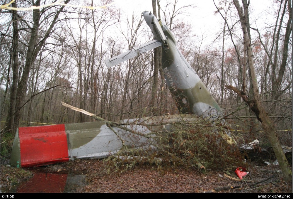
photo (c) NTSB; Clayton County Airport-Tara Field, GA; 08 March 2011; (publicdomain)
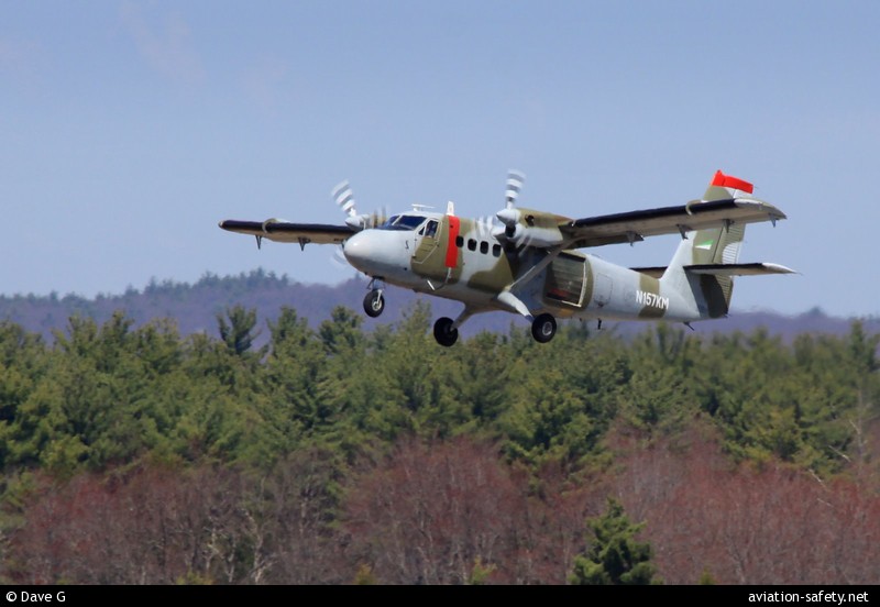
photo (c) Dave G; Orange Municipal Airport, MA (KORE); 25 April 2009
Revision history:
| Date/time | Contributor | Updates |
|---|
The Aviation Safety Network is an exclusive service provided by:
Quick Links:
| ASN Home | Send Correction / Feedback |
| FSF Home | Disclaimer | Copyright |
| Contact Us | Privacy Policy |
| Press / Media |
 ©2024 Flight Safety Foundation