ASN Wikibase Occurrence # 319883
| Date: | Monday 1 May 2017 |
| Time: | 13:50 |
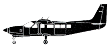
| Type: |  Cessna 208B Grand Caravan |
| Owner/operator: | Grant Aviation |
| Registration: | N803TH |
| MSN: | 208B0321 |
| Year of manufacture: | 1992 |
| Total airframe hrs: | 17990 hours |
| Engine model: | Pratt & Whitney Canada PT6A-114A |
| Fatalities: | Fatalities: 1 / Occupants: 1 |
| Aircraft damage: | Destroyed, written off |
| Category: | Accident |
| Location: | Chignik, AK -
 United States of America United States of America
|
| Phase: | En route |
| Nature: | Passenger - Scheduled |
| Departure airport: | Port Heiden Airport, AK (PTH/PAPH) |
| Perryville Airport, AK (KPV/PAPE) | |
| Investigating agency: | NTSB |
| Confidence Rating: |
A Cessna 208B Grand Caravan airplane, N803TH, sustained substantial damage after impacting steep, mountainous terrain about 8 miles south of Chignik Lake Airport, Alaska. The airplane was being operated as Flight 341 by Grant Aviation as a scheduled commuter flight. The pilot, the sole occupant, sustained fatal injuries. Visual meteorological conditions prevailed at the airplane's point of departure. Flight 341 departed Port Heiden Airport, Alaska, at 13:05, destined for Perryville Airport, Perryville, Alaska.
Flight 341 originated at the King Salmon Airport, Alaska, with one passenger who disembarked at the Port Heiden Airport. The scheduled flight continued to the Perryville Airport, which was about 80 miles away, with 1,322 lbs. of mail and no passengers.
After an ELT signal of the aircraft was received, a search mission was initiated. At 17:30, the wreckage was located.
The wreckage came to rest in deep snow at about 2,993 feet on the west face of a treeless, steep mountain in the Alaska Peninsula National Wildlife Refuge of the Aleutian Range. It is located about 500 feet from the top of the mountain ridge and partially submerged in the snow on its left side with the nose section under the snow pack. The fragmented wreckage was contained in an area of about 100 feet by 40 feet, on a heading of about 030 ° magnetic, with the right wing separated and located about 40 feet forward of the main wreckage. The wings and fuselage sustained substantial damage.
At 12:39, an aviation special weather report (SPECI) from the Chignik Airport (the closest weather reporting facility) reported, in part: wind variable at 4 knots; visibility 10 statute miles, light rain; sky condition, overcast at 1,700 feet; temperature 39 ° F, dewpoint 36 ° F; altimeter, 29.51 inHg.
Probable Cause: "The pilot's continued visual flight rules flight into an area of mountainous terrain and instrument meteorological conditions, which resulted in controlled flight into terrain (CFIT). Contributing to the accident was the company's failure to provide the pilot with CFIT-avoidance recurrent simulator training as required by their CFIT avoidance program and the company's inadequate flight risk assessment processes, which did not account for the known weather hazards relevant to the accident route of flight."
Accident investigation:
 |
|
Sources:
FAA
KTVA
NTSB
Location
Images:

photo (c) Alaska State Troopers; near Chignik, AK; 03 May 2017

photo (c) NTSB; near Chignik, AK; May 2017; (publicdomain)
Revision history:
| Date/time | Contributor | Updates |
|---|
The Aviation Safety Network is an exclusive service provided by:


 ©2024 Flight Safety Foundation