

ASN Wikibase Occurrence # 144891
This information is added by users of ASN. Neither ASN nor the Flight Safety Foundation are responsible for the completeness or correctness of this information.
If you feel this information is incomplete or incorrect, you can submit corrected information.
| Date: | Sunday 8 April 2012 |
| Time: | 06:55 |
| Type: |  Extra EA-300 |
| Owner/operator: | Private |
| Registration: | N45R |
| MSN: | 045 |
| Total airframe hrs: | 1281 hours |
| Engine model: | Lycoming AEIO-540 SER |
| Fatalities: | Fatalities: 2 / Occupants: 2 |
| Aircraft damage: | Substantial |
| Category: | Accident |
| Location: | near Salinas Municipal Airport (SNS/KSNS), CA -
 United States of America United States of America
|
| Phase: | Manoeuvring (airshow, firefighting, ag.ops.) |
| Nature: | Private |
| Departure airport: | Salinas Municipal Airport, CA (KSNS) |
| Salinas Municipal Airport, CA (KSNS) | |
| Investigating agency: | NTSB |
| Confidence Rating: |
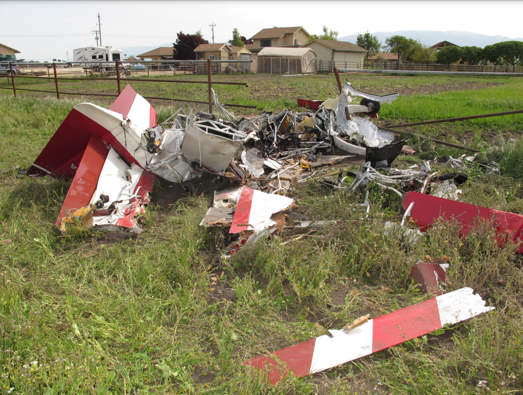
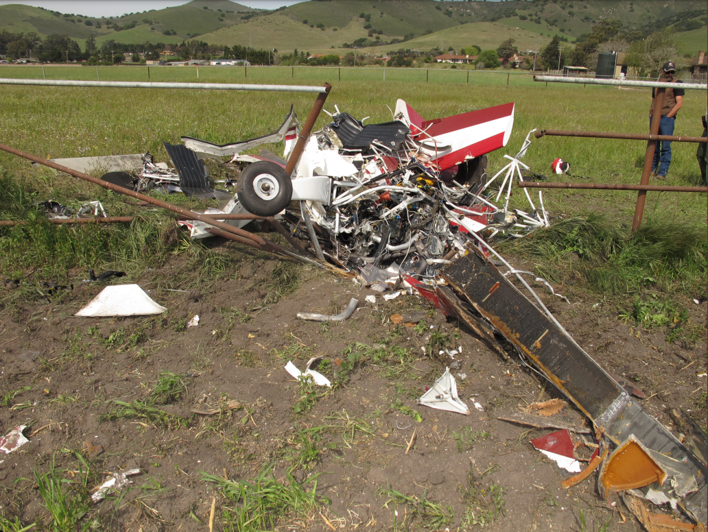
Radar data recorded the airplane operating between 3,500 feet and 1,500 feet mean sea level. Two witnesses observed the airplane performing aerobatics. One witness stated that he observed the airplane perform two chandelles over the foothills north of his house, then the airplane turned south heading into an open valley. The airplane completed two aileron rolls and was halfway into a third roll when the nose pitched down, then pitched up, and the airplane rolled so that one wing was pointing down. The airplane then simultaneously rolled inverted and pitched down entering a very rapid descent into the ground. The witness stated that the engine was operating at what sounded like full power throughout the event.
On-scene examination determined that the airplane impacted the ground with the left wing down and a 30-degree nose-down pitch. The wreckage examination identified a loose, puck-like, 4.5-inch diameter portable XM-GPS antenna in the empennage tail space that houses the elevator bell crank. The antenna had a 9-mm diameter semicircular indentation witness mark that was consistent in shape and size to the end of a 9-mm diameter bolt that attaches the forward spar of the vertical stabilizer to the fuselage frame, located directly above the elevator bell crank. The antenna location and associated witness mark indicate that the unsecured antenna migrated to the tail section of the airplane and obstructed the free movement of the elevator bell crank, limiting the pilot’s ability to control the airplane in pitch. The pilot had opened a weather service account linked through the XM-GPS antenna about 1 week before the accident. The GPS unit intended for use with the XM-GPS antenna was not located with the wreckage.
Probable Cause: A loose portable XM-GPS antenna that migrated to the tail section of the airplane and jammed the elevator bell crank. Contributing to the accident was the pilot’s failure to account for the cockpit portable GPS antenna during preflight or postflight inspection.
Accident investigation:
 |
|
Sources:
NTSB
Location
Images:

Photos(c): NTSB
Revision history:
| Date/time | Contributor | Updates |
|---|---|---|
| 09-Apr-2012 07:31 | RobertMB | Added |
| 09-Apr-2012 08:04 | Geno | Updated [Source] |
| 09-Apr-2012 12:49 | Alpine Flight | Updated [Aircraft type, Narrative] |
| 09-Apr-2012 14:49 | RobertMB | Updated [Aircraft type, Narrative] |
| 17-Apr-2012 09:21 | Geno | Updated [Time, Aircraft type, Source] |
| 16-Feb-2013 14:26 | Alpine Flight | Updated [Aircraft type, Narrative] |
| 23-Oct-2014 17:24 | Alpine Flight | Updated [Time, Aircraft type, Location] |
| 21-Dec-2016 19:28 | ASN Update Bot | Updated [Time, Damage, Category, Investigating agency] |
| 27-Nov-2017 20:37 | ASN Update Bot | Updated [Operator, Other fatalities, Departure airport, Destination airport, Source, Narrative] |
| 11-Mar-2022 16:09 | Captain Adam | Updated [Other fatalities, Location, Departure airport, Destination airport, Narrative, Photo] |
| 11-Mar-2022 16:10 | Captain Adam | Updated [Photo] |
| 11-Mar-2022 16:10 | Captain Adam | Updated [Photo] |
Corrections or additions? ... Edit this accident description
The Aviation Safety Network is an exclusive service provided by:
Quick Links:
| ASN Home | Send Correction / Feedback |
| FSF Home | Disclaimer | Copyright |
| Contact Us | Privacy Policy |
| Press / Media |
 ©2024 Flight Safety Foundation