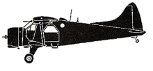
ASN Wikibase Occurrence # 145620
This information is added by users of ASN. Neither ASN nor the Flight Safety Foundation are responsible for the completeness or correctness of this information.
If you feel this information is incomplete or incorrect, you can submit corrected information.
| Date: | Sunday 13 May 2012 |
| Time: | 18:45 LT |
| Type: |  de Havilland Canada DHC-2 Beaver |
| Owner/operator: | private |
| Registration: | C-GCZA |
| MSN: | 1667 |
| Year of manufacture: | 1966 |
| Fatalities: | Fatalities: 3 / Occupants: 3 |
| Aircraft damage: | Destroyed |
| Category: | Accident |
| Location: | near Brenda Mines, BC -
 Canada Canada
|
| Phase: | En route |
| Nature: | Private |
| Departure airport: | Okanagan Lake, BC |
| Pitt Meadows, BC | |
| Investigating agency: | TSB |
| Confidence Rating: |
Lake While enroute, the aircraft struck trees and collided with terrain close to and 100 feet below the level of Highway 97C, near the Brenda Mines tailings hill.
Findings as to causes and contributing factors:
1. The combination of relatively high weight, effects of density altitude, and down-flowing air likely reduced the climb performance of the aircraft, resulting in the aircraft’s altitude being lower than anticipated at that stage in the flight.
2. The pilot’s vision was likely impaired by the sun, and the pilot may have been exposed to visual illusions; both were factors that contributed to the pilot not noticing the trees and the rising terrain, and colliding with them.
Findings as to risk:
1. Visual illusions cause false impressions or misconceptions of actual conditions. Unrecognized and uncorrected spatial disorientation, caused by illusions, carries a high risk of incident or accident.
2. When there are no special departure procedures published for airports in mountainous regions surrounded by high terrain, there is a risk of pilots departing the valley at an altitude too low for terrain clearance.
Accident investigation:
 |
|
Sources:
http://tsb.gc.ca/eng/rapports-reports/aviation/2012/A12P0070/A12P0070.asp
[LINK NOT WORKING ANYMORE:http://www.kelownadailycourier.ca/front-page-news/5-feared-dead-as-float-plane-crashes-near-brenda-mines.html]
http://web.archive.org/web/20120618114028/http://www.cbc.ca:80/news/canada/british-columbia/story/2012/05/14/bc-plane-crash.html?cmp=rss
https://www.huffingtonpost.ca/2012/05/14/float-plane-crash-bc_n_1513686.html
http://www.globaltvbc.com/three+victims+confirmed+dead+in+float+plane+crash+near+kelowna/6442640381/story.html
History of this aircraft
Other occurrences involving this aircraft
| 15 July 1998 | C-GCZA | Air Rainbow Midcoast | Saturna Island, British Columbia |  |
||
| Loss of control | ||||||
Revision history:
| Date/time | Contributor | Updates |
|---|---|---|
| 13-May-2012 23:53 | gerard57 | Added |
| 13-May-2012 23:54 | gerard57 | Updated [Narrative] |
| 14-May-2012 01:07 | gerard57 | Updated [Source, Narrative] |
| 14-May-2012 02:29 | TB | Updated [Aircraft type, Registration] |
| 14-May-2012 03:12 | Anon. | Updated [[Aircraft type, Registration]] |
| 14-May-2012 04:02 | Anon. | Updated [Location] |
| 14-May-2012 10:46 | gerard57 | Updated [Source, Narrative] |
| 14-May-2012 13:28 | Anon. | Updated [Registration, Cn] |
| 14-May-2012 13:53 | Alpine Flight | Updated [Time] |
| 09-Aug-2013 19:07 | harro | Updated [Departure airport, Destination airport, Source, Narrative] |
| 19-Feb-2014 16:59 | TB | Updated [Operator, Location] |
Corrections or additions? ... Edit this accident description
The Aviation Safety Network is an exclusive service provided by:


 ©2024 Flight Safety Foundation