

ASN Wikibase Occurrence # 173165
This information is added by users of ASN. Neither ASN nor the Flight Safety Foundation are responsible for the completeness or correctness of this information.
If you feel this information is incomplete or incorrect, you can submit corrected information.
| Date: | Tuesday 20 January 2015 |
| Time: | 20:05 |
| Type: |  Beechcraft 36 Bonanza |
| Owner/operator: | Private |
| Registration: | N999CJ |
| MSN: | E-80 |
| Year of manufacture: | 1968 |
| Fatalities: | Fatalities: 2 / Occupants: 2 |
| Aircraft damage: | Destroyed |
| Category: | Accident |
| Location: | near Mountain Pass, CA -
 United States of America United States of America
|
| Phase: | En route |
| Nature: | Private |
| Departure airport: | California City Municipal Airport, CA (L71) |
| Las Vegas-Henderson Sky Harbor Airport, NV (HSH/KHND) | |
| Investigating agency: | NTSB |
| Confidence Rating: |
On January 20, 2015, about 2005 Pacific standard time (PST), a Beech 36, N999CJ, departed cruise flight and impacted desert terrain near Mountain Pass, California. The commercial pilot and one passenger were fatally injured; the airplane was destroyed by impact forces. The airplane was registered to and operated by the pilot as a 14 Code of Federal Regulations Part 91 personal cross-country flight. Night visual meteorological (VMC) conditions prevailed in the area, and no flight plan had been filed. The flight departed California City Municipal Airport (L71), California City, California, about 1910 with a planned destination of Henderson Executive Airport (HND), Henderson, Nevada.
The commercial pilot and one passenger departed on a cross-country flight in dark night visual meteorological conditions to return to their home airport. The pilot established contact with air traffic control (ATC) and climbed the airplane to a cruise altitude of 7,500 ft mean sea level (msl) over sparsely-populated, desert terrain. About 40 minutes into the flight, an ATC controller advised the pilot that the airplane would be passing through an area of known poor radar coverage and that radar contact would be reestablished in several minutes. The pilot acknowledged. Radar data indicated that radar contact was lost for about 7 minutes then was reestablished for about 1 minute before contact was lost again at an altitude of 7,400 ft msl. About 10 minutes after the final loss of radar contact, the ATC controller attempted to advise the pilot that radar contact had not yet been restored; however, the pilot did not respond, and subsequent attempts to contact the pilot were unsuccessful. Despite the loss of radar contact, the pilot would have been able to contact ATC via radio throughout this area; there were no distress calls from the accident airplane. The wreckage was located the next day about 0.4 nm from the airplane's last radar return.
The wreckage was heavily fragmented, consistent with a high-speed impact. Examination of the airframe and engine revealed no anomalies that would have precluded normal operation.
A family member reported that the pilot had an appointment scheduled at home the next day, so he likely felt some pressure to make the flight even though he typically did not fly at night. Although the pilot was instrument-rated, review of his personal logbook revealed no evidence of recent night or instrument flight experience. Autopsy and toxicology testing did not reveal any evidence of a medical condition that would have affected the pilot's ability to operate the airplane safely. The dark night conditions, lack of ground lighting in the area of the accident site, and the pilot's lack of recent night and instrument flight experience would have increased the pilot's susceptibility to spatial disorientation, which could have contributed to a loss of control; however, based on the lack of available information about the airplane's final moments of flight, a reason for the loss of control could not be determined.
Probable Cause: An in-flight loss of control for reasons that could not be determined based on available information.
Accident investigation:
 |
|
Sources:
NTSB
Location
Images:
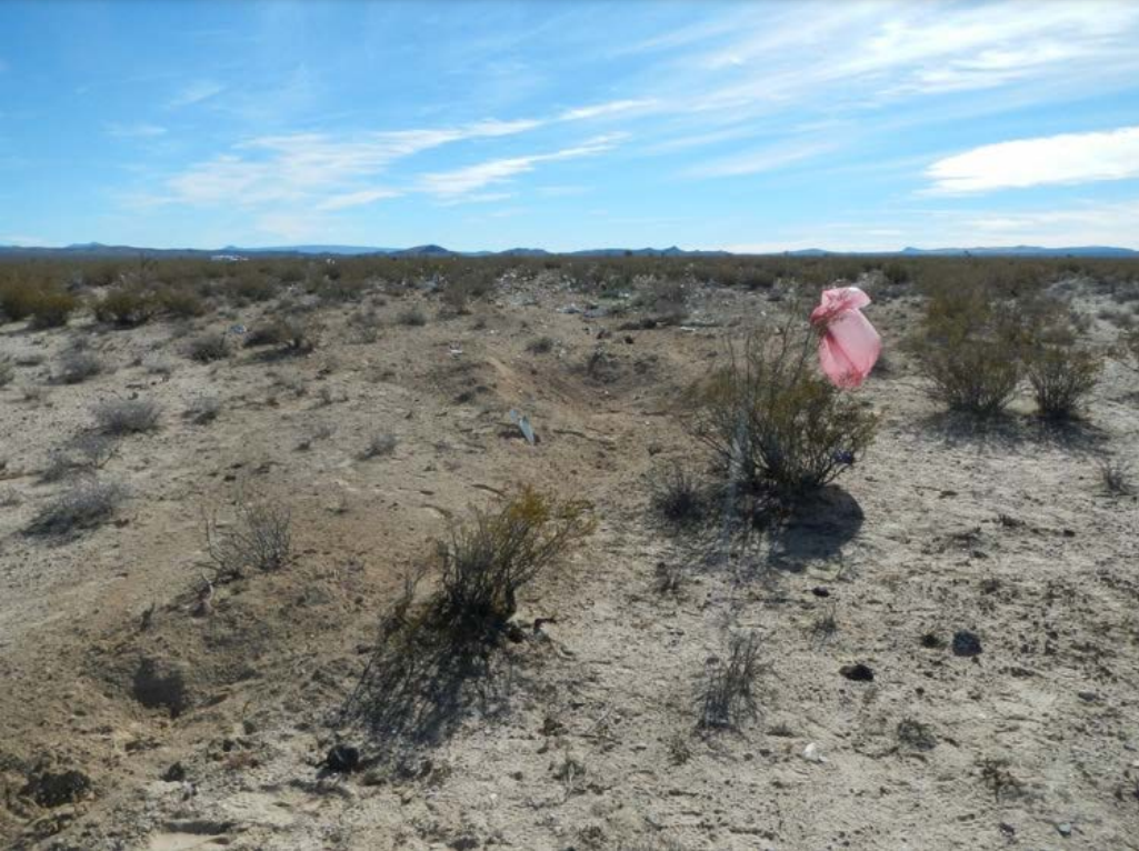
Photo: NTSB
Revision history:
| Date/time | Contributor | Updates |
|---|---|---|
| 21-Jan-2015 15:58 | gerard57 | Added |
| 21-Jan-2015 16:36 | Geno | Updated [Cn, Location, Departure airport, Destination airport, Source, Narrative] |
| 22-Jan-2015 04:26 | Geno | Updated [Total occupants, Location, Source, Narrative] |
| 22-Jan-2015 16:58 | Geno | Updated [Total fatalities, Other fatalities, Source, Damage, Narrative] |
| 30-Jan-2015 23:59 | Geno | Updated [Time, Location, Source, Narrative] |
| 21-Dec-2016 19:28 | ASN Update Bot | Updated [Time, Damage, Category, Investigating agency] |
| 17-May-2017 16:25 | PiperOnslaught | Updated [Source, Narrative] |
| 19-Aug-2017 14:59 | ASN Update Bot | Updated [Other fatalities, Departure airport, Destination airport, Source, Narrative] |
| 12-Aug-2020 01:41 | Captain Adam | Updated [Aircraft type, Other fatalities, Location] |
| 11-Sep-2022 17:06 | Captain Adam | Updated [Location, Departure airport, Destination airport, Narrative, Photo] |
| 11-Sep-2022 17:06 | Captain Adam | Updated [Destination airport] |
Corrections or additions? ... Edit this accident description
The Aviation Safety Network is an exclusive service provided by:
Quick Links:
| ASN Home | Send Correction / Feedback |
| FSF Home | Disclaimer | Copyright |
| Contact Us | Privacy Policy |
| Press / Media |
 ©2024 Flight Safety Foundation