

ASN Wikibase Occurrence # 225435
This information is added by users of ASN. Neither ASN nor the Flight Safety Foundation are responsible for the completeness or correctness of this information.
If you feel this information is incomplete or incorrect, you can submit corrected information.
| Date: | Friday 24 May 2019 |
| Time: | 11:16 |
| Type: |  Cirrus SR22 GTS |
| Owner/operator: | Tierra Grande Aviation LLC |
| Registration: | N809SR |
| MSN: | 2129 |
| Year of manufacture: | 2006 |
| Total airframe hrs: | 2672 hours |
| Engine model: | Continental IO-550-N |
| Fatalities: | Fatalities: 2 / Occupants: 2 |
| Aircraft damage: | Destroyed |
| Category: | Accident |
| Location: | Grover, UT -
 United States of America United States of America
|
| Phase: | En route |
| Nature: | Private |
| Departure airport: | Moab-Canyonlands Field, UT (CNY/KCNY) |
| Las Vegas-Henderson Sky Harbor Airport, NV (HSH/KHND) | |
| Investigating agency: | NTSB |
| Confidence Rating: |
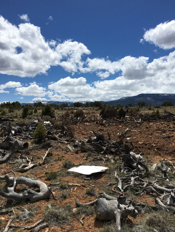
The pilot departed on an instrument flight rules cross-country flight and climbed to a cruise altitude of 14,000 ft mean sea level (msl). About 30 minutes into the flight, he requested a climb to 16,000 ft msl. Radar data indicated that over the next several minutes, the airplane climbed to 14,500 ft, then began an increasingly rapid descent as its groundspeed decayed from about 111 knots (kts) to about 64 kts before radar contact was lost. Witnesses reported that they heard the airplane and looked up to see it descending nose down like a corkscrew before it impacted terrain. Postaccident examination of the airframe and engine did not reveal any anomalies that would have precluded normal operation.
AIRMET Zulu for moderate icing conditions was valid for the area of the accident site at the time of the accident, and an atmospheric sounding supported the likely formation of moderate rime and mixed-type icing in the area. The sounding also indicated the potential for supercooled large droplet icing formation near the top of the cloud layer near 15,000 ft msl. Satellite imagery depicted cumulus and cumulus congestus type clouds with vertical development over the flight track and accident site, and weather radar imagery depicted the airplane entering an area of light-to-moderate intensity echoes just before radar contact was lost. Immediately before and after the accident, two other aircraft operating at similar altitudes reported encountering light clear to mixed icing conditions. The pilot had received preflight weather information containing the relevant forecasts and advisories. In addition, the airplane was equipped with a TKS ice protection system, but it was heavily fragmented during the accident sequence and the investigation was unable to determine if the system was activated or working at the time of the accident.
It is likely that, during the last minutes of the flight, the airplane encountered moderate-to-severe icing conditions, which adversely affected the airplane's handling characteristics and likely resulted in a loss of control.
Probable Cause: The pilot's encounter with moderate to severe icing conditions during cruise flight, which resulted in structural icing and a subsequent loss of control. Contributing to the accident was the pilot’s decision to continue a flight route through known moderate to severe icing conditions.
Accident investigation:
 |
|
Sources:
https://www.deseretnews.com/article/900072373/two-killed-in-southern-utah-plane-crash.html
https://www.abc4.com/news/local-news/two-dead-after-small-plane-crash-in-wayne-county/2025556887
https://fox13now.com/2019/05/24/two-dead-plane-crash-near-capitol-reef-escalante/
https://www.ksl.com/article/46559518/2-dead-in-wayne-county-plane-crash
https://www.flightradar24.com/data/aircraft/n809sr#20a1f59e
https://flightaware.com/live/flight/N809SR/history/20190524/1630Z/KCNY/KHND
http://www.coyotehillconsulting.com/people/wesley/flying/aircraft/ViewAircraft.php?tail=N809SR&make=Cirrus&model=SR22&cn=&cc=Airplane%20Single-engine%20Land&icao=SR22 (photo)
NTSB
Location
Images:
Photo(c): NTSB
Media:
A plane crash in Wayne County this morning resulted in the death of both occupants.https://t.co/q3WJJ0GCiB
— KSL 5 TV (@KSL5TV) 24 mai 2019
Revision history:
| Date/time | Contributor | Updates |
|---|---|---|
| 25-May-2019 00:04 | Captain Adam | Added |
| 25-May-2019 00:06 | Captain Adam | Updated [Time, Aircraft type, Source] |
| 25-May-2019 04:28 | Iceman 29 | Updated [Total occupants, Embed code, Narrative] |
| 25-May-2019 06:33 | RobertMB | Updated [Phase, Nature, Source, Embed code, Narrative] |
| 26-May-2019 07:34 | sdbeach | Updated [Registration, Cn, Departure airport, Destination airport, Source] |
| 26-May-2019 08:49 | RobertMB | Updated [Aircraft type, Operator, Source, Narrative] |
| 19-Jun-2019 05:19 | Iceman 29 | Updated [Source, Narrative] |
| 13-Mar-2022 03:54 | Captain Adam | Updated [Time, Location, Source, Narrative, Category, Accident report, Photo] |
Corrections or additions? ... Edit this accident description
The Aviation Safety Network is an exclusive service provided by:
Quick Links:
| ASN Home | Send Correction / Feedback |
| FSF Home | Disclaimer | Copyright |
| Contact Us | Privacy Policy |
| Press / Media |
 ©2024 Flight Safety Foundation