

ASN Wikibase Occurrence # 228152
This information is added by users of ASN. Neither ASN nor the Flight Safety Foundation are responsible for the completeness or correctness of this information.
If you feel this information is incomplete or incorrect, you can submit corrected information.
| Date: | Sunday 11 August 2019 |
| Time: | 10:28 |
| Type: |  Lancair IV |
| Owner/operator: | Private |
| Registration: | N350CL |
| MSN: | 021 |
| Year of manufacture: | 1996 |
| Total airframe hrs: | 1358 hours |
| Engine model: | Continental TSIO-550 |
| Fatalities: | Fatalities: 2 / Occupants: 2 |
| Aircraft damage: | Destroyed |
| Category: | Accident |
| Location: | Kooskia, ID -
 United States of America United States of America
|
| Phase: | En route |
| Nature: | Private |
| Departure airport: | Polson Airport, MT (8S1) |
| Sacramento, CA | |
| Investigating agency: | NTSB |
| Confidence Rating: |
The pilot departed on a visual flight rules cross-country flight. A review of radar data revealed that the airplane began to climb from its previously established cruise altitude of around 10,800 ft mean sea level (msl) to 13,500 ft msl. During the climb, the groundspeed decayed from about 215 knots to 79 knots and continued to decay as the airplane subsequently entered a rapid, left-turning descent that continued until ground contact. The airplane was largely consumed by a postcrash fire, but examination revealed no evidence of any mechanical malfunctions or anomalies that would have precluded normal operation. The pilot was not in communication with air traffic control during the flight.
Around the time the airplane began to climb, it entered an area of light-to-heavy precipitation and likely reduced visbility. A model atmospheric sounding for the area of the accident site revealed a potential for icing above 14,000 ft msl and the likely presence of updrafts and downdrafts. Witnesses near the accident site reported heavy rain and lightning around the time of the accident. Whether or to what extent the pilot obtained preflight weather information could not be determined, and there was no record of the pilot receiving a weather briefing for the flight from an access-controlled source.
Although the pilot was instrument rated and his logbook indicated that he had completed 28 instrument approaches within the 10 months before the accident, he did not record any actual or simulated instrument flight experience during that time, and his instrument proficiency could not be determined. The airplane’s loss of airspeed throughout the climb and its subsequent rapid descent without an associated increase in airspeed suggest that the airplane entered an aerodynamic stall/spin that continued until impact.
Probable Cause: The pilot’s failure to maintain airspeed while maneuvering in an area of precipitation and reduced visibility, which resulted in an aerodynamic stall and spin and loss of airplane control.
Accident investigation:
 |
|
Sources:
https://lcvalley.dailyfly.com/Home/ArtMID/1352/ArticleID/53371/Determination-of-Sunday-Plane-Crash-Victims-Pending-Federal-Agency-Investigation
NTSB
https://registry.faa.gov/aircraftinquiry/NNum_Results.aspx?NNumbertxt=350CL
http://www.airport-data.com/aircraft/photo/000857223.html (photo)
Location
Images:
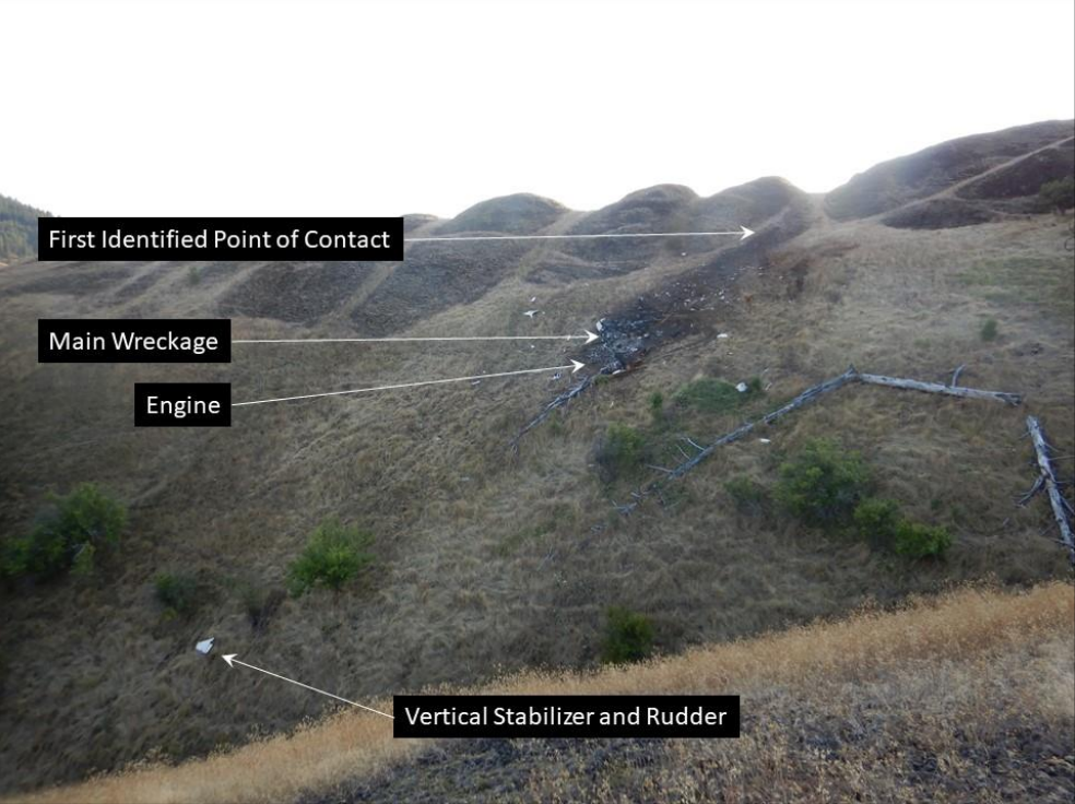
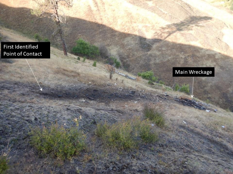
Photos: NTSB
Revision history:
| Date/time | Contributor | Updates |
|---|---|---|
| 12-Aug-2019 23:26 | Captain Adam | Added |
| 13-Aug-2019 03:51 | RobertMB | Updated [Registration, Cn, Operator, Total fatalities, Total occupants, Other fatalities, Phase, Nature, Source, Narrative] |
| 13-Aug-2019 03:52 | RobertMB | Updated [Aircraft type] |
| 13-Aug-2019 12:14 | Captain Adam | Updated [Total fatalities, Total occupants, Source, Narrative] |
| 20-May-2022 21:09 | Captain Adam | Updated [Time, Location, Departure airport, Destination airport, Source, Narrative, Category, Accident report, Photo] |
| 20-May-2022 21:10 | Captain Adam | Updated [Photo] |
Corrections or additions? ... Edit this accident description
The Aviation Safety Network is an exclusive service provided by:
Quick Links:
| ASN Home | Send Correction / Feedback |
| FSF Home | Disclaimer | Copyright |
| Contact Us | Privacy Policy |
| Press / Media |
 ©2024 Flight Safety Foundation