

ASN Wikibase Occurrence # 232084
This information is added by users of ASN. Neither ASN nor the Flight Safety Foundation are responsible for the completeness or correctness of this information.
If you feel this information is incomplete or incorrect, you can submit corrected information.
| Date: | Saturday 11 January 2020 |
| Time: | c. 18:01 |
| Type: |  Cessna TR182 Turbo Skylane RG |
| Owner/operator: | Marginal Aviation LLC |
| Registration: | N736YU |
| MSN: | R18200792 |
| Year of manufacture: | 1978 |
| Total airframe hrs: | 3101 hours |
| Engine model: | Lycoming Engines O-540-L3C5D |
| Fatalities: | Fatalities: 4 / Occupants: 4 |
| Aircraft damage: | Destroyed |
| Category: | Accident |
| Location: | Billings, MT -
 United States of America United States of America
|
| Phase: | En route |
| Nature: | Private |
| Departure airport: | Big Horn County Airport, MT (00U) |
| Roundup Airport, MT (RPX/KRPX) | |
| Investigating agency: | NTSB |
| Confidence Rating: |
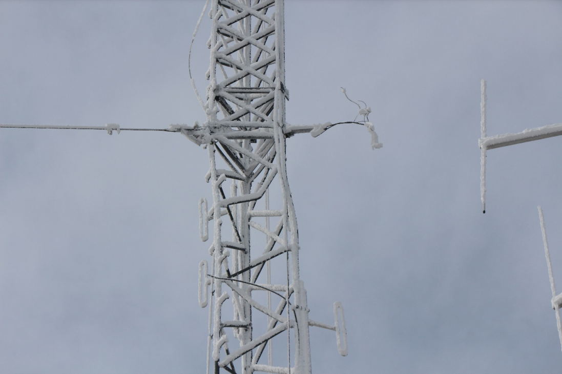
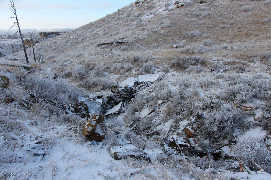
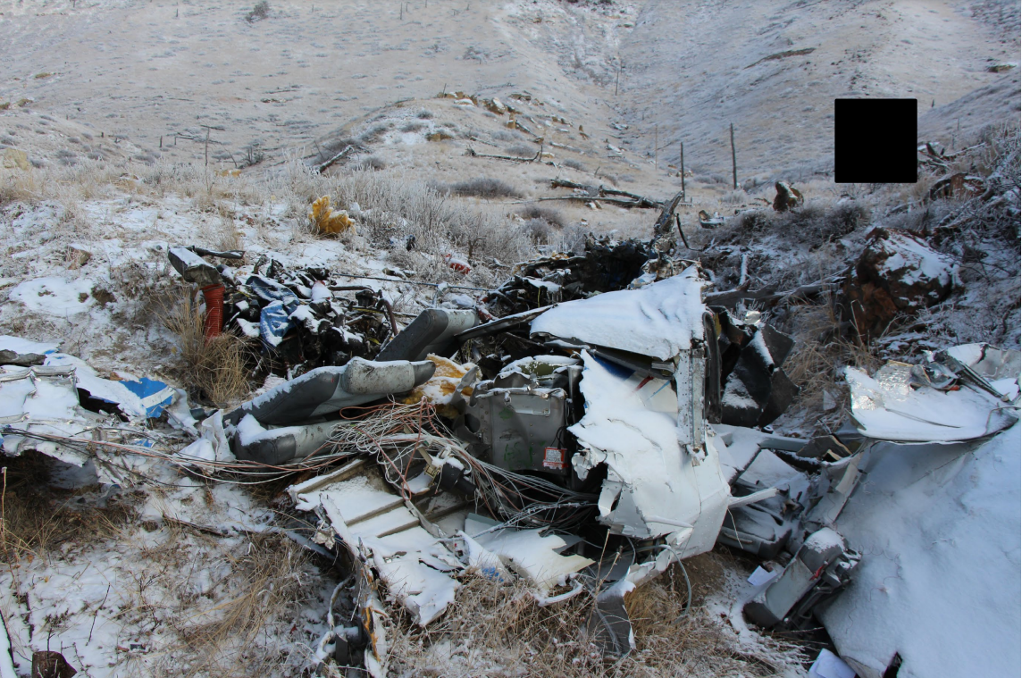
The pilot departed with three passengers to the northwest on a flight at night, without any clouds and good visibility at the pilot’s planned cruise altitudes. The airplane leveled off about 4,792 ft mean sea level (msl) and maintained a similar altitude and height above terrain between 1,400 ft and 2,100 ft above ground level (agl) for most of the flight. The terrain elevation increased in the airplane’s final 40 seconds of flight. The airplane was about 65 ft agl (4,809 ft msl) when it impacted a tower. All occupants were fatally injured, and the airplane was destroyed.
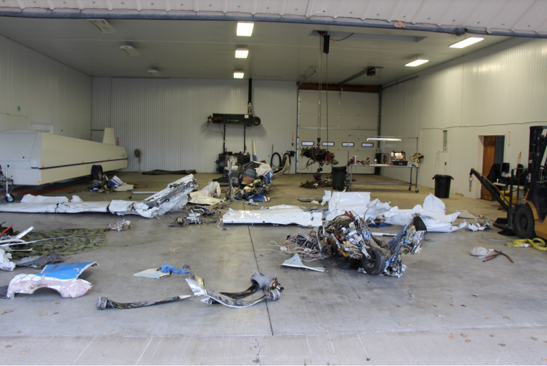
Postaccident examination of the airplane and engine revealed no mechanical malfunctions or anomalies that would have precluded normal operation. The airplane’s primary flight display (PFD) reported barometric altitude adjustable by altimeter setting, and its two multifunction displays (MFDs) reported GPS altitude based on satellite geometry. The flight data showed that the barometric altitude (shown on the PFD) about the time of the accident was 207 ft higher than the GPS altitude (displayed on the MFD at the center of the instrument panel). The pilot, who was also a certified flight instructor, had every opportunity to observe the difference between the GPS and barometric altitudes during his instrument scan. The airplane’s relatively consistent cruise flight altitude during the accident leg suggests that autopilot was engaged. It is unclear from available evidence whether the pilot would have used barometric altitude or GPS altitude to set the autopilot or whether the MFD provided a terrain alert before the accident occurred. However, data from previous flights showed that the pilot had extensive knowledge of the area and had intentionally circumvented this tower at a similar altitude during a flight a few days prior.
The tower did not meet the Federal Aviation Administration’s (FAA) 200-ft minimum height requirement to be lit or placed on an aviation chart. However, the FAA sectional chart, which was available to the accident pilot for this flight, showed the height of the plateau beneath the tower. The pilot instead relied on the MFD terrain map for topographical features and obstacles. A review of the terrain map before the accident flight or during cruise flight would have led a conscientious pilot to maintain a safe distance from terrain by climbing to a higher cruise altitude, consistent with the minimum safety altitudes provided in Federal Aviation Regulations. Thus, despite having a preexisting knowledge of the area topography and obstacles, the pilot exercised poor decision making in operating at a cruise altitude less than the minimum safe altitudes specified in regulations.
Probable Cause: The pilot’s failure to maintain clearance due to poor decision making in selecting an unsafe altitude during cruise flight.
Accident investigation:
 |
|
Sources:
https://www.ktvq.com/news/local-news/plane-crashes-north-of-billings
https://www.kulr8.com/digital_hub/breaking-plane-crashes-miles-north-of-billings/article_38940dfa-3564-11ea-81a4-632617752c10.html
https://www.google.com/amp/s/www.mysanantonio.com/news/amp/Airplane-with-4-people-on-board-crashes-north-of-14969579.php
NTSB
https://registry.faa.gov/aircraftinquiry/NNum_Results.aspx?NNumbertxt=N736YU
http://www.airport-data.com/aircraft/photo/001295544L.html (photo)
Location
Images:
Photos: NTSB
Revision history:
| Date/time | Contributor | Updates |
|---|---|---|
| 12-Jan-2020 20:28 | Geno | Added |
| 12-Jan-2020 20:43 | Captain Adam | Updated [Aircraft type, Total occupants, Other fatalities, Source, Damage, Narrative] |
| 12-Jan-2020 20:54 | Captain Adam | Updated [Location] |
| 13-Jan-2020 02:06 | Captain Adam | Updated [Total fatalities, Narrative] |
| 13-Jan-2020 09:02 | Iceman 29 | Updated [Embed code] |
| 13-Jan-2020 14:56 | RobertMB | Updated [Aircraft type, Registration, Cn, Operator, Phase, Nature, Source, Embed code, Narrative] |
| 18-Jan-2020 10:49 | semajsirhc | Updated [Departure airport] |
| 04-Feb-2020 22:50 | Captain Adam | Updated [Departure airport, Destination airport, Source, Narrative] |
| 29-Jan-2021 10:08 | viking | Updated [Date, Time] |
| 18-Mar-2022 13:28 | Captain Adam | Updated [Location, Departure airport, Destination airport, Source, Embed code, Narrative, Category, Accident report, Photo] |
| 18-Mar-2022 13:29 | Captain Adam | Updated [Photo] |
| 18-Mar-2022 13:30 | Captain Adam | Updated [Photo] |
| 18-Mar-2022 13:31 | Captain Adam | Updated [Photo] |
Corrections or additions? ... Edit this accident description
The Aviation Safety Network is an exclusive service provided by:
Quick Links:
| ASN Home | Send Correction / Feedback |
| FSF Home | Disclaimer | Copyright |
| Contact Us | Privacy Policy |
| Press / Media |
 ©2024 Flight Safety Foundation