

ASN Wikibase Occurrence # 234148
This information is added by users of ASN. Neither ASN nor the Flight Safety Foundation are responsible for the completeness or correctness of this information.
If you feel this information is incomplete or incorrect, you can submit corrected information.
| Date: | Wednesday 18 March 2020 |
| Time: | 22:47 |
| Type: |  Piper PA-28R-180 Cherokee Arrow |
| Owner/operator: | Private |
| Registration: | N3943T |
| MSN: | 28-30286 |
| Year of manufacture: | 1967 |
| Total airframe hrs: | 4552 hours |
| Engine model: | Lycoming IO-360-B1E |
| Fatalities: | Fatalities: 1 / Occupants: 1 |
| Aircraft damage: | Destroyed |
| Category: | Accident |
| Location: | Pleasant Plain, OH -
 United States of America United States of America
|
| Phase: | Approach |
| Nature: | Private |
| Departure airport: | Muskogee-Davis Field, OK (KMKO) |
| Clermont County Airport, OH (I69) | |
| Investigating agency: | NTSB |
| Confidence Rating: |
The instrument-rated pilot was on the final segment of an instrument flight rules (IFR) flight in dark night instrument meteorological conditions (IMC). After being cleared for an RNAV approach to his intended destination, the pilot made several course deviations inbound to the initial approach fix. The pilot informed air traffic control (ATC) that he was experiencing autopilot problems, "heavy turbulence," and "heavy downdrafts." Radar and automated dependent surveillance-broadcast data showed the airplane enter a rapidly descending left turn. ATC issued a low-altitude alert to the pilot and advised him to climb to 4,000 ft immediately. The pilot did not respond, and there were no further communications from the pilot. Radar contact was lost as the airplane descended through 1,400 ft.
The airplane wreckage was found severely fragmented amidst a heavily wooded area. Examinations of the airframe, flight controls, and engine did not reveal any pre-impact mechanical anomalies. The airplane was flying in an area of a stationary frontal system, which resulted in an extensive area of IFR conditions, low ceilings, low visibilities, drizzle, and rain. The weather in the accident area was conducive to low-level windshear and convective turbulence at the time of the accident. There was no record of the pilot obtaining a preflight weather briefing, and his flight plan did not list an alternate airport. The pilot’s report of heavy turbulence and downdrafts was consistent with the existing weather conditions. It is likely when the pilot encountered the turbulence and wind shear in dark night conditions, he became spatially disoriented and lost control of the airplane.
Probable Cause: The pilot’s encounter with convective turbulence and low-level wind shear in dark night instrument meteorological conditions that resulted in spatial disorientation and the loss of airplane control.
Accident investigation:
 |
|
Sources:
https://www.fox19.com/2020/03/19/pilot-killed-warren-county-plane-crash/
https://www.wlwt.com/article/oshp-pilot-dies-when-small-plane-crashes-in-warren-county/31769742
https://registry.faa.gov/aircraftinquiry/NNum_Results.aspx?NNumbertxt=3943T
https://flightaware.com/live/flight/N314VR/history/20200318/2230Z/KMKO/I69
https://www.radarbox24.com/data/registration/N314VR
NTSB
Location
Images:
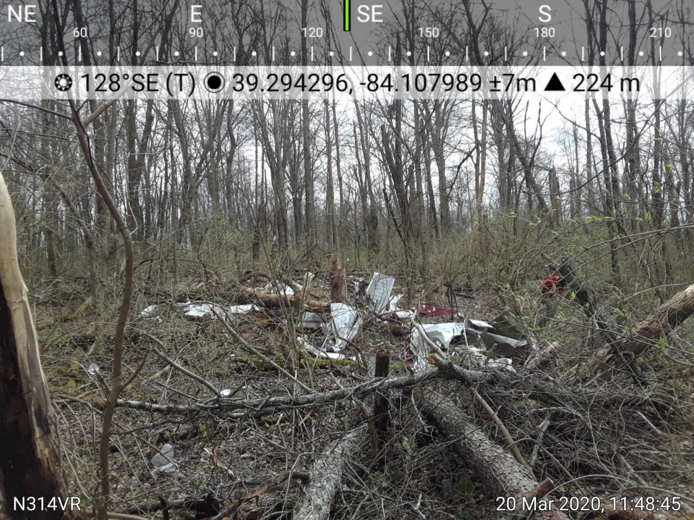
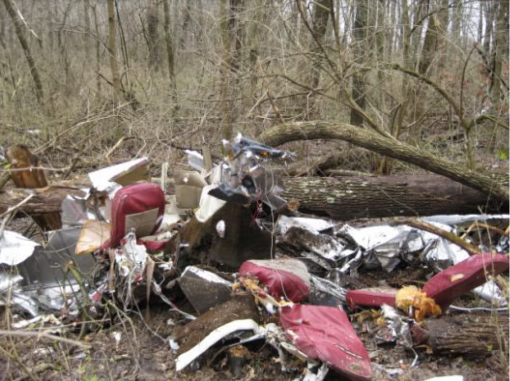
Photos: NTSB
Revision history:
| Date/time | Contributor | Updates |
|---|---|---|
| 19-Mar-2020 07:33 | gerard57 | Added |
| 19-Mar-2020 10:11 | Captain Adam | Updated [Aircraft type, Registration, Location, Phase, Departure airport, Destination airport, Source, Narrative] |
| 19-Mar-2020 12:55 | Iceman 29 | Updated [Time, Source] |
| 19-Mar-2020 13:54 | RobertMB | Updated [Time, Aircraft type, Registration, Location, Source, Narrative] |
| 20-Mar-2020 15:36 | RobertMB | Updated [Aircraft type, Registration, Cn, Source, Narrative] |
| 20-Jun-2021 05:51 | aaronwk | Updated [Time, Location, Source, Narrative] |
| 08-May-2022 05:25 | Captain Adam | Updated [Time, Location, Source, Narrative, Category, Accident report, Photo] |
| 08-May-2022 05:26 | Captain Adam | Updated [Photo] |
Corrections or additions? ... Edit this accident description
The Aviation Safety Network is an exclusive service provided by:
Quick Links:
| ASN Home | Send Correction / Feedback |
| FSF Home | Disclaimer | Copyright |
| Contact Us | Privacy Policy |
| Press / Media |
 ©2024 Flight Safety Foundation