

ASN Wikibase Occurrence # 238712
This information is added by users of ASN. Neither ASN nor the Flight Safety Foundation are responsible for the completeness or correctness of this information.
If you feel this information is incomplete or incorrect, you can submit corrected information.
| Date: | Saturday 25 July 2020 |
| Time: | 12:49 LT |
| Type: |  Van's RV-6 |
| Owner/operator: | Private |
| Registration: | N327WB |
| MSN: | 24169 |
| Year of manufacture: | 1996 |
| Total airframe hrs: | 754 hours |
| Engine model: | Lycoming O-320-H2AD |
| Fatalities: | Fatalities: 0 / Occupants: 2 |
| Aircraft damage: | Substantial |
| Category: | Accident |
| Location: | Chase County between Enders and Imperial, NE -
 United States of America United States of America
|
| Phase: | Take off |
| Nature: | Private |
| Departure airport: | Imperial, NE |
| Imperial Airport, NE (IML/KIML) | |
| Investigating agency: | NTSB |
| Confidence Rating: |
The pilot stated that this was his third passenger carrying flight of the day and he determined his takeoff weight was about 146 lbs below max gross weight. For the takeoff from the grass strip, he elected not to utilize flaps or the full length of the runway, leaving about 100-200 ft behind him. During the takeoff roll, the pilot had the sense that the roll was taking longer than normal, and he began to be concerned about powerlines at the end of the runway. When about 10-25 ft above the ground, he began a shallow bank turn to the right. Immediately after starting the turn, he flew over a corn field and experienced a loss of lift. The airplane then impacted the corn, resulting in substantial damage to the right wing and fuselage. The pilot reported no mechanical anomalies with the airplane that would have precluded normal operation.
The pilot noted that he listened to the density altitude reported on the Automated Weather Observing System for a nearby airport but did not process the effects it would have on the accident flight. The density altitude was about 6,184 ft.
Probable Cause: The pilot's inadequate preflight performance planning and his decision not to utilize all available runway during high density altitude operations which led to an inflight loss of control and subsequent collision with terrain.
Accident investigation:
 |
|
Sources:
FAA register: https://registry.faa.gov/aircraftinquiry/NNum_Results.aspx?NNumbertxt=N327WB
NTSB CEN20CA307
Location
Images:
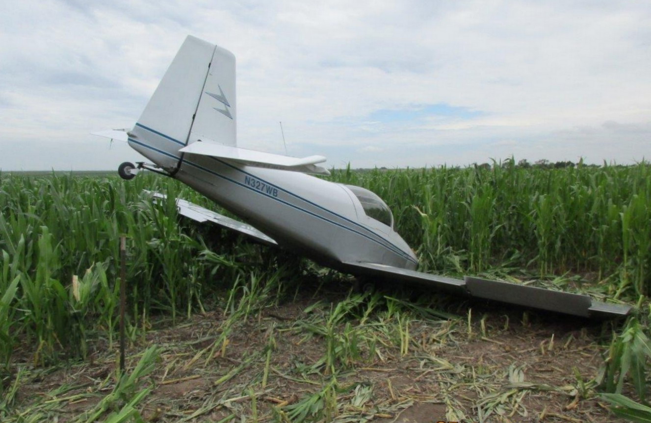
Photo: NTSB
Revision history:
| Date/time | Contributor | Updates |
|---|---|---|
| 27-Jul-2020 12:36 | Captain Adam | Added |
| 27-Jul-2020 16:56 | RobertMB | Updated [Time, Aircraft type, Registration, Cn, Operator, Total fatalities, Total occupants, Other fatalities, Location, Nature, Source, Narrative] |
| 27-Jul-2020 17:22 | Geno | Updated [Total occupants, Location, Source, Narrative] |
| 25-Mar-2021 20:29 | ASN Update Bot | Updated [Time, Other fatalities, Departure airport, Destination airport, Source, Damage, Narrative, Category, Accident report] |
| 25-Mar-2021 20:36 | harro | Updated [Other fatalities, Phase, Departure airport, Source, Narrative, Photo] |
Corrections or additions? ... Edit this accident description
The Aviation Safety Network is an exclusive service provided by:
Quick Links:
| ASN Home | Send Correction / Feedback |
| FSF Home | Disclaimer | Copyright |
| Contact Us | Privacy Policy |
| Press / Media |
 ©2024 Flight Safety Foundation