ASN Wikibase Occurrence # 248290
This information is added by users of ASN. Neither ASN nor the Flight Safety Foundation are responsible for the completeness or correctness of this information.
If you feel this information is incomplete or incorrect, you can submit corrected information.
| Date: | Friday 26 February 2021 |
| Time: | 18:11 |
| Type: |  Cessna R182 Skylane RG |
| Owner/operator: | Private |
| Registration: | N3652C |
| MSN: | R18200296 |
| Year of manufacture: | 1978 |
| Total airframe hrs: | 2400 hours |
| Engine model: | Lycoming O-540-J3C5D |
| Fatalities: | Fatalities: 3 / Occupants: 3 |
| Aircraft damage: | Destroyed |
| Category: | Accident |
| Location: | near Lee Gilmer Memorial Airport (GVL/KGVL), Gainesville, GA -
 United States of America United States of America
|
| Phase: | Initial climb |
| Nature: | Private |
| Departure airport: | Gainesville-Lee Gilmer Memorial Airport, GA (GVL/KGVL) |
| Daytona Beach International Airport, FL (DAB/KDAB) | |
| Investigating agency: | NTSB |
| Confidence Rating: |
On February 26, 2021, about 1811 eastern standard time, a Cessna R182 airplane, N3652C, was substantially damaged when it was involved in an accident near Gainesville, Georgia. The pilot and two passengers were fatally injured. The airplane was operated as a Title 14 Code of Federal Regulations Part 91 personal flight
The instrument-rated pilot departed on an instrument flight rules (IFR) flight plan into instrument meteorological conditions (IMC) that included a cloud ceiling 400 ft above ground level (agl), mist, and low-level wind shear. The pilot was instructed to fly a heading that would have required a 30° right turn from the departure runway heading after takeoff and to climb to 3,000 ft mean sea level (msl). After departure, the airplane entered a right turn to more than 180° from the departure runway heading and performed a series of climbs and descents with corresponding deviations in groundspeed, reaching a maximum altitude of 2,500 ft msl before descending rapidly into trees and terrain.
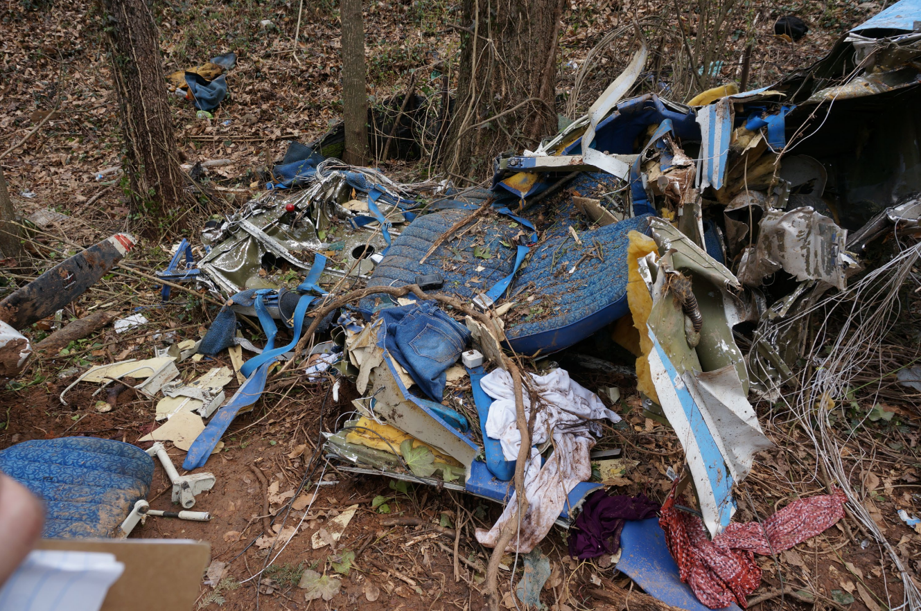
Postaccident examination of the airplane and engine did not reveal any preimpact failures or malfunctions that would have precluded normal operation. The accident site and distribution of the wreckage were consistent with impact at high speed and with the engine producing power.
A friend of the pilot reported that the pilot was proficient in the operation of modern digital flight instruments, but not proficient in the use of analog flight instruments like those installed in the accident airplane. The friend reported that he advised the pilot not to fly the accident airplane in IMC until he upgraded the instrumentation and avionics. The friend also reported that the pilot had likely not previously flown by himself in low IMC, like those present at the time of the accident. The pilot had received preflight weather briefings that advised of the low cloud ceilings, visibility, and wind shear; however, the conversations indicated that the pilot was focused on the potential for icing at cruise altitude.
The airplane’s pitch attitude deviations after takeoff, as evidenced by its climbs, descents, and groundspeed changes, are consistent with the pilot experiencing a type of spatial disorientation known as a somatogravic illusion, which resulted in spatial disorientation, loss of control, and impact with trees and terrain. It is likely that the pilot’s decision to depart into low instrument flight rules conditions, which resulted in his entry into low-visibility conditions during a high-workload phase of flight such as the takeoff and initial climb, increased his susceptibility to the effects of spatial disorientation.
Probable Cause: The pilot’s loss of control due to spatial disorientation. Contributing to the accident was the pilot’s decision to depart into low instrument meteorological conditions.
Accident investigation:
 |
|
Sources:
https://www.13wmaz.com/article/news/local/georgia/plane-crash-reported-gainesville-hall-county/85-dd9ef7c9-2545-4122-9b40-d1ebf54f9088
https://www.wsbtv.com/news/local/hall-county/3-people-dead-home-evacuated-after-plane-crash-hall-county/YKS2QKETDRBVTMOIQLWU62NPNI/
https://data.ntsb.gov/carol-repgen/api/Aviation/ReportMain/GenerateNewestReport/102681/pdf
https://flightaware.com/live/flight/N3652C/history/20210226/2255Z/KGVL/KDAB
https://registry.faa.gov/aircraftinquiry/Search/NNumberResult
https://www.airport-data.com/aircraft/photo/000840355.html
Location
Images:

Photo: NTSB
Revision history:
| Date/time | Contributor | Updates |
|---|---|---|
| 27-Feb-2021 00:19 | Geno | Added |
| 27-Feb-2021 01:31 | Geno | Updated [Time, Total fatalities, Total occupants, Other fatalities, Source, Narrative] |
| 27-Feb-2021 01:49 | Geno | Updated [Aircraft type, Registration, Cn, Operator, Phase, Departure airport, Destination airport, Source] |
| 27-Feb-2021 06:53 | harro | Updated [Registration, Operator, Phase, Source, Damage, Narrative, Category] |
| 10-Jul-2021 08:40 | aaronwk | Updated [Time, Phase, Nature, Source, Narrative] |
Corrections or additions? ... Edit this accident description
The Aviation Safety Network is an exclusive service provided by:


 ©2024 Flight Safety Foundation