ASN Wikibase Occurrence # 294279
This information is added by users of ASN. Neither ASN nor the Flight Safety Foundation are responsible for the completeness or correctness of this information.
If you feel this information is incomplete or incorrect, you can submit corrected information.
| Date: | Saturday 18 December 2004 |
| Time: | 19:55 LT |
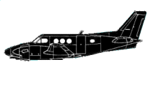
| Type: |  Beechcraft C90A King Air |
| Owner/operator: | Generation 2000 LLC |
| Registration: | N55EP |
| MSN: | LJ1520 |
| Year of manufacture: | 1998 |
| Total airframe hrs: | 1909 hours |
| Engine model: | Pratt & Whitney PT6-21 |
| Fatalities: | Fatalities: 0 / Occupants: 2 |
| Aircraft damage: | Substantial |
| Category: | Accident |
| Location: | Salt Lake City, Utah -
 United States of America United States of America
|
| Phase: | Unknown |
| Nature: | Executive |
| Departure airport: | Salt Lake City International Airport, UT (SLC/KSLC) |
| Las Vegas-North Las Vegas Airport, NV (VGT/KVGT) | |
| Investigating agency: | NTSB |
| Confidence Rating: |
The pilot stated the taxi, takeoff roll, and rotation were normal. The pilot maintained runway heading until visual contact with the ground was lost, at which time a left turn to the assigned heading of 240 degrees was initiated. The pilot stated that while in the left turn, an Enhanced Ground Proximity Warning System warning of sink rate was received. A review of the instrument panel revealed a "climbing left turn" on the left instrument panel and a "descending left turn" on the right instrument panel. The pilot stated that he saw a red light and "immediately pulled hard up" at which time, the airplane struck a weather station antenna. The pilot added full power, leveled the wings and initiated a positive rate of climb, cross referencing both instrument panels until he was clear of the clouds. According to the FAA, the weather station antenna was located approximately 200 feet west of the departure runway, south of the Sierra taxiway, and west of the Romeo taxiway. The antenna measured 40 feet above ground level with a 4 foot lightening arrest rod attached at the top of the antenna. The FAA reported that the airplane impacted the antenna at a 30 foot level. The pilot and co pilot pitot instrument systems were removed from the airplane for bench testing. The test indicated that the systems did not leak and were in compliance with FAR 91.411. An examination of the remaining airplane systems, conducted by the FAA, revealed no anomalies. According to the aviation routine weather report taken at 1856, the weather was reported as visibility, 1/4 statute mile, freezing fog; sky condition, overcast 200 feet agl; temperature, minus 03 degrees Celsius (C), dewpoint, minus 04 degrees C.
Probable Cause: the pilot's failure to obtain/maintain a proper climb rate and the pilot's premature initiation of the turn (low altitude flight maneuver). Contributing factors include the pilot's improper in-flight planning and decision making, the low altitude, the fog, and the weather antenna.
Accident investigation:
 |
|
Sources:
NTSB DEN05LA039
Revision history:
| Date/time | Contributor | Updates |
|---|---|---|
| 11-Oct-2022 14:45 | ASN Update Bot | Added |
Corrections or additions? ... Edit this accident description
The Aviation Safety Network is an exclusive service provided by:


 ©2024 Flight Safety Foundation