

| Date: | Saturday 11 December 1999 |
| Time: | 10:18 |
| Type: |  British Aerospace ATP |
| Owner/operator: | SATA Air Açores |
| Registration: | CS-TGM |
| MSN: | 2030 |
| Year of manufacture: | 1990 |
| Total airframe hrs: | 11305 hours |
| Cycles: | 23584 flights |
| Engine model: | Pratt & Whitney Canada PW126 |
| Fatalities: | Fatalities: 35 / Occupants: 35 |
| Aircraft damage: | Destroyed, written off |
| Category: | Accident |
| Location: | São Jorge Island, Azores -
 Portugal Portugal
|
| Phase: | En route |
| Nature: | Passenger - Scheduled |
| Departure airport: | Ponta Delgada-Nordela Airport, Azores (PDL/LPPD) |
| Horta Airport, Azores (HOR/LPHR) | |
| Investigating agency: | GPS |
| Confidence Rating: |
SATA flight 530 departed from Ponta Delgada, São Miguel Island, at about 09:30 for a flight to Horta on Faial Island. The weather en route was affected by a frontal system with scattered cumulonimbus, heavy showers, turbulence and strong winds from the southwest. The crew decided to alter their flight plan, opting for a route that included approach descent over the channel between Pico and São Jorge islands to intercept the 250 degree VOR/VFL Horta radial. Horta tower initially cleared the flight to FL100. The crew then requested and were cleared to descent to 5000 feet with the instruction of maintaining visual contact with Pico Island. During the descent heavy rain and turbulence were encountered. Seven minutes after initiating the descent, the airplane impacted the northern hillside of Pico da Esperança Mountain (1067 m high) on São Jorge Island in IMC. GPWS alerted the crew 17 seconds before impact.
CAUSES (translated from Portuguese):
The Investigation Committee determined that the causes of the accident were:
- Failure to respect the safety altitude - the en route controlled flight into terrain;
- Inaccurate dead reckoning;
- No proper use of airborne weather radar as an additional ease of navigation;
- Lack of cross-checking the information of the radio altimeter and barometric altimeters.
Contributing factors:
- Weather conditions in the area of the accident;
- Lack of autonomous means of navigation on board the aircraft, which could determine its position with greater precision;
Accident investigation:
 |
|
Sources:
GPIAA RELATÓRIO Nº 21/ACCID/GPS/99
ICAO Adrep
Location
Images:
photo (c) Radiotelevisão Portuguesa; Sao Jorge Island, Açores; December 1999
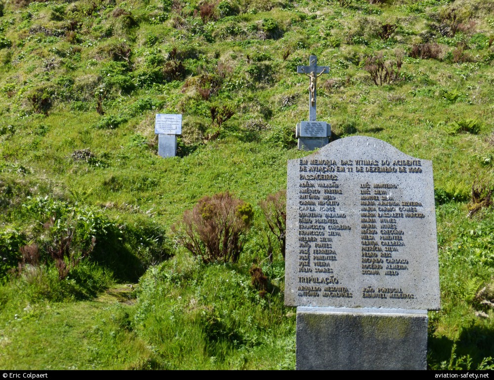
photo (c) Eric Colpaert; Sao Jorge Island, Açores; 05 May 2014
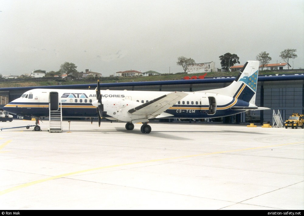
photo (c) Ron Mak; Ponta Delgada-Nordela Airport, Azores (PDL); 15 May 1995
Revision history:
| Date/time | Contributor | Updates |
|---|
The Aviation Safety Network is an exclusive service provided by:
Quick Links:
| ASN Home | Send Correction / Feedback |
| FSF Home | Disclaimer | Copyright |
| Contact Us | Privacy Policy |
| Press / Media |
 ©2024 Flight Safety Foundation