ASN Wikibase Occurrence # 349126
This information is added by users of ASN. Neither ASN nor the Flight Safety Foundation are responsible for the completeness or correctness of this information.
If you feel this information is incomplete or incorrect, you can submit corrected information.
| Date: | Friday 17 March 2000 |
| Time: | |
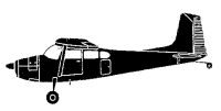
| Type: |  Cessna 180J |
| Owner/operator: | |
| Registration: | C-GRPR |
| MSN: | |
| Fatalities: | Fatalities: / Occupants: |
| Aircraft damage: | |
| Location: | Smoothstone Lake, Saskatchewan, 10 nm SE -
 Canada Canada
|
| Phase: | Unknown |
| Nature: | Unknown |
| Departure airport: | |
| Investigating agency: | TSB |
| Confidence Rating: |
A ski-equipped Cessna 180J, C-GRPR, with the pilot and one passenger on board, departed from the frozen surface of Delaronde Lake, Saskatchewan, at 1500 central standard time on a visual flight rules flight to a cabin at Swan Lake. As the aircraft was approaching the midpoint of the 80 nautical mile flight, the cloud ceilings lowered and snow began to fall, which reduced forward visibility. An area of heavier snow was noted further along the route of flight, and the pilot was in the process of deciding whether to make a precautionary landing on a nearby road to await improved weather conditions, or to return to his base at Delaronde Lake. As the aircraft was rolling out of a left turn at about 500 feet above ground level, it yawed to the right. Airframe buffeting was noted, and the pilot had difficulty maintaining pitch control. Despite the application of elevator pitch input and full engine power, the aircraft descended and crashed in a wooded area. The pilot called the La Ronge flight service station by satellite telephone, and a search was commenced. The two occupants were airlifted from the site and taken to hospital with serious injuries. The aircraft was destroyed by impact forces. There was no fire. The accident occurred during daylight at latitude 54°20′ north, longitude 104°30′ west.
Accident investigation:
 |
|
Sources:
TSB
Revision history:
| Date/time | Contributor | Updates |
|---|
Corrections or additions? ... Edit this accident description
The Aviation Safety Network is an exclusive service provided by:


 ©2024 Flight Safety Foundation