

ASN Wikibase Occurrence # 36773
This information is added by users of ASN. Neither ASN nor the Flight Safety Foundation are responsible for the completeness or correctness of this information.
If you feel this information is incomplete or incorrect, you can submit corrected information.
| Date: | Saturday 3 April 1999 |
| Time: | 23:50 |
| Type: |  MBB Bo 105CBS-4 |
| Owner/operator: | Metro Aviation Inc |
| Registration: | N105HH |
| MSN: | S-339 |
| Total airframe hrs: | 5763 hours |
| Engine model: | Allison 250-C20B |
| Fatalities: | Fatalities: 3 / Occupants: 3 |
| Aircraft damage: | Destroyed |
| Category: | Accident |
| Location: | near Indian Springs, NV -
 United States of America United States of America
|
| Phase: | En route |
| Nature: | Ferry/positioning |
| Departure airport: | Las Vegas, NV |
| Hidden Hills Airport, NV (L57) | |
| Investigating agency: | NTSB |
| Confidence Rating: |
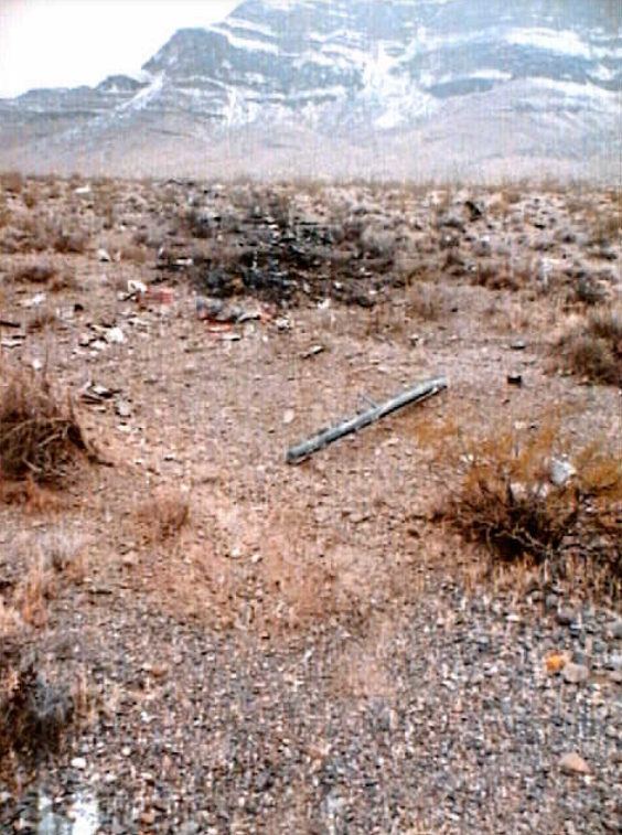
On April 3, 1999, about 2350 hours Pacific standard time, a Messerschmitt-Bolkow-Blohm (Mbb) BO-105CBS-4, N105HH, with the call sign Lifeguard 2, was en route to Pahrump, Nevada, when it collided with terrain and burned while maneuvering near Indian Springs, Nevada. The aircraft was destroyed and the certificated airline transport pilot and his two medical crewmembers received fatal injuries. The aircraft was operated as a positioning flight under 14 CFR Part 91 by Metro Aviation, Inc., when the accident occurred. The flight originated from Las Vegas, Nevada, about 2315 on April 3, 1999. Instrument meteorological conditions prevailed at the accident site and a company flight plan had been filed.
The medical evacuation helicopter was on a positioning flight back to its remote base location on a dark night. The pilot received a weather briefing at 1700; however, there was no record of him receiving an update. The area forecast was for broken clouds, scattered light rain showers, instrument flight rules (IFR) conditions, strong northerly winds over rough terrain, light to occasional moderate rime icing in precipitation, and a freezing level between 7,000 and 9,000 feet mean sea level. A winter advisory was in effect for 2 to 3 inches of snow with winds from the southeast at 13 to 22 knots. A motorist saw the helicopter flying west over a highway leading to the accident site at 1,000 feet above ground level (AGL). The sky was overcast with freezing rain that turned into wet snow and then finally freezing sleet. A second motorist nearer the accident site saw the helicopter using its searchlight to follow the highway at 150 to 200 feet AGL in conditions of lower clouds and reduced visibility. A resident next to the accident site heard the helicopter flying back and forth for a few minutes followed by the crash. He drove in the direction of the sound and found the crash site in flames. Snow had reduced visibility to less than 50 yards at the time. The aircraft was not certified for flight in IFR conditions; however, it had full flight instruments, a radar altimeter, a GPS, and VHF navigational radios. The operator reported the pilot had undergone an inadvertent instrument meteorological conditions evaluation within the last 90 days; however, documentation of this training was not found.
Probable Cause: the pilot's decision to continue VFR flight in deteriorating IFR conditions resulting in spatial disorientation and subsequent loss of control.
Sources:
NTSB: https://www.ntsb.gov/_layouts/ntsb.aviation/brief.aspx?ev_id=20001205X00485&key=1
Images:

Photos: NTSB
Revision history:
| Date/time | Contributor | Updates |
|---|---|---|
| 24-Oct-2008 10:30 | ASN archive | Added |
| 16-Feb-2010 03:44 | TB | Updated [Other fatalities, Location] |
| 27-Oct-2012 09:38 | TB | Updated [Time, Cn, Operator, Location, Phase, Source, Narrative] |
| 27-Oct-2012 09:42 | TB | Updated [Time, Operator] |
| 11-Oct-2016 14:35 | TB | Updated [Source] |
| 21-Dec-2016 19:23 | ASN Update Bot | Updated [Time, Damage, Category, Investigating agency] |
| 26-Nov-2017 12:38 | ASN Update Bot | Updated [Cn, Operator, Source, Narrative] |
| 13-Oct-2022 08:12 | Captain Adam | Updated [Operator, Destination airport, Narrative, Photo] |
| 13-Oct-2022 08:13 | Captain Adam | Updated [Photo] |
Corrections or additions? ... Edit this accident description
The Aviation Safety Network is an exclusive service provided by:
Quick Links:
| ASN Home | Send Correction / Feedback |
| FSF Home | Disclaimer | Copyright |
| Contact Us | Privacy Policy |
| Press / Media |
 ©2024 Flight Safety Foundation