ASN Wikibase Occurrence # 37985
This information is added by users of ASN. Neither ASN nor the Flight Safety Foundation are responsible for the completeness or correctness of this information.
If you feel this information is incomplete or incorrect, you can submit corrected information.
| Date: | Thursday 9 December 1982 |
| Time: | 13:10 |
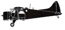
| Type: |  de Havilland Canada DHC-2 Beaver |
| Owner/operator: | Tyee Airlines |
| Registration: | N68081 |
| MSN: | 906 |
| Total airframe hrs: | 12735 hours |
| Engine model: | P & W R-985 |
| Fatalities: | Fatalities: 8 / Occupants: 8 |
| Aircraft damage: | Destroyed |
| Category: | Accident |
| Location: | near Klawock, AK -
 United States of America United States of America
|
| Phase: | Manoeuvring (airshow, firefighting, ag.ops.) |
| Nature: | Passenger - Scheduled |
| Departure airport: | Ketchikan, AK (C) |
| Craig, AK (C) | |
| Investigating agency: | NTSB |
| Confidence Rating: |
AT 1236 THE FLT DEPARTED KETCHIKAN SEAPLANE BASE WITH A SPECIAL VFR CLEARANCE & AT 1240 REPORTED CLEAR OF THE CONTROL ZONE. THE NEXT & LAST TRANSMISSION BY THE PLT WAS MADE TO THE COMPANY VIA FM RADIO AT ABOUT 1340. THIS REPORT WAS ISSUEDIN THE VICINITY OF HAPPY HARBOR (PASSING OVER KASAAN ISLAND) & WAS THE APPROXIMATE MID-POINT OF THE FLT TO CRAIG. WITNESSES REPORTED SEEING THE ACFT FLYING SW OVER TWELVEMILE ARM TOWARD HOLLIS. UPON REACHING HOLLIS THE FLT WOULD BE EXPECTED TO TURN WEST & CROSS INLAND OVER PRINCE OF WALES ISLAND UNTIL REACHING THE WEST SHORELINE & THENCE DIRECTLY TO CRAIG. THERE WAS A FOG BANK ABOUT 2 MI PRIOR TO HOLLIS IN TWELVEMILE ARM & THE ACFT WAS OBSERVED TO REVERSE COURSE AS THE WX WAS APPROACHED & PROCEED NORTH. THE ACFT WAS LOST FROM SIGHT DUE TO TREES & RAPIDLY UPSLOPING TERRAIN. AN INCREASE IN ENG SOUND WAS HEARD PRIOR TO THE CRASH. WITNESSES DESCRIBED THE CLOUDS AS ESSENTIALLY BROKEN WITH BASES AT ABOUT 1000 FT OVER THE WATER & OBSTRUCTING THE TOPS OF SOME OF THE HIGHER ISLANDS.
Sources:
https://www.ntsb.gov/aviationquery/brief.aspx?ev_id=20020917X05129&key=1
http://www.dhc-2.com/id518.htm
Revision history:
| Date/time | Contributor | Updates |
|---|---|---|
| 24-Oct-2008 10:30 | ASN archive | Added |
| 03-Aug-2011 12:58 | TB | Updated [Location, Nature, Source, Narrative] |
| 21-Dec-2016 19:23 | ASN Update Bot | Updated [Time, Damage, Category, Investigating agency] |
Corrections or additions? ... Edit this accident description
The Aviation Safety Network is an exclusive service provided by:


 ©2024 Flight Safety Foundation