ASN Wikibase Occurrence # 38045
This information is added by users of ASN. Neither ASN nor the Flight Safety Foundation are responsible for the completeness or correctness of this information.
If you feel this information is incomplete or incorrect, you can submit corrected information.
| Date: | Friday 18 November 1988 |
| Time: | 18:33 |
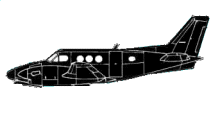
| Type: |  Beechcraft E90 King Air |
| Owner/operator: | M & L Aircraft |
| Registration: | N308PS |
| MSN: | LW-92 |
| Year of manufacture: | 1973 |
| Total airframe hrs: | 6964 hours |
| Engine model: | P&W PT6A-28 |
| Fatalities: | Fatalities: 6 / Occupants: 6 |
| Aircraft damage: | Destroyed |
| Category: | Accident |
| Location: | Locust Grove, AR -
 United States of America United States of America
|
| Phase: | Approach |
| Nature: | Private |
| Departure airport: | Orange, TX (ORG) |
| (BVX) | |
| Investigating agency: | NTSB |
| Confidence Rating: |
BFR & DRG FLT, THE PLT RCVD INFO ABOUT TSTMS IN THE VICINITY OF THE DESTN ARPT. DRG ARR, THE PLT WAS GIVEN THE LITTLE ROCK ALTIMETER SETTING. HE WAS CLRD TO DSCND & CROSS THE NDB (INITIAL APCH FIX) AT OR ABV 3100' MSL, THEN WAS CLRD FOR THE APCH. ABOUT 7-1/2 MIN LATER, THE PLT DECLARED A MISSED APCH & REQUESTED ANOTHER. HE ACKNOWLEDGED CLNC FOR THE 2ND APCH, THEN THERE WAS NO FURTHER RADIO CONTACT WITH THE ACFT. SUBSEQUENTLY, THE ACFT HIT TREES & CRASHED ON HIGH (MTN) TERRAIN ABOUT 6-1/2 MI WSW OF THE ARPT. IMPACT OCCURRED WHILE THE ACFT WAS ON AN EASTERLY HEADING AT ABOUT 1195' MSL. MIN ALT FOR THE APCH WAS 2300' UNTIL ESTABLISHED INBOUND FROM THE NDB, THEN WHEN USING A LITTLE ROCK ALTIMETER SETTING, A MIN ALT OF 1860' WAS REQUIRED UNTIL PASSING THE BAIKS FAN MARKER, 4.6 MI FROM THE RWY. A PLT, WHO WAS WAITING TO DEPART THE AIRPORT, ESTIMATED THERE WAS A VARIABLE OVERCAST AT 300' TO 700' & THE VIS WAS 1 TO 2 MI WITH RAIN. THE airport ELEV WAS 464'. CAUSE: THE PILOT'S FAILURE TO MAINTAIN OBSTACLE CLEARANCE ALTITUDE AND EXCEEDING THE MINIMUM DESCENT ALTITUDE PUBLISHED IN THE APPROACH PROCEDURE.
Sources:
NTSB: https://www.ntsb.gov/ntsb/brief.asp?ev_id=20001213X27317
Revision history:
| Date/time | Contributor | Updates |
|---|---|---|
| 24-Oct-2008 10:30 | ASN archive | Added |
| 21-Dec-2016 19:23 | ASN Update Bot | Updated [Time, Damage, Category, Investigating agency] |
Corrections or additions? ... Edit this accident description
The Aviation Safety Network is an exclusive service provided by:


 ©2024 Flight Safety Foundation