

ASN Wikibase Occurrence # 44033
This information is added by users of ASN. Neither ASN nor the Flight Safety Foundation are responsible for the completeness or correctness of this information.
If you feel this information is incomplete or incorrect, you can submit corrected information.
| Date: | Thursday 24 August 2006 |
| Time: | 12:32 |
| Type: |  Piper PA-28-140 |
| Owner/operator: | Private |
| Registration: | N9714W |
| MSN: | 28-23190 |
| Year of manufacture: | 1967 |
| Total airframe hrs: | 4780 hours |
| Engine model: | Lycoming O-320-E2A |
| Fatalities: | Fatalities: 1 / Occupants: 1 |
| Aircraft damage: | Destroyed |
| Category: | Accident |
| Location: | Kulm, ND -
 United States of America United States of America
|
| Phase: | En route |
| Nature: | Private |
| Departure airport: | Bismarck Airport, ND (BIS) |
| Fergus Falls Municipal Airport, MN (FFM) | |
| Investigating agency: | NTSB |
| Confidence Rating: |
The non-instrument rated private pilot departed on a cross-country flight into an area of forecast instrument meteorological conditions with widely scattered thunderstorms, rain, fog and mist. The pilot did not request, nor was he provided any weather briefing services prior to or during the accident flight. Additionally, no flight plan information was filed for the accident airplane within 24 hours of the accident. According to aircraft radar track data, the accident airplane was cruising 200 - 500 feet above ground level while en route to the planned destination. Weather Surveillance Radar data for the area showed a mixture of thunderstorms and rain showers scattered along the planned route of flight. The aircraft radar track data was plotted on a weather radar image for the corresponding time period. This composite image showed the last two aircraft beacon returns were 3 to 5 miles northwest of a level-three thunderstorm. The data indicated that the convective cell was moving toward the northeast and intensifying around the accident time. Instrument meteorological conditions with light to moderate turbulence were associated with the convective cell. The accident site was located about 1.5 miles southeast of the last recorded aircraft beacon return. Examination of the recovered wreckage revealed no evidence of a pre-impact mechanical malfunction. A review of the airframe, engine and propeller records found no history of unresolved airworthiness issues.
Probable Cause: The non-instrument rated pilot's continued flight into instrument meteorological conditions which resulted in his inadvertent encounter with a thunderstorm and his loss of aircraft control. A factor to the accident was the thunderstorm.
Accident investigation:
 |
|
Sources:
NTSB: https://www.ntsb.gov/_layouts/ntsb.aviation/brief.aspx?ev_id=20061012X01503&key=1
History of this aircraft
Other occurrences involving this aircraft
| 18 February 2001 | N9714W | West Central Airways, Inc. | 0 | Detroit Lakes, MN | |
sub |
| 29 September 2002 | N9714W | West Central Airways Inc | 0 | Moorhead, Minnesota | |
sub |
Location
Images:
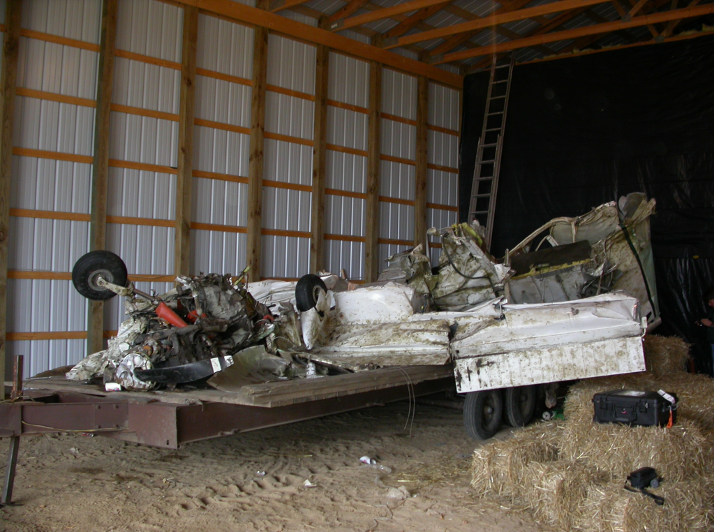
Photo: NTSB
Revision history:
| Date/time | Contributor | Updates |
|---|---|---|
| 28-Oct-2008 00:45 | ASN archive | Added |
| 21-Dec-2016 19:24 | ASN Update Bot | Updated [Time, Damage, Category, Investigating agency] |
| 05-Dec-2017 09:21 | ASN Update Bot | Updated [Operator, Other fatalities, Source, Narrative] |
| 10-Apr-2022 23:06 | Captain Adam | Updated [Other fatalities, Departure airport, Destination airport, Narrative, Accident report, Photo] |
Corrections or additions? ... Edit this accident description
The Aviation Safety Network is an exclusive service provided by:
Quick Links:
| ASN Home | Send Correction / Feedback |
| FSF Home | Disclaimer | Copyright |
| Contact Us | Privacy Policy |
| Press / Media |
 ©2024 Flight Safety Foundation