

ASN Wikibase Occurrence # 44882
This information is added by users of ASN. Neither ASN nor the Flight Safety Foundation are responsible for the completeness or correctness of this information.
If you feel this information is incomplete or incorrect, you can submit corrected information.
| Date: | Tuesday 20 April 2004 |
| Time: | 23:43 |
| Type: |  Bell 206L-1 LongRanger II |
| Owner/operator: | Air Evac Life Team |
| Registration: | N137AE |
| MSN: | 45266 |
| Year of manufacture: | 1979 |
| Total airframe hrs: | 26910 hours |
| Engine model: | Allison 250-C28B |
| Fatalities: | Fatalities: 1 / Occupants: 4 |
| Aircraft damage: | Substantial |
| Category: | Accident |
| Location: | Boonville, IN -
 United States of America United States of America
|
| Phase: | En route |
| Nature: | Ambulance |
| Departure airport: | St. Joseph's Hospital Heliport, IN (II47) |
| Deaconess Hospital, IN (16IN) | |
| Investigating agency: | NTSB |
| Confidence Rating: |
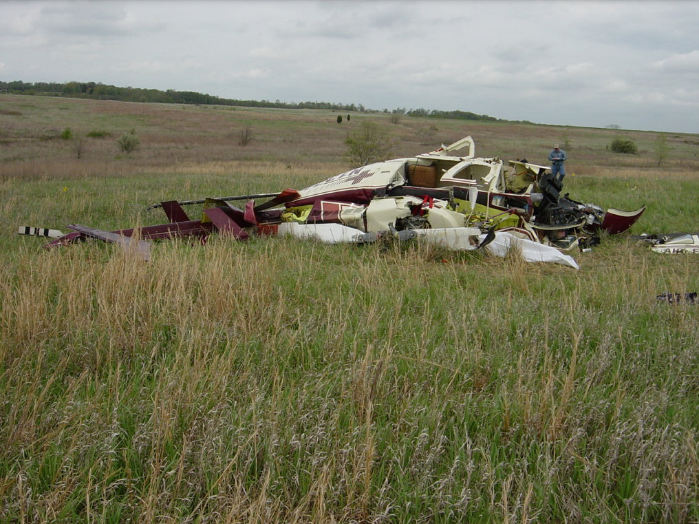
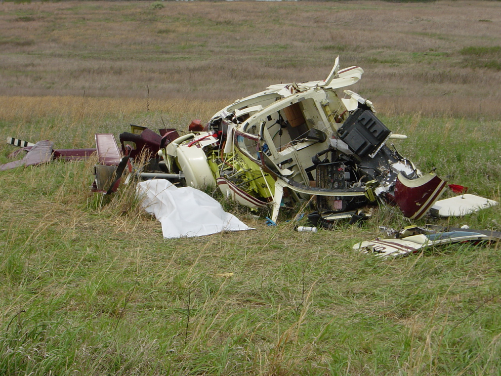
On April 20, 2004, at 2343 central daylight time, a Bell 206L-1, N137AE, operated by Air Evac Life Team as Air Evac 17, collided with the terrain during a medivac flight. The patient was fatally injured. The pilot, paramedic, and nurse, were seriously injured. The helicopter was substantially damaged. The 14 CFR Part 135 flight was operating in visual meteorological conditions and was receiving company flight following at the time of the accident. The helicopter last departed the St. Joseph's Hospital Heliport (II47), in Huntingburg, Indiana, with an intended destination of Deaconess Hospital (16IN) in Evansville, Indiana.
The helicopter collided with up sloping terrain during a night air medical flight. The accident occurred while transporting a patient from one hospital to another. Examination of the accident site and wreckage revealed the helicopter impacted the terrain in a level flight attitude. The accident site was at an abandoned strip mine located in a rural area. The area contained very few ground structures to provide reference lighting. During post accident interviews the pilot stated that he remembered picking up the patient and the next thing he remembered is the helicopter tumbling. The flight nurse and paramedic on board did not recall there being any indication of a problem prior to impact. The destination hospital is located inside the Class C airspace of the Evansville Regional Airport (EVV). The air traffic control facility at EVV closes at 2300. Between 2328 and 2339, the pilot made 12 attempts to establish contact with approach control as he approached the Class C airspace. There was a time zone change at EVV 16 days prior to the accident. Examination of the cockpit revealed the altimeter was set at 30.08 inches of mercury. The current altimeter setting was 29.77 inches of mercury. This resulted in the altimeter indicating about 310 feet higher then the actual altitude of the helicopter. The pilot who flew the helicopter prior to the accident flight reported the radar altimeter was operating erratically. This pilot and the mechanic who maintained the helicopter, both stated the accident pilot was informed of the problem. Bench testing of the radar altimeter failed to duplicate the reported erratic operation. The decision height (DH) bug on the radar altimeter was found set to 60 feet. Company policy is that the DH bug be set to 500 feet during visual night operations. Examination of the airframe, engine, and flight controls failed to reveal any mechanical failure/malfunction.
Probable Cause: The pilot's inadequate planning/decision which resulted in his failure to maintain terrain clearance. Contributing factors were the pilot's inadequate preflight planning, his diverted attention, and the dark night conditions.
Accident investigation:
 |
|
Sources:
NTSB: https://www.ntsb.gov/_layouts/ntsb.aviation/brief.aspx?ev_id=20040426X00513&key=1
Location
Images:

Photos: NTSB
Revision history:
| Date/time | Contributor | Updates |
|---|---|---|
| 28-Oct-2008 00:45 | ASN archive | Added |
| 21-Dec-2016 19:24 | ASN Update Bot | Updated [Time, Damage, Category, Investigating agency] |
| 07-Dec-2017 17:53 | ASN Update Bot | Updated [Source, Narrative] |
| 13-Mar-2021 16:38 | TB | Updated [Nature, Damage] |
Corrections or additions? ... Edit this accident description
The Aviation Safety Network is an exclusive service provided by:
Quick Links:
| ASN Home | Send Correction / Feedback |
| FSF Home | Disclaimer | Copyright |
| Contact Us | Privacy Policy |
| Press / Media |
 ©2024 Flight Safety Foundation