

ASN Wikibase Occurrence # 45271
This information is added by users of ASN. Neither ASN nor the Flight Safety Foundation are responsible for the completeness or correctness of this information.
If you feel this information is incomplete or incorrect, you can submit corrected information.
| Date: | Friday 7 March 2003 |
| Time: | 19:18 |
| Type: |  Piper PA-46-500TP Malibu Meridian |
| Owner/operator: | Private |
| Registration: | N522RF |
| MSN: | 4697119 |
| Year of manufacture: | 2001 |
| Total airframe hrs: | 365 hours |
| Engine model: | Pratt & Whitney Canada PT6A-42 |
| Fatalities: | Fatalities: 3 / Occupants: 3 |
| Aircraft damage: | Destroyed |
| Category: | Accident |
| Location: | Albuquerque, NM -
 United States of America United States of America
|
| Phase: | Approach |
| Nature: | Private |
| Departure airport: | Scottsdale Airport, AZ (SCF/KSDL) |
| Albuquerque-Double Eagle II Airport, NM (KAEG) | |
| Investigating agency: | NTSB |
| Confidence Rating: |
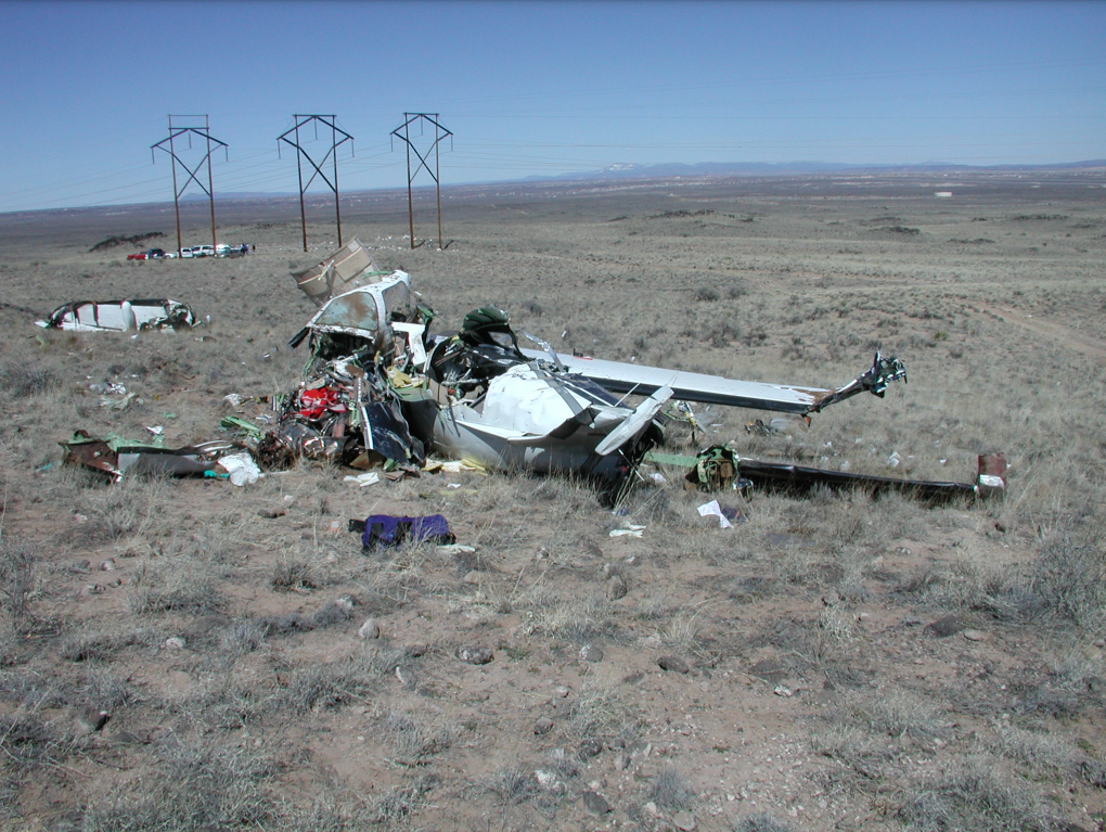
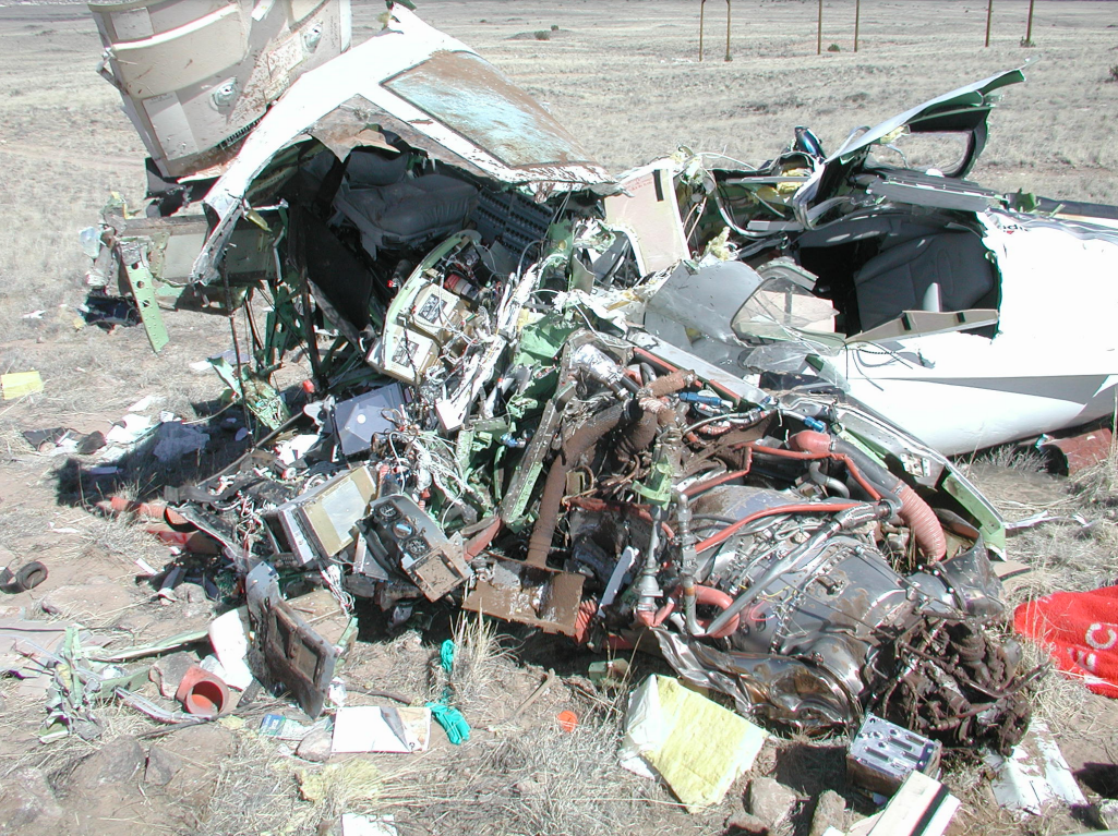
On March 7, 2003, at 1918 mountain standard time, a Piper PA-46-500TP, N522RF, was destroyed when it impacted terrain near Double Eagle II Airport (AEG), Albuquerque, New Mexico. The instrument rated private pilot and his two passengers were fatally injured. The pilot/owner was operating the airplane under the provisions of Title 14 CFR Part 91. Night, visual meteorological conditions prevailed for the personal, cross-country flight that originated from Scottsdale, Arizona, 1 hour, 12 minutes before the accident. The pilot canceled his IFR flight plan at 1911:31, and was flying a VFR traffic pattern for a full stop landing at a non-towered airport.
The pilot was performing a night, VFR traffic pattern, to a full stop at a non-towered airport in a turboprop aircraft. He entered the traffic pattern (6,800 feet; 1,000 feet AGL) on an extended down wind; radar data indicated that his ground-speed was 205 knots. Over the next 3 nautical miles on down wind, radar data indicated that he slowed to a ground-speed of 171 knots, lost approximately 500 feet of altitude, and reduced his parallel distance from the runway from 4,775 feet to 2,775 feet. Witnesses said that his radio transmissions on CTAF appeared normal. The two witnesses observed a bright blue flash, followed by a loss of contact with the airplane. Rescue personnel found a broken and downed static wire from a system of three sets of power transmission wires. The dark night precluded ground rescue personnel from locating the downed aircraft; a police helicopter found the airplane approximately 2 hours after the accident. The pilot had recently completed his factory approved annual flight training. His flight instructor said that the pilot was taught to fly a VFR traffic pattern at 1,500 feet AGL (or 500 feet above piston powered aircraft), enter the down wind leg from a 45 degree leg, and fly parallel to the down wind approximately 1 to 1.5 nautical miles separation from it. His speed on downwind should have been 145 to 150 knots indicated, with 90 to 95 knots on final for a stabilized approach. The flight instructor said that the base turn should be at a maximum bank angle of 30 degrees. Radar data indicates that the pilot was in a maximum descent, while turning base to final, of 1,800 to 1,900 feet per minute with an airspeed on final of 145 to 150 knots. His maximum bank angle during this turn was calculated to have been more than 70 degrees. The separated static wire was located 8,266.5 feet from the runway threshold, and was approximately 30 feet higher than the threshold. Post-accident examinations of the airplane and its engine revealed no anomalies which would have precluded normal operations prior to impact.
Probable Cause: The pilot's unstabilized approach and his failure to maintain obstacle clearance. Contributing factors were the dark night light condition, and the static wires.
Accident investigation:
 |
|
Sources:
NTSB: https://www.ntsb.gov/_layouts/ntsb.aviation/brief.aspx?ev_id=20030313X00327&key=1
Location
Images:


Photos: NTSB
Revision history:
| Date/time | Contributor | Updates |
|---|---|---|
| 28-Oct-2008 00:45 | ASN archive | Added |
| 21-Dec-2016 19:24 | ASN Update Bot | Updated [Time, Damage, Category, Investigating agency] |
| 08-Dec-2017 18:27 | ASN Update Bot | Updated [Operator, Source, Narrative] |
Corrections or additions? ... Edit this accident description
The Aviation Safety Network is an exclusive service provided by:
Quick Links:
| ASN Home | Send Correction / Feedback |
| FSF Home | Disclaimer | Copyright |
| Contact Us | Privacy Policy |
| Press / Media |
 ©2024 Flight Safety Foundation