

ASN Wikibase Occurrence # 199263
This information is added by users of ASN. Neither ASN nor the Flight Safety Foundation are responsible for the completeness or correctness of this information.
If you feel this information is incomplete or incorrect, you can submit corrected information.
| Date: | Monday 28 August 2017 |
| Time: | 08:39 |
| Type: |  Beechcraft A36 Bonanza |
| Owner/operator: | Private |
| Registration: | N87RY |
| MSN: | E-2917 |
| Year of manufacture: | 1994 |
| Total airframe hrs: | 3278 hours |
| Engine model: | Continental IO-550-B29B |
| Fatalities: | Fatalities: 3 / Occupants: 3 |
| Aircraft damage: | Destroyed |
| Category: | Accident |
| Location: | Ellabell, GA -
 United States of America United States of America
|
| Phase: | En route |
| Nature: | Executive |
| Departure airport: | Savannah/Hilton Head International Airport, GA (SAV/KSAV) |
| Cobb County International Airport, GA (RYY) | |
| Investigating agency: | NTSB |
| Confidence Rating: |
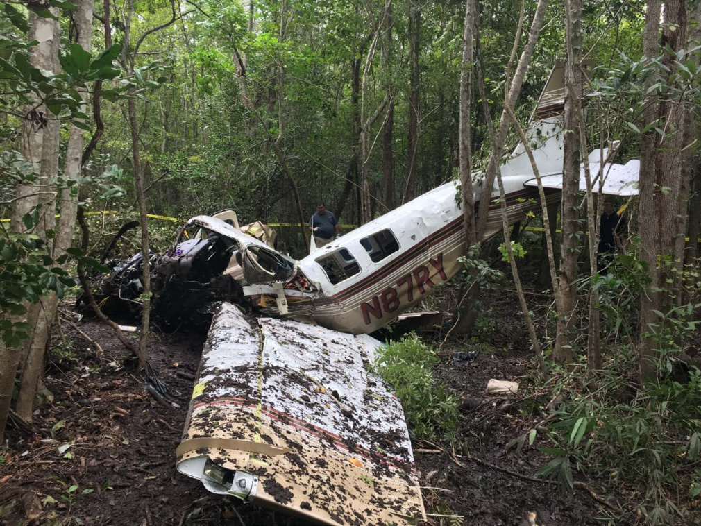
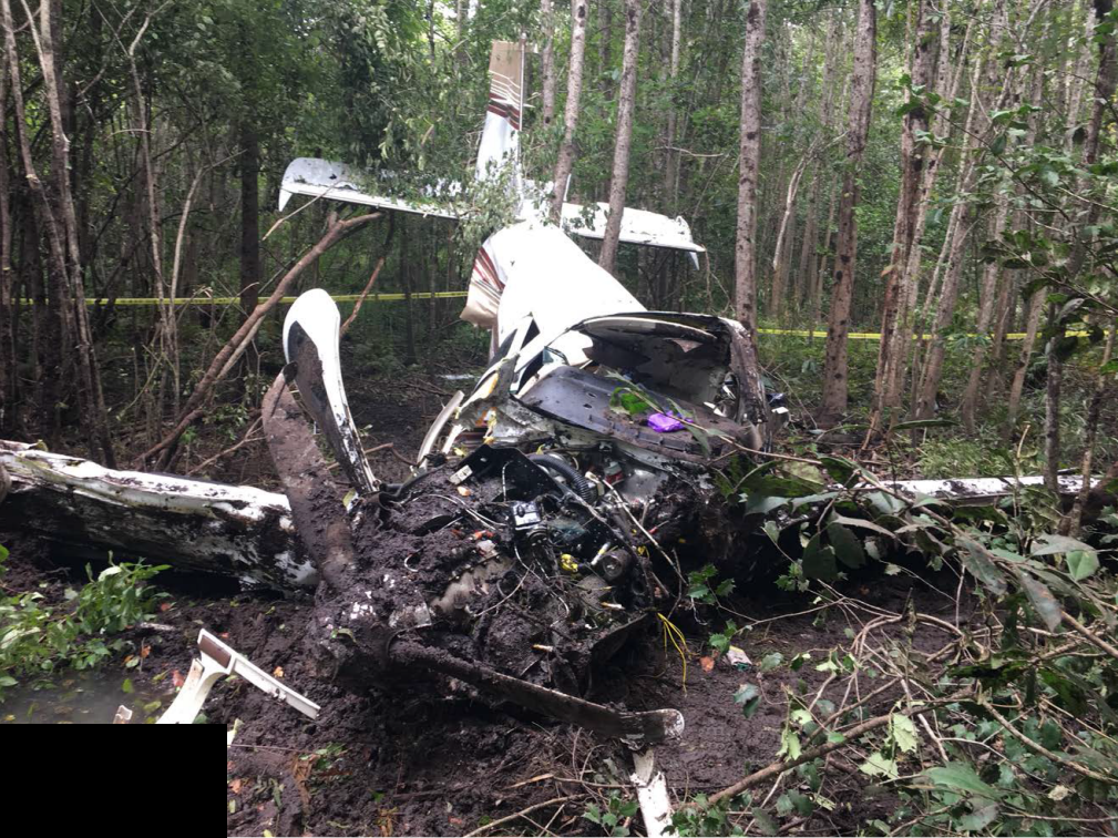
The commercial pilot was conducting a business flight; while climbing out after departure, the pilot declared an emergency and reported a loss of engine power to air traffic control. The controller provided vectors to a private airport about 6.5 nautical miles (nm) behind the airplane and stayed in communication with the pilot until communications and radar were lost. The airplane then began a wide turn to head back to the private airport, traveling about 6.3 nm during the turn. The airplane impacted trees and terrain about 6 miles from the private airport.
The airplane's maintenance records showed that all six engine cylinders were replaced about 15 months and 227 engine hours before the accident. Postaccident examination of the engine revealed that four of the eight nuts that retained the No. 1 cylinder and one nut that retained the No. 2 cylinder were loose during disassembly, and no breakout torque reading could be measured. Two of the loose nuts on the No. 1 cylinder were on the through-studs that provided clamping force on the No.1 main crankshaft bearing. Disassembly of the crankcase revealed that the No. 1 main bearing had shifted to the rear of the crankcase, which obstructed the oil flow to the No. 1 main bearing and the No. 1 connecting rod bearing.
Given the available evidence, it is likely that, during replacement of the engine cylinders, improper torque of the cylinder hold-down bolts and through-studs resulted in an insufficient clamping torque, which allowed the No. 1 main bearing to shift. This shift precluded oil from reaching the No. 1 main bearing and the No. 1 connecting rod bearing, which led to the failure of the connecting rod during the accident flight.
The emergency obstruction video map (EOVM) used by the controller handling the flight did not depict another private airport, which was closer (3.4 nm) and was in more of a direct path from the airplane's heading and position at the time of the emergency. The Federal Aviation Administration order governing EOVM displays stated that they must contain satellite airports and other airports that could serve in an emergency. The order also noted that the information depicted on the EOVM should be restricted to only the information that is "absolutely essential." On the basis of the distance that the airplane was able to glide after the pilot declared the emergency (6.3 nm), the airplane should have been able to reach the closer airport that was ahead of it. Thus, the omission of this airport on the controller's EOVM resulted in the pilot attempting, at the direction of the controller, to reach an airport that was beyond the airplane's gliding distance.
Probable Cause: The total loss of engine power due to oil starvation to the No. 1 connecting rod, which resulted from the improper torque of the No. 1 cylinder hold-down bolts and through-studs at the time of the cylinder's installation, which resulted in the failure of the connecting rod due to oil starvation. Contributing to the accident was the omission, from the air traffic control emergency obstruction video map, of a closer alternate airport for the emergency landing.
Accident investigation:
 |
|
Sources:
NTSB
https://flightaware.com/resources/registration/N87RY
Location
Images:
Photos(c): NTSB
Revision history:
| Date/time | Contributor | Updates |
|---|---|---|
| 29-Aug-2017 05:52 | gerard57 | Added |
| 29-Aug-2017 06:07 | gerard57 | Updated [Time, Location, Source] |
| 29-Aug-2017 09:26 | Iceman 29 | Updated [Time, Registration, Cn, Source, Embed code] |
| 29-Aug-2017 11:03 | Iceman 29 | Updated [Embed code] |
| 29-Aug-2017 12:44 | Aerossurance | Updated [Location] |
| 20-Sep-2017 07:31 | Iceman 29 | Updated [Departure airport, Destination airport, Source, Embed code, Narrative] |
| 11-Nov-2019 17:39 | ASN Update Bot | Updated [Time, Aircraft type, Nature, Departure airport, Destination airport, Source, Embed code, Narrative, Accident report, ] |
| 12-Mar-2022 23:07 | Captain Adam | Updated [Location, Departure airport, Destination airport, Source, Embed code, Narrative, Photo] |
| 12-Mar-2022 23:09 | Captain Adam | Updated [Photo] |
Corrections or additions? ... Edit this accident description
The Aviation Safety Network is an exclusive service provided by:
Quick Links:
| ASN Home | Send Correction / Feedback |
| FSF Home | Disclaimer | Copyright |
| Contact Us | Privacy Policy |
| Press / Media |
 ©2024 Flight Safety Foundation