

ASN Wikibase Occurrence # 199736
This information is added by users of ASN. Neither ASN nor the Flight Safety Foundation are responsible for the completeness or correctness of this information.
If you feel this information is incomplete or incorrect, you can submit corrected information.
| Date: | Friday 15 September 2017 |
| Time: | 20:10 |
| Type: |  Cirrus SR22 |
| Owner/operator: | Private |
| Registration: | N462SR |
| MSN: | 2495 |
| Year of manufacture: | 2007 |
| Total airframe hrs: | 1468 hours |
| Engine model: | Continental IO-550-N |
| Fatalities: | Fatalities: 4 / Occupants: 4 |
| Aircraft damage: | Destroyed |
| Category: | Accident |
| Location: | N of Glenwood Springs, Garfield County CO -
 United States of America United States of America
|
| Phase: | En route |
| Nature: | Private |
| Departure airport: | Fort Collins/Loveland Municipal Airport, CO (FNL/KFNL) |
| Moab-Canyonlands Field, UT (CNY/KCNY) | |
| Investigating agency: | NTSB |
| Confidence Rating: |
The non-instrument-rated private pilot and three passengers departed on a night cross-county flight over mountainous terrain. Radar track data showed that the airplane traveled mainly on a southwesterly heading directly towards its destination with a series of altitude changes. About 5 minutes before the accident, the airplane turned to the northwest, a deviation off the destination course, and continued northwest for about 12 miles. After the turn, a passenger sent a text message to a family member stating that they were "taking the long way around, lots of weather, keep you posted." Shortly thereafter, the airplane entered a gradual left turn to the southwest, descending from 11,500 ft to 11,300 ft, then climbing back to 11,400 ft. The last recorded radar return was about 1/4 mile south of the accident site, which was located at an elevation of 10,800 ft. Postaccident examination of the airframe and engine showed severe fragmentation of the airplane consistent with a high-energy impact and did not reveal any preimpact anomalies that would have precluded normal operation.
The flight was likely operating in instrument meteorological conditions (IMC) at the time of the accident, including light to moderate icing conditions. The airplane likely encountered intermittent IMC beginning about 30 minutes after takeoff, and continued into an area of solid IMC about 3 minutes before the accident occurred.
There was no record of the pilot retrieving preflight weather information from an official, access-controlled source, and what weather information, if any, he obtained before or during the flight could not be determined. Based on the weather forecasts and information valid before the airplane departed and while en route, and the equipment available onboard the airplane, there was sufficient weather information available to the pilot before and during the flight to make informed decisions regarding the weather he would likely encounter.
The night instrument conditions present at the time of the accident were conducive to the development of spatial disorientation and the circumstances of the accident. The non-instrument-rated pilot's continued flight into IMC, the airplane's descending turn depicted on radar, and the fragmentation of the wreckage due to high-energy impact are all consistent with the known effects of a loss of control due to spatial disorientation. It is likely that, while maneuvering, the pilot experienced spatial disorientation, which resulted in a loss of control and subsequent descent into terrain.
Probable Cause: The non-instrument-rated pilot's inadequate preflight weather planning, his decision to depart into forecast instrument meteorological conditions along the route of flight, and his continued visual flight into instrument meteorological conditions, which resulted in spatial disorientation and a subsequent loss of airplane control.
Accident investigation:
 |
|
Sources:
NTSB
FAA register: http://registry.faa.gov/aircraftinquiry/NNum_Results.aspx?NNumbertxt=462SR
Location
Images:
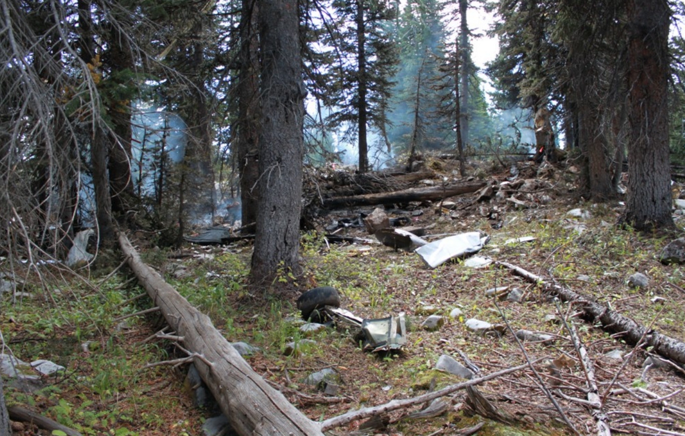
Photo: NTSB
Revision history:
| Date/time | Contributor | Updates |
|---|---|---|
| 16-Sep-2017 23:44 | Iceman 29 | Added |
| 16-Sep-2017 23:57 | Iceman 29 | Updated [Narrative] |
| 17-Sep-2017 15:51 | Aerossurance | Updated [Date, Time, Location, Destination airport, Source, Narrative] |
| 17-Sep-2017 23:13 | Geno | Updated [Registration, Cn, Operator, Nature, Departure airport, Source] |
| 20-Sep-2017 16:02 | Iceman 29 | Updated [Source, Embed code] |
| 15-Jul-2019 18:05 | ASN Update Bot | Updated [Time, Operator, Nature, Departure airport, Destination airport, Source, Embed code, Narrative, Accident report, ] |
| 15-Jul-2019 19:54 | harro | Updated [Departure airport, Destination airport, Source, Embed code, Narrative, Photo] |
Corrections or additions? ... Edit this accident description
The Aviation Safety Network is an exclusive service provided by:
Quick Links:
| ASN Home | Send Correction / Feedback |
| FSF Home | Disclaimer | Copyright |
| Contact Us | Privacy Policy |
| Press / Media |
 ©2024 Flight Safety Foundation