ASN Wikibase Occurrence # 200440
This information is added by users of ASN. Neither ASN nor the Flight Safety Foundation are responsible for the completeness or correctness of this information.
If you feel this information is incomplete or incorrect, you can submit corrected information.
| Date: | Monday 16 October 2017 |
| Time: | 14:30 |
| Type: |  Cessna 210-5 (205) |
| Owner/operator: | Private |
| Registration: | N8347Z |
| MSN: | 205-0347 |
| Year of manufacture: | 1963 |
| Total airframe hrs: | 5533 hours |
| Engine model: | Continental O-470 |
| Fatalities: | Fatalities: 1 / Occupants: 1 |
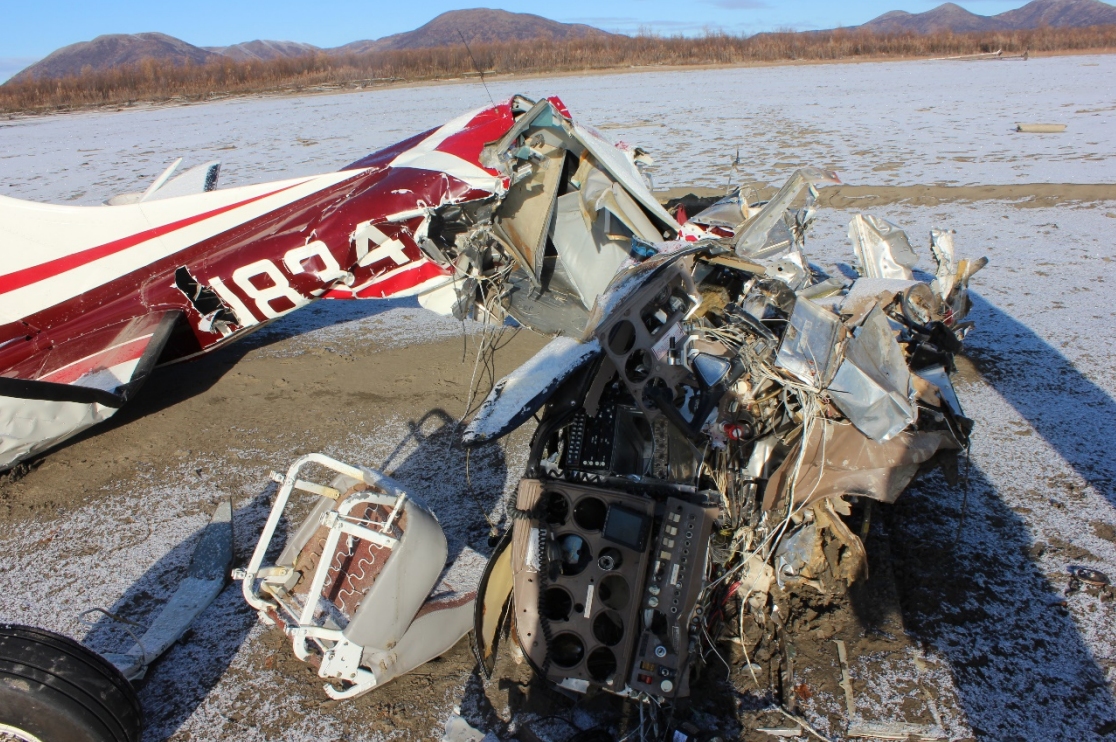
| Aircraft damage: | Destroyed |
| Category: | Accident |
| Location: | South of Russian Mission, Kusilvak Census Area, AK -
 United States of America United States of America
|
| Phase: | En route |
| Nature: | Private |
| Departure airport: | Russian Mission, AK (9AK2) |
| Bethel, AK (BET) | |
| Investigating agency: | NTSB |
| Confidence Rating: |
The non-instrument-rated private pilot was conducting a VFR cross-country flight in an area of low clouds and fog layers. According to a pilot who departed about 10 minutes ahead of the accident pilot on the same flight route, widespread areas of low-level fog existed along the flight route. The interviewed pilot estimated that fog existed between 400 and 600 ft above ground level (agl). The interviewed pilot also stated that he flew his airplane at 1,500 ft agl, above the fog and with good visibility, but he did not know the altitude at which the accident pilot would be flying his airplane.
Examination of the airplane did not reveal any anomalies that would have precluded normal operation. Meteorological information indicated that the accident pilot would have encountered instrument meteorological conditions during the flight. Specifically, the area forecast that was valid at the time of the accident included an AIRMET for instrument conditions, a broken to overcast ceiling at 300 ft with cloud tops at 10,000 ft, and visibilities below 1 mile in mist. Also, images from the FAA's aviation weather camera facing the direction of the accident location indicated a low bank of clouds toward the accident site and along the intended flight route.
The pilot's relatively low flight experience, lack of an instrument rating and the lack of visual references due to fog and cloud layers created a situation conducive to the development of spatial disorientation. The airplane wreckage and impact information indicated that a loss of control occurred, which is consistent with the known effects of spatial disorientation.
Probable Cause: The pilot's decision to continue visual flight into instrument meteorological conditions, which resulted in spatial disorientation and a subsequent loss of control.
Accident investigation:
 |
|
Sources:
NTSB
FAA register: http://registry.faa.gov/aircraftinquiry/NNum_Results.aspx?NNumbertxt=N8347Z
Location
Images:

Photo: NTSB
Revision history:
| Date/time | Contributor | Updates |
|---|---|---|
| 18-Oct-2017 03:06 | Geno | Added |
| 22-Oct-2017 08:31 | gerard57 | Updated [Total fatalities, Source, Narrative] |
| 11-Nov-2018 10:54 | harro | Updated [Source, Narrative, Photo, Accident report, ] |
Corrections or additions? ... Edit this accident description
The Aviation Safety Network is an exclusive service provided by:


 ©2024 Flight Safety Foundation