

| Date: | Monday 26 May 1952 |
| Time: | |
| Type: |  Handley Page HP.81 Hermes IV |
| Owner/operator: | British Overseas Airways Corporation - BOAC |
| Registration: | G-ALDN |
| MSN: | HP.81/15 |
| Year of manufacture: | 1950 |
| Fatalities: | Fatalities: 1 / Occupants: 18 |
| Aircraft damage: | Destroyed, written off |
| Category: | Accident |
| Location: | 114 km SSE of Atar -
 Mauritania Mauritania
|
| Phase: | En route |
| Nature: | Passenger - Scheduled |
| Departure airport: | Tripoli International Airport (TIP/HLLT) |
| Kano International Airport (KAN/DNKN) | |
| Confidence Rating: |
The Hermes was on a flight to Kano when the crew lost its way over the desert area. Close to fuel exhaustion, a forced wheels-up landing was carried out in the desert. The left wing broke off during the ground slide. The first officer died 5 days later due to exhaustion, brought about by strain and heat.
PROBABLE CAUSE: "1) Faulty use by the navigator of the variation setting control on the CL2 Gyrosyn compass. 2) Faulty checking of compasses by incorrect astral bearing and without the aid of radio bearing. 3) Incorrect inference drawn by the captain in pronouncing the CL2 Gyrosyn compass correct and the P.12 magnetic compass unserviceable. 4) Fault on the part of the captain in not returning to Tripoli when the P.12 compass was regarded as unserviceable (in breach of BOAC regulations). 5) Inability of the crew to realize that astro shots were being taken on the wrong stars. 6) Inability of the crew to determine the aircraft's position properly by the standard methods when the VSC setting error was discovered. 7) Lack of decisive action on the part of the captain once he knew he had lost his way. 8) Ignorance on the part of those on board, of the assistance which could have been afforded by Atar airfield."
Sources:
ICAO Circular 38-AN/33 (79-85)
Location
Images:
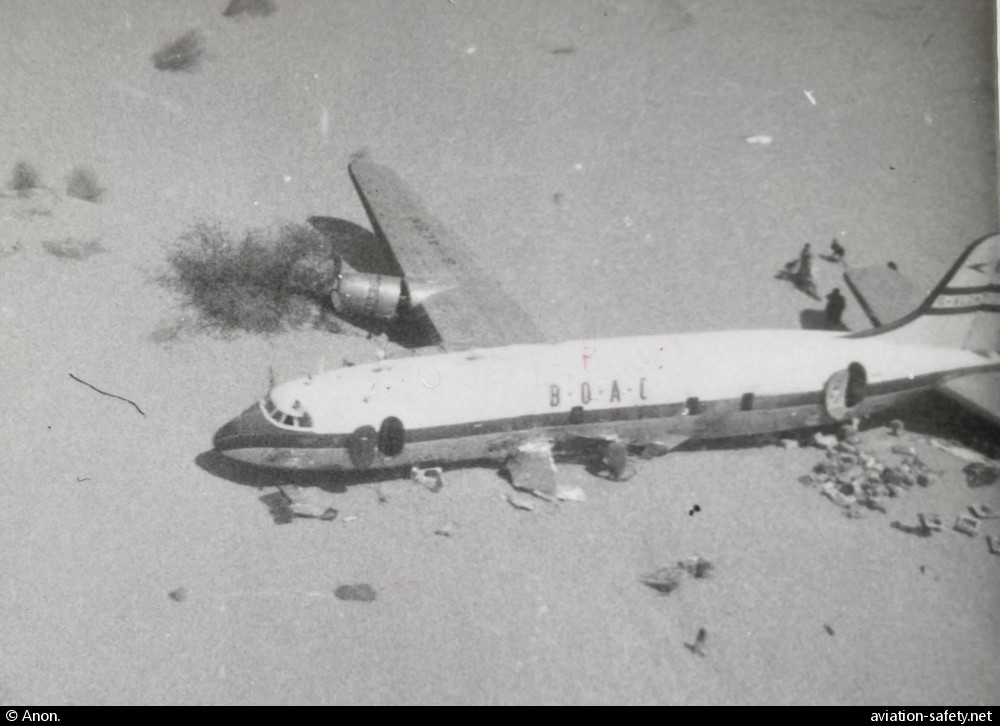
photo (c) Anon.; 114 km SSE of Atar; May 1952
Revision history:
| Date/time | Contributor | Updates |
|---|
The Aviation Safety Network is an exclusive service provided by:
Quick Links:
| ASN Home | Send Correction / Feedback |
| FSF Home | Disclaimer | Copyright |
| Contact Us | Privacy Policy |
| Press / Media |
 ©2024 Flight Safety Foundation