

| Date: | Monday 24 January 1966 |
| Time: | 07:02 |
| Type: |  Boeing 707-437 |
| Owner/operator: | Air-India |
| Registration: | VT-DMN |
| MSN: | 18055/200 |
| Year of manufacture: | 1961 |
| Total airframe hrs: | 16188 hours |
| Engine model: | Rolls-Royce Conway 508 |
| Fatalities: | Fatalities: 117 / Occupants: 117 |
| Aircraft damage: | Destroyed, written off |
| Category: | Accident |
| Location: | Mont Blanc -
 France France
|
| Phase: | En route |
| Nature: | Passenger - Scheduled |
| Departure airport: | Beirut International Airport (BEY/OLBA) |
| Genève-Cointrin Airport (GVA/LSGG) | |
| Investigating agency: | BEA |
| Confidence Rating: |
The Boeing 707, named "Kanchenjunga", operated on a flight from Mumbai (Bombay) to London via Delhi, Beirut and Geneva. The flight to and takeoff from Beirut where routine, except for a failure of the no. 2 VOR. At 07:00 GMT the pilot reported reaching FL190 to Geneva ACC. He was told to maintain that flight level "unless able to descend VMC one thousand on top". The pilot confirmed this and added that they were passing abeam Mont Blanc. The controller noted that the flight wasn't abeam Mont Blanc yet and radioed "you have 5 miles to the Mont Blanc", to which the pilot answered with "Roger." Flight 101 then started to descend from FL190 until it struck the Mont Blanc at an elevation of 15585 feet (4750 m).
PROBABLE CAUSE: "The commission concluded that the most likely hypothesis was the following: a) The pilot-in-command, who knew on leaving Beirut that one of the VORs was unserviceable, miscalculated his position in relation to Mont Blanc and reported his own estimate of this position to the controller; the radar controller noted the error, determined the position of the aircraft correctly and passed a communication to the aircraft which, he believed, would enable it to correct its position.; b) For want of a sufficiently precise phraseology, the correction was mis-understood by the pilot who, under the mistaken impression that he had passed the ridge leading to the summit and was still at a flight level which afforded sufficient safety clearance over the top of Mont Blanc, continued his descent."
Accident investigation:
 |
|
Sources:
ICAO Circular Accident Digest 18-I
Location
Images:
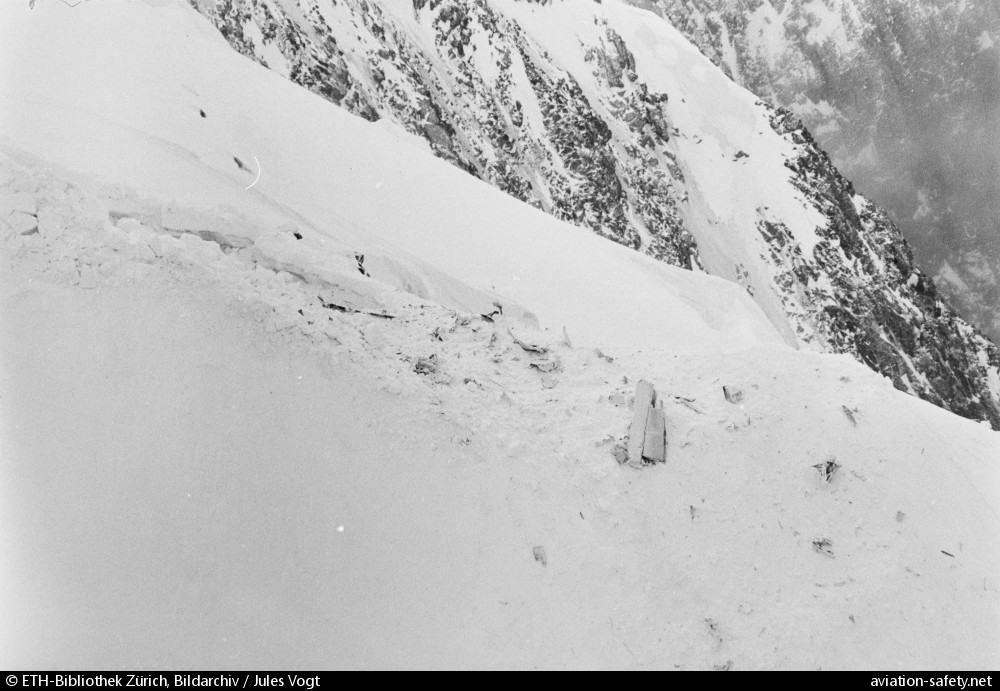
photo (c) ETH-Bibliothek Zürich, Bildarchiv / Jules Vogt; Mont Blanc; January 1966; (CC:by-sa)
Revision history:
| Date/time | Contributor | Updates |
|---|
The Aviation Safety Network is an exclusive service provided by:
Quick Links:
| ASN Home | Send Correction / Feedback |
| FSF Home | Disclaimer | Copyright |
| Contact Us | Privacy Policy |
| Press / Media |
 ©2024 Flight Safety Foundation