| Date: | Wednesday 22 March 1995 |
| Time: | 08:12 |
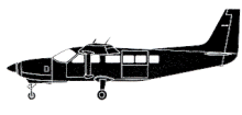
| Type: |  Cessna 208B Super Cargomaster |
| Owner/operator: | Union Flights |
| Registration: | N9417B |
| MSN: | 208B0065 |
| Year of manufacture: | 1987 |
| Total airframe hrs: | 4959 hours |
| Engine model: | Pratt & Whitney Canada PT6A-114 |
| Fatalities: | Fatalities: 1 / Occupants: 1 |
| Aircraft damage: | Destroyed, written off |
| Category: | Accident |
| Location: | Reno, NV -
 United States of America United States of America
|
| Phase: | Approach |
| Nature: | Cargo |
| Departure airport: | Sacramento Metropolitan Airport, CA (SMF/KSMF) |
| Reno/Tahoe International Airport, NV (RNO/KRNO) | |
| Investigating agency: | NTSB |
| Confidence Rating: |
Approaching Reno (RNO), the pilot received an instrument clearance to perform a Localizer DME-1, runway 16R, approach, which the FAA had previously approved for the operator's use. The localizer centreline passed over a 6,161-foot (1885 m) msl mountain, which was depicted on the chart. The pilot was familiar with the area, having transported cargo from Sacramento to Reno for 5 days each week since December, 1994. IMC existed and light snow showers were present. ATC issued the pilot a series of instructions as he was radar vectored toward the final approach fix (FAF), which had a minimum crossing altitude of 6,700 feet (2050 m) msl. The pilot misstated four of the instructions during clearance read backs and was corrected by ATC each time. Contact with the pilot was lost following issuance of his landing clearance. The airplane impacted the mountainside at an elevation of about 6,050 feet (1851 m), while tracking inbound near the centreline of the localizer course, about 2.7 nautical miles before reaching the FAF.
PROBABLE CAUSE: "The pilot's failure to comply with published instrument approach procedures by a premature descent below the minimum altitude specified for the approach. "
Accident investigation:
 |
|
Sources:
NTSB id LAX95FA141
Location
Revision history:
| Date/time | Contributor | Updates |
|---|
The Aviation Safety Network is an exclusive service provided by:


 ©2024 Flight Safety Foundation