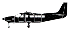
ASN Wikibase Occurrence # 323855
| Date: | Monday 23 November 1998 |
| Time: | 00:30 |
| Type: |  Cessna 208B Super Cargomaster |
| Owner/operator: | Regency Express Air |
| Registration: | N9352B |
| MSN: | 208B0061 |
| Year of manufacture: | 1987 |
| Total airframe hrs: | 6717 hours |
| Engine model: | Pratt & Whitney Canada PT6A-114 |
| Fatalities: | Fatalities: 2 / Occupants: 2 |
| Aircraft damage: | Destroyed, written off |
| Category: | Accident |
| Location: | 9 km N of Victoria International Airport, BC (YYJ) -
 Canada Canada
|
| Phase: | Approach |
| Nature: | Cargo |
| Departure airport: | Vancouver International Airport, BC (YVR/CYVR) |
| Victoria International Airport, BC (YYJ/CYYJ) | |
| Investigating agency: | TSB |
| Confidence Rating: |
Regency Express Air flight 434 was on a night cargo flight from Vancouver (YVR) to Victoria (YYJ) and was operating under VFR. The aircraft departed from Vancouver's runway 08R at 00:12 PST and completed a climbing right-hand turn onto a direct track towards Active Pass. The aircraft leveled off at 2000 feet agl and remained at that altitude for all but the last portion of the flight. As the aircraft approached Active Pass, the crew made a radio call to inform any traffic in the Victoria area of their intention to join left-base for a landing on runway 09 at the Victoria airport. Several minutes later, the crew made a second report indicating that they were 10 nm (18,5 km) back, for a landing on runway 09. The last position report was made as they approached Beaver Point, at the south-east end of Saltspring Island. The aircraft then made a noticeable turn to the right, in the vicinity of Beaver Point, and began to track towards high ground north of the Victoria airport. At 00:26, the aircraft began a gradual, descending turn to the left onto a south-easterly heading, before striking trees near the peak of Mount Tuam on the southern end of Saltspring Island.
FINDINGS AS TO CAUSES AND CONTRIBUTING FACTORS:
1. Although weather information was available by radio from the Vancouver FSS specialists or from the Victoria Terminal controllers, there is no indication that the pilots requested weather updates from either of these units.
2. The crew of RXX434 would have encountered the lower ceiling in the vicinity of Beaver Point. This lower layer of cloud would have restricted the crew's view of the ground lighting and reduced the ambient lighting available to navigate by visual means.
3. With the loss of ground references, it is unlikely that the crew would have been able to perceive the divergence of the aircraft's flight path away from its intended track by visual means.
4. The crew was unable to maintain separation between the aircraft and the terrain by visual means.
5. The published VFR arrival and departure routes for Victoria were not consistent with obstacle clearance requirements for commercial operators.
6. Regency Express Air Operations' crew manual suggested an en route altitude of 1 500 feet for this particular flight. That route and altitude combination is not consistent with published obstacle clearance requirements.
Accident investigation:
 |
|
Sources:
Location
Images:

photo (c) TSB
Revision history:
| Date/time | Contributor | Updates |
|---|
The Aviation Safety Network is an exclusive service provided by:


 ©2024 Flight Safety Foundation