ASN Wikibase Occurrence # 323714
| Date: | Tuesday 20 July 1999 |
| Time: | 11:05 |
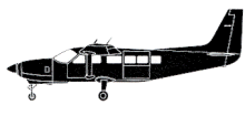
| Type: |  Cessna 208B Grand Caravan |
| Owner/operator: | La Costeña |
| Registration: | YN-CED |
| MSN: | 208B0341 |
| Year of manufacture: | 1993 |
| Engine model: | Pratt & Whitney Canada PT6A-114A |
| Fatalities: | Fatalities: 16 / Occupants: 16 |
| Aircraft damage: | Destroyed, written off |
| Category: | Accident |
| Location: | 50 km W of Bluefields -
 Nicaragua Nicaragua
|
| Phase: | En route |
| Nature: | Passenger - Scheduled |
| Departure airport: | Managua-Augusto C. Sandino Airport (MGA/MNMG) |
| Bluefields Airport (BEF/MNBL) | |
| Confidence Rating: |
The Grand Caravan YN-CED was equipped with a Garmin 100 GPS. At some time prior to the flight the GPS was removed because it was to be used in a helicopter operated by La Costeña. The airplane departed Managua (MGA) on a flight to Bluefields (BEF). The descent for Bluefields was started prematurely.
The Caravan flew into a remote hillside of the Cerro Silva at approx. the 2000 feet level. the aircraft was on a VFR flight in weather conditions including low clouds and rain. Safety altitude in the area was 2700 feet.
Sources:
Avión se estrelló por "razones desconocidas"(El Nuevo Diario 25-9-1999)
History of this aircraft
Other occurrences involving this aircraft
| 30 July 1995 | YN-CED | La Costeña | 1 | Villavicencio-La Vanguardia Airport (VVC) |  |
unk |
Location
Revision history:
| Date/time | Contributor | Updates |
|---|
The Aviation Safety Network is an exclusive service provided by:


 ©2024 Flight Safety Foundation