

| Date: | Tuesday 8 February 2000 |
| Time: | 10:07 |
| Type: |  Embraer EMB-110P2 Bandeirante |
| Owner/operator: | Sabin Air |
| Registration: | C9-AUH |
| MSN: | 110186 |
| Year of manufacture: | 1978 |
| Engine model: | Pratt & Whitney Canada PT6A-34 |
| Fatalities: | Fatalities: 0 / Occupants: 18 |
| Other fatalities: | 1 |
| Aircraft damage: | Destroyed, written off |
| Category: | Accident |
| Location: | W of Maputo International Airport (MPM) -
 Mozambique Mozambique
|
| Phase: | Initial climb |
| Nature: | Passenger - Non-Scheduled/charter/Air Taxi |
| Departure airport: | Maputo International Airport (MPM/FQMA) |
| Manzini-Matsapha International Airport (MTS/FDMS) | |
| Confidence Rating: |
The Sabin Air plane had trouble gaining height following takeoff. It struck a house, killing a woman who was washing clothing when the plane struck the house in the "25th June" neighborhood, near the airport. Weather at the time of the crash was hot and sunny. The aircraft was chartered to fly back some students to their boarding school in Eswatini.
Sources:
Scramble 252
Africa News Online
Hannah Boughton
Scramble 250
Images:
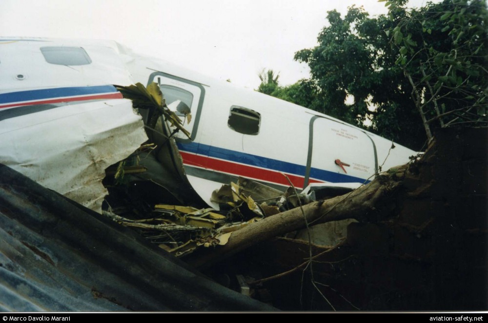
photo (c) Marco Davolio Marani; Maputo; 10 February 2000
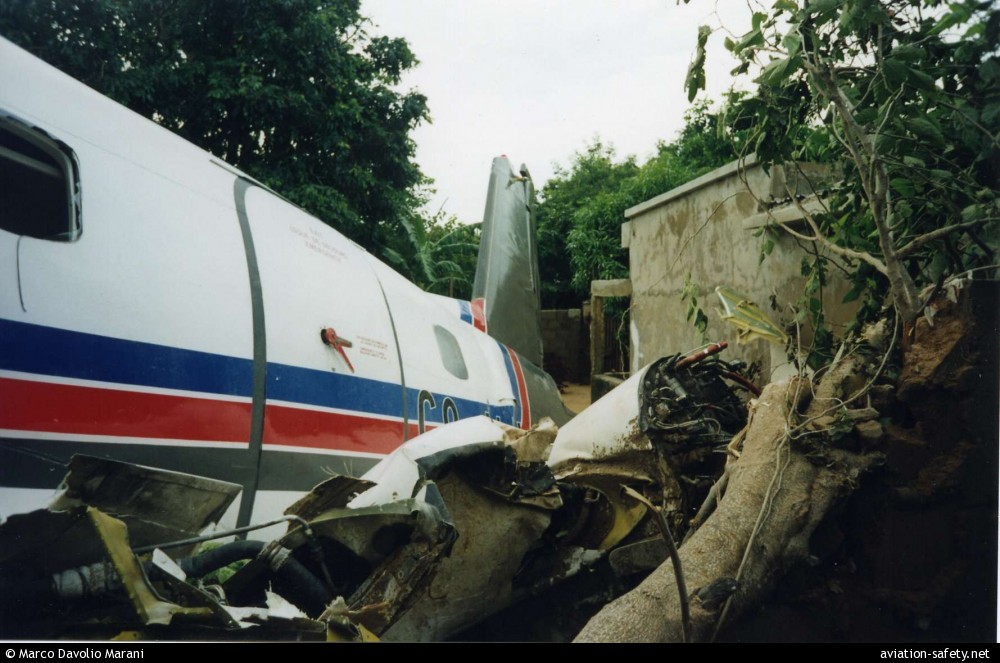
photo (c) Marco Davolio Marani; Maputo; 10 February 2000
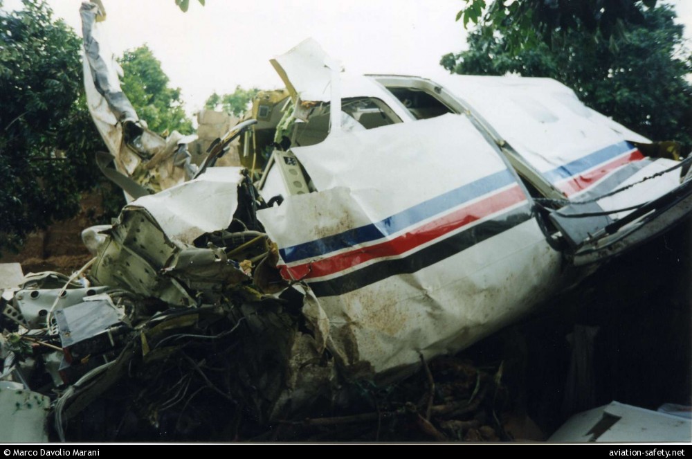
photo (c) Marco Davolio Marani; Maputo; 10 February 2000
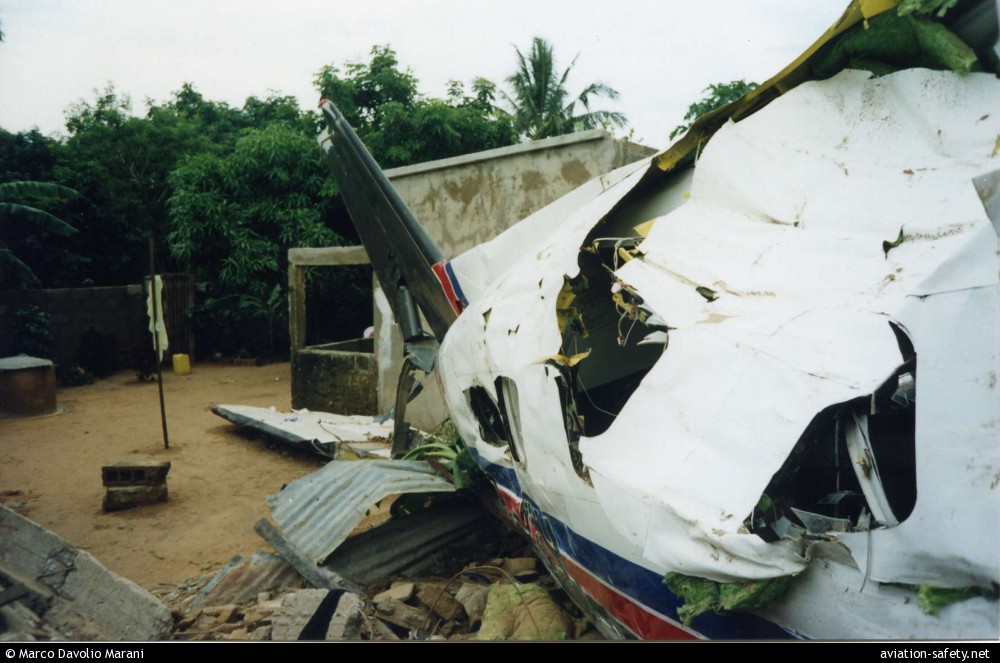
photo (c) Marco Davolio Marani; Maputo; 10 February 2000
Revision history:
| Date/time | Contributor | Updates |
|---|
The Aviation Safety Network is an exclusive service provided by:
Quick Links:
| ASN Home | Send Correction / Feedback |
| FSF Home | Disclaimer | Copyright |
| Contact Us | Privacy Policy |
| Press / Media |
 ©2024 Flight Safety Foundation