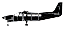
ASN Wikibase Occurrence # 323184
| Date: | Friday 2 November 2001 |
| Time: | 19:32 |
| Type: |  Cessna 208B Grand Caravan |
| Owner/operator: | Stage Air Ltd. |
| Registration: | C-GGUH |
| MSN: | 208B0827 |
| Year of manufacture: | 2000 |
| Engine model: | Pratt & Whitney Canada PT6A-114A |
| Fatalities: | Fatalities: 0 / Occupants: 2 |
| Aircraft damage: | Substantial, repaired |
| Category: | Accident |
| Location: | Genève-Cointrin Airport (GVA) -
 Canada Canada
|
| Phase: | Approach |
| Nature: | Ferry/positioning |
| Departure airport: | Tuktoyaktuk Airport, NT (YUB/CYUB) |
| Inuvik/Mike Zubko Airport, NT (YEV/CYEV) | |
| Investigating agency: | TSB |
| Confidence Rating: |
The Cessna Caravan, C-GGUH, was on a visual flight rules flight, at night, from Tuktoyaktuk, Northwest Territories, to Inuvik-Mike Zubko Airport, when instrument meteorological conditions (IMC) were encountered. Before entering the Inuvik control zone, the pilot contacted the air traffic controller and was issued an instrument approach clearance for runway 23 at 19:32 local time. During the approach the aircraft contacted a hill top four nautical miles north of the airport and came to rest in an upright position. The aircraft was substantially damaged; the pilot and the one passenger sustained minor injuries.
Findings as to Causes and Contributing Factors
1. The pilot did not adequately plan for the IFR approach, did not execute the approach in a manner so as to align the aircraft with the runway, and flew into terrain.
2. The pilot=s low comfort level with IFR procedures coupled with the relatively short time to organize for the assigned approach most likely resulted in the pilot losing situational awareness.
3. The pilot did not use the autopilot or the radar altimeter to reduce workload and provide terrain alerting during the approach.
Accident investigation:
 |
|
Sources:
Location
Revision history:
| Date/time | Contributor | Updates |
|---|
The Aviation Safety Network is an exclusive service provided by:


 ©2024 Flight Safety Foundation