

| Date: | Monday 18 June 2018 |
| Time: | 14:52 |
| Type: |  Cessna 208B Grand Caravan |
| Owner/operator: | Spirit Avia Sentosa |
| Registration: | PK-FSL |
| MSN: | 208B1254 |
| Year of manufacture: | 2007 |
| Total airframe hrs: | 11276 hours |
| Cycles: | 15519 flights |
| Engine model: | Pratt & Whitney Canada PT6A-114A |
| Fatalities: | Fatalities: 0 / Occupants: 13 |
| Aircraft damage: | Substantial, repaired |
| Category: | Accident |
| Location: | 6,7 km E of Nabire Airport (NBX) -
 Indonesia Indonesia
|
| Phase: | Approach |
| Nature: | Passenger - Non-Scheduled/charter/Air Taxi |
| Departure airport: | Bilogai/Sugapa Airport (ZGP/WAYB) |
| Nabire Airport (NBX/WABI) | |
| Investigating agency: | NTSC |
| Confidence Rating: |
The Spirit Avia Sentosa Cessna 208B was conducting unscheduled passenger flights. The flights of the day planned for the pilots were from Douw Aturure Airport (WABI), Nabire to Sugapa Airstrip (WAYB) and return for three times. The PIC acted as Pilot Flying (PF) and the SIC acted as Pilot Monitoring (PM) on all these flights.
After the third flight from Nabire to Bilorai, the aircraft landed safely at Sugapa Airstrip. Prior to the departure to Nabire, there was no report or record of aircraft system malfunction and the aircraft was operated within the approved weight and balance envelope. On board the aircraft were two pilots and 11 passengers.
The aircraft departed from in daylight conditions and cruised at an altitude of 10,500 feet. The aircraft was flying in an out through clouds when approaching Nabire.
Over checkpoint BRAVO, the pilot made initial contact with Nabire Tower controller and advised that the aircraft was descending and passed altitude of 6,600 feet.
During descent after checkpoint BRAVO, the pilot noticed development of clouds along the route and decided to avoid the clouds by deviating the aircraft track to the right of the GPS route.
At about 4.5 Nm from NBR VOR/DME, the flight monitoring system of the Spirit Avia Sentosa recorded the aircraft altitude was 2,000 feet.
The PM noticed yellow on the aircraft GPS which meant the terrain was between 1,000 feet and 100 feet below the aircraft altitude and advised the PF. The PF decided to disengage the auto pilot, reduced the rate of descend and continued to get visual reference on ground.
The PM noticed an "X" symbol on the GPS which indicated a potential impact point and advised the PF. The PF was continuing the descent and then the second "X" appeared on the GPS. A few second later, the PF noticed terrain ahead and pulled the aircraft. The left side of the aircraft impacted a tree.
At about 2 Nm, the pilot advised the controller of the aircraft position and requested to make a landing approach using runway 16. The controller approved the pilot request. The rest of the flight was uneventful and the aircraft landed safely using runway 16 at Nabire.
No one injured in this occurrence and the aircraft was substantially damaged. Evidence of impact marks were found on the left side of the aircraft which were on the main landing gear strut, wing strut fairing, wing and horizontal stabilizer
The KNKT concluded the contributing factors as follows:
- The VFR weather minimum requirement that was not implemented properly made the pilot did not have clear visual of the surrounding area.
- The consideration of less risk of flying into clouds and relying to the GPWS's aural alert or having visual contact to the terrain, resulted in the ignorance to the GPS alert and continuation of the descend while flying into clouds.
Accident investigation:
 |
|
Sources:
Location
Images:
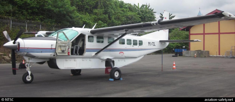
photo (c) NTSC; Nabire Airport (NBX); June 2018
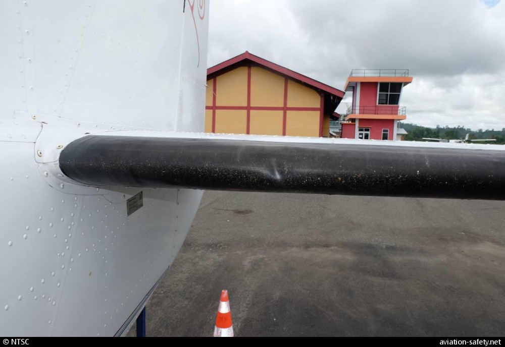
photo (c) NTSC; Nabire Airport (NBX); June 2018
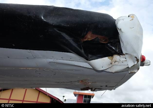
photo (c) NTSC; Nabire Airport (NBX); June 2018
Revision history:
| Date/time | Contributor | Updates |
|---|
The Aviation Safety Network is an exclusive service provided by:
Quick Links:
| ASN Home | Send Correction / Feedback |
| FSF Home | Disclaimer | Copyright |
| Contact Us | Privacy Policy |
| Press / Media |
 ©2024 Flight Safety Foundation