ASN Wikibase Occurrence # 164033
This information is added by users of ASN. Neither ASN nor the Flight Safety Foundation are responsible for the completeness or correctness of this information.
If you feel this information is incomplete or incorrect, you can submit corrected information.
| Date: | Sunday 26 January 2014 |
| Time: | 15:30 |
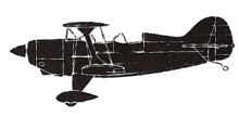
| Type: |  Aviat S-2C |
| Owner/operator: | Private |
| Registration: | N102ZT |
| MSN: | 6057 |
| Year of manufacture: | 2003 |
| Total airframe hrs: | 127 hours |
| Engine model: | Lycoming AEVI-540-O4A5 |
| Fatalities: | Fatalities: 0 / Occupants: 1 |
| Aircraft damage: | Substantial |
| Category: | Accident |
| Location: | Roseburg Regional Airport (KRBG), Roseburg, OR -
 United States of America United States of America
|
| Phase: | Approach |
| Nature: | Private |
| Departure airport: | Roseburg, OR (RBG) |
| Roseburg, OR (RBG) | |
| Investigating agency: | NTSB |
| Confidence Rating: |
The commercial pilot was conducting a local personal flight. The pilot reported that he entered the traffic pattern behind a much slower airplane and observed a second (high-wing) airplane on an apparent base leg about 1 mile south of the airport. The pilot made a right 360-degree turn while on the downwind leg for spacing. After reestablishing his position on the downwind leg, he requested position reports from local area traffic. The pilot in the first airplane in the traffic pattern reported clear of the runway; the accident pilot heard no other position reports and subsequently began a normal approach to the runway. Immediately before turning to final, the pilot from an unknown airplane transmitted that his airplane was on final for the same runway. The accident pilot then rolled the airplane wings level and checked the final approach path for traffic. He observed no traffic and subsequently rolled the airplane back into a left turn to final with a shallow left forward slip. As the airplane rolled onto short final, it collided with the upper portion of a tall tree. The pilot then landed the airplane successfully.
The Federal Aviation Administration Digital Airport/Facility Directory noted that the runway had a displaced threshold of 371 ft due to a tree, which was also depicted on the airport diagram. It is likely that the pilot lost his orientation with respect to the tree when he diverted his scan to look for another airplane in the traffic pattern.
Probable Cause: The pilot’s loss of orientation while scanning for airport traffic during the turn from the base to final legs of the traffic pattern, which resulted in his failure to maintain clearance from a tree.
Accident investigation:
 |
|
Sources:
NTSB
FAA register: http://registry.faa.gov/aircraftinquiry/NNum_Results.aspx?NNumbertxt=102ZT
Location
Revision history:
| Date/time | Contributor | Updates |
|---|---|---|
| 20-Feb-2014 01:36 | Geno | Added |
| 21-Dec-2016 19:28 | ASN Update Bot | Updated [Time, Damage, Category, Investigating agency] |
| 29-Nov-2017 13:21 | ASN Update Bot | Updated [Operator, Other fatalities, Departure airport, Destination airport, Source, Narrative] |
Corrections or additions? ... Edit this accident description
The Aviation Safety Network is an exclusive service provided by:


 ©2024 Flight Safety Foundation