

ASN Wikibase Occurrence # 211268
This information is added by users of ASN. Neither ASN nor the Flight Safety Foundation are responsible for the completeness or correctness of this information.
If you feel this information is incomplete or incorrect, you can submit corrected information.
| Date: | Sunday 20 May 2018 |
| Time: | 14:23 |
| Type: |  Piper PA-34-200T Seneca II |
| Owner/operator: | Private |
| Registration: | N1101X |
| MSN: | 34-7570208 |
| Year of manufacture: | 1975 |
| Total airframe hrs: | 7603 hours |
| Engine model: | Continental LTSIO-360-EB |
| Fatalities: | Fatalities: 1 / Occupants: 1 |
| Aircraft damage: | Destroyed |
| Category: | Accident |
| Location: | Bald Mountain, Bennington County, Woodford, VT -
 United States of America United States of America
|
| Phase: | En route |
| Nature: | Private |
| Departure airport: | Burlington International Airport, VT (BTV/KBTV) |
| Oxford-Waterbury Airport, CT (OXC/KOXC) | |
| Investigating agency: | NTSB |
| Confidence Rating: |
After receiving commercial and flight instructor certificates with a designated pilot examiner (DPE), the instrument-rated commercial pilot planned to fly back to his home airport the following day. The DPE reviewed weather with the pilot and advised him to delay the flight 2 days due to poor weather; however, the following day, the pilot attempted the visual flight rules flight in instrument meteorological conditions with mountain obscuration. Before departing on the flight, the pilot received three weather briefings and all three contained information regarding instrument flight rules conditions with mountain obscuration.
The pilot was receiving flight following services from air traffic control, while proceeding southeast, in clouds, below the minimum vectoring altitude, near mountainous terrain. The controller suggested a westbound turn for lower terrain and continued radar coverage. The airplane briefly turned to a westbound heading, then turned back to a southeast heading. About 4 miles later, the controller again advised the pilot that, if he continued on the present heading, radar coverage would be lost. The pilot asked again what heading he should fly and the controller responded westbound, to which the pilot responded, "westbound heading 270." Radar and radio contact were lost during the second westbound turn. The last radar target indicated an altitude of 3,500 ft msl and groundspeed of 218 knots about 1,000 ft from the accident site, which was located at an elevation about 2,625 ft msl.
Examination of the accident site revealed a 60-ft debris path on a 265° course through trees, consistent with a 45° nose-down attitude at impact. Examination of the wreckage did not reveal any preimpact mechanical malfunctions. The pilot had entered clouds and was trying to fly clear of clouds. The conditions were conducive to the development of spatial disorientation; however, the extent to which spatial disorientation played a role could not be determined as the descent could have also been the result of an uncoordinated turn or distraction.
Probable Cause: The pilot's improper decision to attempt a visual flight rules flight in instrument meteorological conditions, which resulted in a loss of control during a turn.
Accident investigation:
 |
|
Sources:
NTSB
FAA register: http://registry.faa.gov/aircraftinquiry/NNum_Results.aspx?NNumbertxt=1101X
https://flightaware.com/live/flight/N1101X
Location
Images:
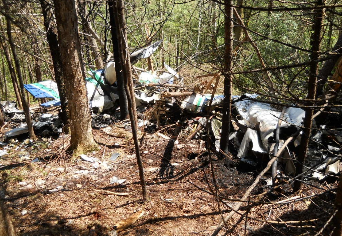
Photo: NTSB
Revision history:
| Date/time | Contributor | Updates |
|---|---|---|
| 21-May-2018 06:55 | gerard57 | Added |
| 21-May-2018 13:08 | gerard57 | Updated [Aircraft type, Total fatalities, Source, Damage, Narrative] |
| 21-May-2018 18:58 | harro | Updated [Aircraft type, Registration, Cn, Source] |
| 21-May-2018 19:11 | Geno | Updated [Time, Location, Departure airport, Destination airport, Source, Narrative] |
| 11-Nov-2019 17:42 | ASN Update Bot | Updated [Time, Departure airport, Destination airport, Source, Narrative, Accident report, ] |
| 11-Nov-2019 18:19 | harro | Updated [Departure airport, Destination airport, Source, Narrative, Photo] |
Corrections or additions? ... Edit this accident description
The Aviation Safety Network is an exclusive service provided by:
Quick Links:
| ASN Home | Send Correction / Feedback |
| FSF Home | Disclaimer | Copyright |
| Contact Us | Privacy Policy |
| Press / Media |
 ©2024 Flight Safety Foundation