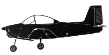
ASN Wikibase Occurrence # 213810
This information is added by users of ASN. Neither ASN nor the Flight Safety Foundation are responsible for the completeness or correctness of this information.
If you feel this information is incomplete or incorrect, you can submit corrected information.
| Date: | Monday 8 October 1973 |
| Time: | 11:00 |
| Type: |  Victa Airtourer 100 |
| Owner/operator: | private |
| Registration: | VH-MUH |
| MSN: | |
| Fatalities: | Fatalities: 1 / Occupants: 2 |
| Aircraft damage: | Destroyed |
| Category: | Accident |
| Location: | Tumby Bay, SA -
 Australia Australia
|
| Phase: | Take off |
| Nature: | Private |
| Departure airport: | Tumby Bay, SA |
| YMTG | |
| Investigating agency: | BASI |
| Confidence Rating: |
The area which was available for take-off was aligned east/west, 3,000 feet in length and 160 feet wide, and its surface was a short crop stubble. A wire fence three feet six inches high formed the northern and western boundaries and the area was bounded to the south by a standing crop. The Flight Manual of the aircraft required a distance of 1840 feet to be available for this take-off under the conditions which existed at the time. The aircraft had been parked at the western boundary of the area and, after starting the engine, the pilot taxied to a position on the southern side which he estimated to be 2000 feet from the western end but, during investigation, this distance was found to be only 1600 feet. The wind was from the north-west and was gusting to about 20 knots and the pilot decided to take off in a westerly direction, but angled at about 15 degrees across the area so that the take-off would be more nearly Into wind. The distance available between the selected point for commencement of take-off and the point at which this take-off path intersected the northern boundary fence, was subsequently established as 1100 feet. The take-off was commenced and the aircraft was not airborne as it approached the northern boundary fence. It was turned slightly to the left and the take-off run continued close and parallel to the fence until the aircraft became airborne in a nose high attitude with the tall bumper striking the ground. It then began a further turn to the left during which the port wing tip grazed the ground for a distance of almost 90 feet. After recovering to about a laterally level attitude, on a south-westerly heading, the aircraft touched down heavily, bounced and again touched down heavily before becoming airborne In the direction of a group of trees located outside the western boundary of the take-off area. The port wing then contacted a post in the boundary fence and the undercarriage picked up the top strand of wire. The aircraft crashed into the base of the trees and came to rest after the starboard wing root struck a substantial tree which penetrated the right hand side of the cockpit structure.
Accident investigation:
 |
|
Sources:
New Straits Times 9 October 1973, p3
https://www.atsb.gov.au/publications/investigation_reports/1973/aair/aair197304105/
https://www.atsb.gov.au/media/25083/197304105.pdf
Revision history:
| Date/time | Contributor | Updates |
|---|---|---|
| 30-Jul-2018 06:01 | Pineapple | Added |
| 03-Feb-2019 18:03 | TB | Updated [Operator, Source] |
Corrections or additions? ... Edit this accident description
The Aviation Safety Network is an exclusive service provided by:


 ©2024 Flight Safety Foundation