ASN Wikibase Occurrence # 219039
This information is added by users of ASN. Neither ASN nor the Flight Safety Foundation are responsible for the completeness or correctness of this information.
If you feel this information is incomplete or incorrect, you can submit corrected information.
| Date: | Tuesday 14 April 2015 |
| Time: | 08:11 |
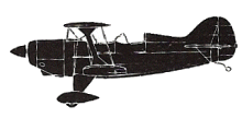
| Type: |  Pitts S-2E |
| Owner/operator: | Private |
| Registration: | N75BH |
| MSN: | 1251 |
| Year of manufacture: | 1987 |
| Engine model: | Lycoming IO360 SER |
| Fatalities: | Fatalities: 1 / Occupants: 1 |
| Aircraft damage: | Destroyed |
| Category: | Accident |
| Location: | Lebec, CA -
 United States of America United States of America
|
| Phase: | En route |
| Nature: | Private |
| Departure airport: | Bakersfield, CA (KBFL) |
| Blythe, CA (KBLH) | |
| Investigating agency: | NTSB |
| Confidence Rating: |
The airline transport pilot was conducting a visual flight rules (VFR) cross-county flight. When he did not check in after a planned stop, the pilot’s family reported him overdue, and an ALNOT (alert notice) was issued. The wreckage was located the next day in a remote area. Data retrieved from a handheld GPS unit revealed that, after takeoff, the airplane attained a maximum altitude of 2,500 ft above ground level (agl) and then descended to about 200 ft agl above an interstate. The airplane then turned east as it approached a mountain range. The final portion of the recording identified the airplane in a climbing left turn, starting from about 100 ft agl, climbing to 900 ft agl before descending in a right turn. The airplane impacted mountainous tree-covered terrain on a ridgeline. The wreckage distribution path was about 500 feet long and the airplane was heavily fragmented.
Weather conditions at the departure airport were VFR; however, an AIRMET (Airman’s Meteorological Information) for instrument meteorological conditions was in effect for the area at the time of the accident; witnesses reported low clouds in the area on the morning of the accident. No record was found that indicated that the pilot contacted a flight service station for a weather briefing.
A postaccident examination of the airframe and engine revealed no evidence of preimpact mechanical malfunctions or failures that would have precluded normal operation.
It is likely that the pilot encountered adverse weather along the flight route as the airplane approached the mountain range, which forced the pilot to maneuver from his course and change altitude in an attempt to remain in visual conditions. The flight likely encountered instrument meteorological conditions as it continued further into the mountains, and, during the pilot’s likely attempted to return to the interstate, he did not maintain sufficient clearance from rising terrain.
Probable Cause: The pilot’s continued visual flight into instrument meteorological conditions, which resulted in his failure to maintain sufficient clearance from rising terrain.
Accident investigation:
 |
|
Sources:
NTSB
Location
Revision history:
| Date/time | Contributor | Updates |
|---|---|---|
| 05-Dec-2018 18:46 | ASN Update Bot | Added |
Corrections or additions? ... Edit this accident description
The Aviation Safety Network is an exclusive service provided by:


 ©2024 Flight Safety Foundation