

ASN Wikibase Occurrence # 227901
This information is added by users of ASN. Neither ASN nor the Flight Safety Foundation are responsible for the completeness or correctness of this information.
If you feel this information is incomplete or incorrect, you can submit corrected information.
| Date: | Sunday 4 August 2019 |
| Time: | 15:50 LT |
| Type: |  Cessna 310I |
| Owner/operator: | Hwy 17 Trucking LLC |
| Registration: | N310QA |
| MSN: | 310I0063 |
| Engine model: | Continental IO-470 SER |
| Fatalities: | Fatalities: 1 / Occupants: 2 |
| Aircraft damage: | Substantial |
| Category: | Accident |
| Location: | near De Queen-J Lynn Helms Sevier County Airport (KDEQ), AR -
 United States of America United States of America
|
| Phase: | Approach |
| Nature: | Test |
| Departure airport: | De Queen-J Lynn Helms Sevier County Airport, AR (KDEQ) |
| De Queen-J Lynn Helms Sevier County Airport, AR (KDEQ) | |
| Investigating agency: | NTSB |
| Confidence Rating: |
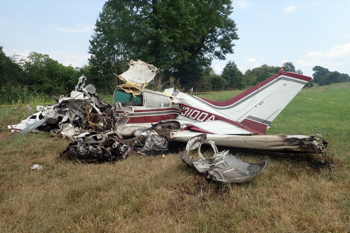
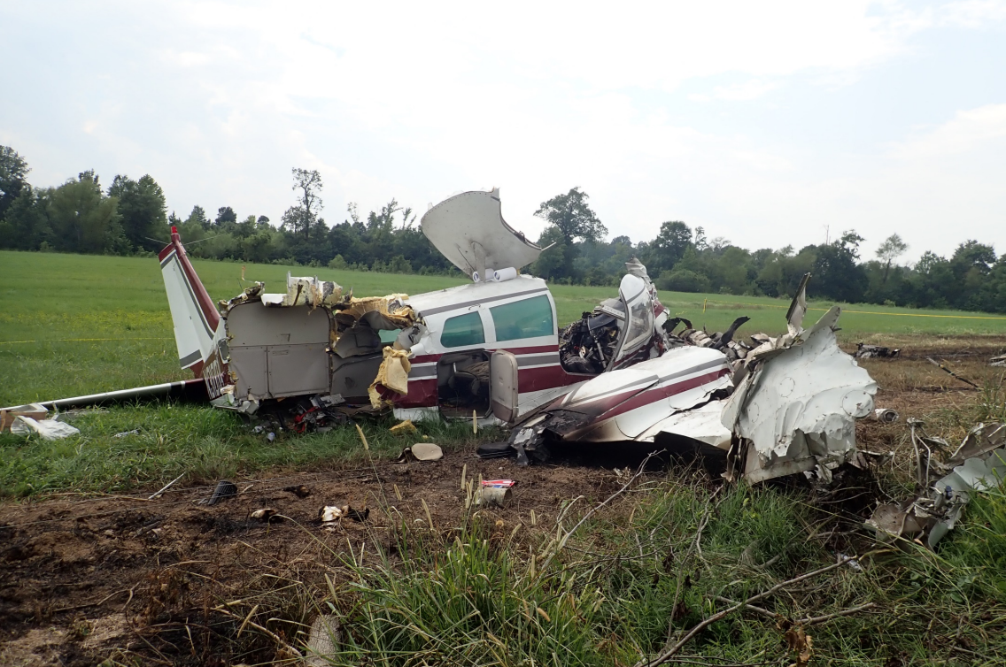
The pilots departed on a local flight in the multiengine airplane in visual meteorological conditions. Radar and GPS data showed the airplane maneuvering around the area of the departure airport at an altitude about 2,000 to 1,800 ft above ground level before it turned toward the airport and entered a descent that continued until ground contact. During the descent, the airplane's speed slowed below its published stall speed. Examination of the airframe and engines did not reveal any anomalies that would have precluded normal operation of the airplane.
A review of weather information found an area of cumuliform clouds and dissipating precipitation near the accident site. Although no AIRMETs or SIGMET advisories were valid for the area around the time of the accident, scattered thunderstorm activity was forecast for the area of the accident site around the accident time. During the dissipating stage, rain showers and thunderstorms are dominated by downdrafts and outflow boundaries. Although nearby surface observations did not record any gusty wind around the accident time, it is possible that the airplane encountered an area of localized outflow or turbulence that may have contributed to the accident.
Probable Cause: A loss of control for reasons that could not be determined based on the available information.
Accident investigation:
 |
|
Sources:
NTSB CEN19FA248
Location
Images:
Photos(c): NTSB
Revision history:
| Date/time | Contributor | Updates |
|---|---|---|
| 05-Aug-2019 03:24 | Geno | Added |
| 05-Aug-2019 11:03 | Captain Adam | Updated [Aircraft type, Registration, Cn, Phase, Departure airport, Destination airport, Source, Narrative] |
| 05-Aug-2019 13:25 | harro | Updated [Aircraft type, Registration, Cn, Source, Narrative] |
| 05-Aug-2019 13:28 | harro | Updated [Location, Phase, Departure airport, Destination airport, Source] |
| 05-Aug-2019 16:22 | Geno | Updated [Aircraft type, Registration, Cn, Operator, Total fatalities, Total occupants, Phase, Source, Damage, Narrative] |
| 05-Aug-2019 19:39 | Captain Adam | Updated [Source, Narrative] |
| 05-Aug-2019 20:18 | RobertMB | Updated [Location, Nature, Source, Narrative] |
| 05-Aug-2019 20:19 | RobertMB | Updated [Location, Narrative] |
| 05-Aug-2019 20:20 | RobertMB | Updated [Location] |
| 07-Mar-2022 01:41 | Captain Adam | Updated [Location, Departure airport, Source, Narrative, Category, Photo] |
| 07-Mar-2022 01:42 | Captain Adam | Updated [Accident report, Photo] |
| 02-Jul-2022 07:13 | ASN Update Bot | Updated [Time, Operator, Other fatalities, Nature, Source, Narrative, Accident report] |
Corrections or additions? ... Edit this accident description
The Aviation Safety Network is an exclusive service provided by:
Quick Links:
| ASN Home | Send Correction / Feedback |
| FSF Home | Disclaimer | Copyright |
| Contact Us | Privacy Policy |
| Press / Media |
 ©2024 Flight Safety Foundation