

ASN Wikibase Occurrence # 230208
This information is added by users of ASN. Neither ASN nor the Flight Safety Foundation are responsible for the completeness or correctness of this information.
If you feel this information is incomplete or incorrect, you can submit corrected information.
| Date: | Friday 25 October 2019 |
| Time: | 12:00 LT |
| Type: |  Mooney M20J 201 |
| Owner/operator: | Private |
| Registration: | N201BJ |
| MSN: | 24-0010 |
| Year of manufacture: | 1976 |
| Engine model: | Continental IO-550-A |
| Fatalities: | Fatalities: 1 / Occupants: 1 |
| Aircraft damage: | Substantial |
| Category: | Accident |
| Location: | American Falls, SW of American Falls Airport (U01), ID -
 United States of America United States of America
|
| Phase: | En route |
| Nature: | Private |
| Departure airport: | Dinsmore, CA (D63) |
| Nashua-Boire Field, NH (ASH/KASH) | |
| Investigating agency: | NTSB |
| Confidence Rating: |
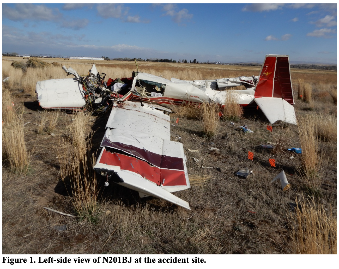
The pilot departed on a visual flight rules cross-country flight. GPS data revealed the airplane deviated from its previously established on-course heading after about 2 hours and established a direct course to a closer airport. The airplane began a descent about 30 minutes later that continued until the end of the recorded data. The airplane began a 180° turn away from a populated area and impacted terrain about 3.5 miles from the airport. A witness, located about 2 miles from the accident site, reported that she observed an airplane flying at a low altitude that turned and went 'straight down.'
During the last moments of the flight, the pilot turned 180° to avoid a populated area. This placed the airplane over farmland with a highway, about 450 ft to the left, and parallel to the airplane's flightpath. It is likely that the pilot continued the left turn to land on the highway but allowed the airplane to slow down and exceed the critical angle of attack, resulting in an aerodynamic stall and spin at an altitude too low for recovery. Ground scars at the accident site were also consistent with the airplane impacting in a near-vertical attitude.
Recorded engine data revealed consistent operation of the engine throughout the flight until about 2 minutes prior to the loss of data, when the data indicated a total loss of engine power.
Postaccident examination of the two main fuel tanks and the two auxiliary fuel tanks revealed no visible fuel remained, along with no hydraulic deformation of the forward wall of the main tanks. The recorded engine data also showed that 12.8 gallons of fuel remained in the airplane; however, it is likely the pilot input an incorrect amount of usable fuel in the engine monitoring device and believed that he had sufficient fuel to reach his destination. It was not possible to determine the amount of fuel onboard at takeoff. Fuel was not available at the departure airport.
Toxicology testing of the pilot's specimens detected the presence of Tetrahydrocannabinol, the psychoactive component of marijuana, at levels considered impairing. It is likely the pilot was impaired by his use of marijuana and made a series of errors including, poor fuel planning, and inability to successfully manage a forced landing following a total loss of engine power due to fuel exhaustion. It is likely impairing effects from his use of marijuana on the day of the flight contributed to this accident.
Probable Cause: The pilot's failure to ensure adequate fuel onboard and his subsequent failure to maintain airspeed while maneuvering which resulted in an aerodynamic stall following a total loss of engine power due to fuel exhaustion. Contributing to the accident was the pilot's impairment due to his use of marijuana.
Accident investigation:
 |
|
Sources:
NTSB WPR20FA015
FAA register: https://registry.faa.gov/aircraftinquiry/NNum_Results.aspx?NNumbertxt=201BJ
Location
Images:
Photo(c): NTSB
Revision history:
| Date/time | Contributor | Updates |
|---|---|---|
| 25-Oct-2019 23:02 | Geno | Added |
| 25-Oct-2019 23:08 | Geno | Updated [Location, Narrative] |
| 26-Oct-2019 06:20 | RobertMB | Updated [Time, Aircraft type, Registration, Cn, Operator, Location, Phase, Nature, Source, Narrative] |
| 03-Dec-2019 21:57 | Captain Adam | Updated [Departure airport, Destination airport, Source, Narrative] |
| 05-Mar-2022 23:18 | Captain Adam | Updated [Location, Departure airport, Destination airport, Narrative, Category, Photo] |
| 08-Jul-2022 12:06 | ASN Update Bot | Updated [Time, Other fatalities, Departure airport, Source, Narrative, Category, Accident report] |
Corrections or additions? ... Edit this accident description
The Aviation Safety Network is an exclusive service provided by:
Quick Links:
| ASN Home | Send Correction / Feedback |
| FSF Home | Disclaimer | Copyright |
| Contact Us | Privacy Policy |
| Press / Media |
 ©2024 Flight Safety Foundation