

ASN Wikibase Occurrence # 277937
This information is added by users of ASN. Neither ASN nor the Flight Safety Foundation are responsible for the completeness or correctness of this information.
If you feel this information is incomplete or incorrect, you can submit corrected information.
| Date: | Friday 6 May 2022 |
| Time: | 12:10 |
| Type: |  Van’s RV-10 |
| Owner/operator: | Private |
| Registration: | N54MG |
| MSN: | 41688 |
| Year of manufacture: | 2017 |
| Fatalities: | Fatalities: 2 / Occupants: 2 |
| Aircraft damage: | Substantial |
| Category: | Accident |
| Location: | Sausalito, CA -
 United States of America United States of America
|
| Phase: | En route |
| Nature: | Private |
| Departure airport: | Sacramento-Executive Airport, CA (SAC/KSAC) |
| Half Moon Airport, CA (HAF/KHAF) | |
| Investigating agency: | NTSB |
| Confidence Rating: |
The non-instrument-rated private pilot and passenger departed their home airport with the intention of flying to an airport on the coast. About 20 minutes before the accident, the pilot contacted air traffic control and requested to perform sightseeing in the San Francisco Bay area before proceeding southwest toward the destination airport. The pilot was instructed to remain clear of the Class B airspace that overlaid the area at an altitude of 3,000 ft mean sea level (msl). About six minutes before the accident, the pilot requested to transition toward his destination. The controller acknowledged and instructed the pilot to remain outside of Class B airspace. About one minute later, the pilot again stated his intent to proceed to the destination, and the controller again acknowledged and instructed the pilot to remain clear of the Class B. The airplane then made a series of turns, climbs, and descents from an altitude of 2,100 ft msl and below over a period of several minutes before it impacted the ground in a nose-down attitude.
Postaccident examination of the airframe and engine did not reveal any preimpact mechanical anomalies that would have precluded normal operation.
There was no record of the pilot obtaining a weather briefing before departing on the flight. According to witnesses, surveillance video, and weather reports, the airplane flew from an area of visual meteorological conditions into instrument meteorological conditions (IMC) as it neared the accident location. These conditions were forecast and would have been apparent to the pilot as he proceeded toward the area of the accident site. Modeling of the conditions in the area of the accident site indicated that the low-lying clouds and fog began about 200 ft above ground level and likely extended up to an altitude about 2,800 ft above ground level.
The pilot had received instrument flight training, but did not hold an instrument rating at the time of the accident. Logbook entries suggested that the pilot had previously operated under instrument flight rules in IMC without an instructor onboard the airplane.
Autopsy of the pilot revealed a dilated, enlarged heart; however, it is unlikely that the pilot’s heart disease contributed to the accident. Although toxicology testing indicated that the pilot had used the cannabis products delta-9 THC and cannabidiol, no detectable psychoactive cannabinoids remained in the pilot’s postmortem blood, and it is therefore unlikely that effects of his cannabis use contributed to the accident.
The reduced visibility conditions present at the time of the accident in the accident area and the pilot’s lack of instrument flight experience presented circumstances conducive to the development of spatial disorientation. The flight track data, which depicted the airplane’s erratic flight path before collision with terrain, was consistent with the effects of spatial disorientation. Based on the available information, it is likely that the pilot’s decision to proceed into an area of instrument meteorological conditions resulted in his spatial disorientation and a subsequent loss of airplane control.
Probable Cause: The pilot’s improper decision to continue a visual flight rules flight into an area of limited visibility conditions, which resulted in spatial disorientation and a loss of airplane control.
Accident investigation:
 |
|
Sources:
https://abc7news.com/marin-headlands-plane-crash-conzelman-road-golden-gate-sf/11824358/
https://www.kron4.com/news/two-killed-after-small-plane-crashes-in-marin-headlands/
https://data.ntsb.gov/Docket?ProjectID=105050
https://registry.faa.gov/AircraftInquiry/Search/NNumberResult?nNumberTxt=54MG
https://flightaware.com/live/flight/N54MG
https://globe.adsbexchange.com/?icao=a6d6ad&lat=38.116&lon=-122.104&zoom=10.0&showTrace=2022-05-06×tamp=1651864182
https://photos-e1.flightcdn.com/photos/retriever/b3845591fd3fe3ec6d9cc97f875b88ebcface3eb (photo)
Location
Images:
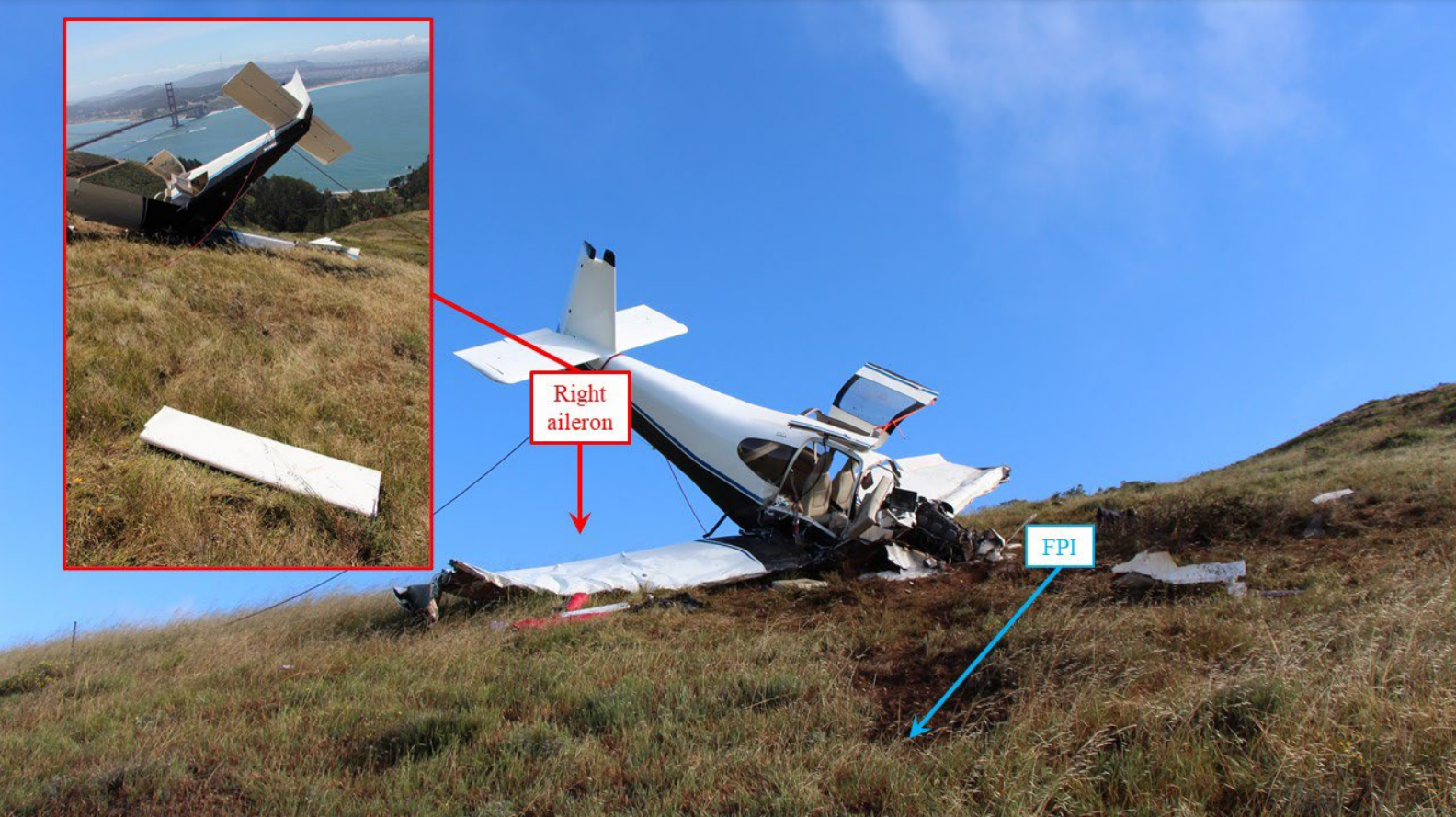
Photo: NTSB
Media:
The NTSB is investigating the crash Friday of an Experimental Vans RV-10 airplane in Sausalito, California.
— NTSB Newsroom (@NTSB_Newsroom) May 7, 2022
Revision history:
| Date/time | Contributor | Updates |
|---|---|---|
| 07-May-2022 00:45 | Geno | Added |
| 07-May-2022 00:47 | Geno | Updated [Narrative] |
| 07-May-2022 00:48 | Geno | Updated [Source] |
| 07-May-2022 04:51 | Captain Adam | Updated [Aircraft type, Registration, Cn, Operator, Location, Phase, Nature, Departure airport, Source, Embed code, Damage, Narrative, Category] |
| 07-May-2022 14:00 | johnwg | Updated [Time, Departure airport, Source, Embed code, Narrative, Category] |
| 24-May-2022 08:30 | Captain Adam | Updated [Time, Departure airport, Destination airport, Source, Narrative] |
| 11-Apr-2024 04:31 | Captain Adam | Updated [Location, Phase, Source, Narrative, Accident report, Photo] |
Corrections or additions? ... Edit this accident description
The Aviation Safety Network is an exclusive service provided by:
Quick Links:
| ASN Home | Send Correction / Feedback |
| FSF Home | Disclaimer | Copyright |
| Contact Us | Privacy Policy |
| Press / Media |
 ©2024 Flight Safety Foundation