ASN Wikibase Occurrence # 278426
This information is added by users of ASN. Neither ASN nor the Flight Safety Foundation are responsible for the completeness or correctness of this information.
If you feel this information is incomplete or incorrect, you can submit corrected information.
| Date: | Saturday 28 May 2022 |
| Time: | 13:47 |
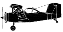
| Type: |  Grumman G-164B Ag-Cat |
| Owner/operator: | Hackberry Flying Service LLC |
| Registration: | N178LB |
| MSN: | 178B |
| Year of manufacture: | 1977 |
| Fatalities: | Fatalities: 1 / Occupants: 1 |
| Aircraft damage: | Destroyed |
| Category: | Accident |
| Location: | near Whiskerville, AR -
 United States of America United States of America
|
| Phase: | Manoeuvring (airshow, firefighting, ag.ops.) |
| Nature: | Agricultural |
| Departure airport: | Beech Grove Airport, AR (PVT) |
| Beech Grove Airport, AR (PVT) | |
| Investigating agency: | NTSB |
| Confidence Rating: |
On May 28, 2022, about 1340 central daylight time, a Grumman American Aviation G-164B airplane, N178LB, was destroyed when it was involved in an accident near Whiskerville, Arkansas. The pilot sustained fatal injuries. The airplane was operated as a Title 14 Code of Federal Regulations Part 137 aerial application flight
The operator reported that the pilot departed for training purposes from the operator’s airstrip near Beech Grove, Arkansas, at 0910, and flew west toward Walnut Ridge, Arkansas. She returned at 1010, refueled the airplane, and flew to the east of Walcott, Arkansas, where she configured her onboard systems and performed several practice aerial application passes over a rice field. The pilot returned to the operator’s airstrip at 1105 and shut down the airplane.
At 1210, another company pilot departed in the airplane and performed an aerial application flight to configure the onboard systems for the pilot. After several aerial application loads, the other company pilot returned to the operator’s airstrip, and the pilot departed in the airplane. She flew the airplane to the rice field she was scheduled to fertilize, located about 1.5 nm southwest of O’Kean, Arkansas. She performed several practice aerial application passes before she returned back to the operator’s airstrip. The hopper was loaded, and the airplane was refueled to about three quarters full of Jet A fuel. The fiberglass hopper had 2,500 lbs of dry product on board. According to the operator, this was the pilot’s first heavy aerial application load.
Shortly before the accident, the operator heard the pilot announce over the company radio frequency, that “I’ve got to land this airplane,” and there were no further radio transmissions from the pilot. The operator classified her tone on the last radio transmission as, “not distraught.” After several attempts to contact the pilot over the radio with no success, a fellow company pilot who was airborne, departed from his current rice field, and flew to the field where the pilot was scheduled to be. He observed black smoke rising in the air before arriving and then observed the wreckage once he arrived on scene.
A witness, who lives about 1.6 nm northwest of the accident site, reported that he was outside working on his farm when he heard the accident airplane flying nearby with a constant engine noise. The engine suddenly either “cut off” or “shut off,” and he heard no further engine noise. The witness believed that the engine “died.” About 5 seconds later, he heard a loud impact noise, and then shortly after he observed black smoke emitting from the accident site. The witness immediately contacted first responders to report the accident. While the witness did not observe the accident sequence, he reported he is familiar with the engine noise emitted from the various turbine-powered airplanes used to provide aerial application services in the area. The witness classified the weather conditions at the time of the accident as clear, the temperature was about 85° F, and the wind originated from the south at about 10 mph.
The airplane came to rest upright on a north to south oriented ditch, in between two large rice fields, about 1.8 nm to the southeast of the rice field and about 3.8 nm northwest of the operator’s airstrip. Based off ground impact marks, the airplane impacted the west side of the ditch, traveled across the area filled with water, and came to rest on the east side of the ditch. A postimpact fire ensued and the wreckage was destroyed. There was no evidence of any obstacle strikes in the area. All major structural airframe components were located at the accident site. The turboprop engine and the metal propeller separated from the airframe and were found buried in the dirt. The wreckage was recovered from the accident site for future examination.
At the time of the accident, the estimated density altitude for the accident site was 1,599 ft above msl.
Sources:
https://www.kait8.com/2022/05/28/plane-crash-lawrence-county/
https://registry.faa.gov/AircraftInquiry/Search/NNumberResult?nNumberTxt=178LB
https://www.airport-data.com/images/aircraft/001/139/001139797.jpg (photo)
https://data.ntsb.gov/carol-repgen/api/Aviation/ReportMain/GenerateNewestReport/105142/pdf
Location
Media:
NTSB is investigating the May 28, 2022, crash of a Grumman G-164B near Whiskerville, Arkansas.
— NTSB Newsroom (@NTSB_Newsroom) May 28, 2022
Revision history:
| Date/time | Contributor | Updates |
|---|---|---|
| 28-May-2022 22:49 | Captain Adam | Added |
| 29-May-2022 06:28 | RobertMB | Updated [Aircraft type, Location, Phase, Nature, Source, Embed code, Damage, Narrative] |
| 29-May-2022 07:02 | harro | Updated [Aircraft type] |
| 31-May-2022 15:02 | Captain Adam | Updated [Registration, Cn, Operator, Location, Phase, Source, Narrative] |
| 02-Jun-2022 00:20 | johnwg | Updated [Time, Location, Source, Narrative] |
| 03-Jun-2022 23:34 | Captain Adam | Updated [Time, Location, Phase, Departure airport, Destination airport, Source, Narrative, Category] |
| 05-Jun-2022 15:40 | johnwg | Updated [Destination airport, Source] |
Corrections or additions? ... Edit this accident description
The Aviation Safety Network is an exclusive service provided by:


 ©2024 Flight Safety Foundation