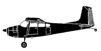
ASN Wikibase Occurrence # 289723
This information is added by users of ASN. Neither ASN nor the Flight Safety Foundation are responsible for the completeness or correctness of this information.
If you feel this information is incomplete or incorrect, you can submit corrected information.
| Date: | Monday 16 September 2013 |
| Time: | 10:26 LT |
| Type: |  Cessna 180 - B |
| Owner/operator: | |
| Registration: | N5112E |
| MSN: | 50412 |
| Year of manufacture: | 1958 |
| Total airframe hrs: | 1914 hours |
| Engine model: | Continental O-470 |
| Fatalities: | Fatalities: 0 / Occupants: 1 |
| Aircraft damage: | Substantial |
| Category: | Accident |
| Location: | Redmond, Oregon -
 United States of America United States of America
|
| Phase: | Landing |
| Nature: | Executive |
| Departure airport: | Prineville, OR (OG21) |
| Redmond-Roberts Field, OR (RDM/KRDM) | |
| Investigating agency: | NTSB |
| Confidence Rating: |
During the approach to the airport, the pilot/owner of the tailwheel-equipped, high-wing airplane obtained the airport conditions via the automated broadcast, which reported the wind direction as "variable," and the wind speed as 3 knots. Per the air traffic control tower controller's instructions, the pilot entered the left downwind leg of the traffic pattern for runway 10; the airplane was subsequently cleared to land. When the airplane was midfield on the downwind leg, the controller advised the pilot that the wind was from 340 degrees at 4 knots. The pilot used full flaps for the final approach and touchdown, which he reported as "normal." However, just after touchdown, a wind gust lifted the left wing, which the pilot was unable to successfully counter with flight control inputs. The airplane ground looped to the left, which damaged the right wing and horizontal stabilizer. The pilot did not report any preimpact mechanical malfunctions or failures with the airplane that would have precluded normal operation.
Review of the wind data revealed that the wind direction at the wind sensor site, which was 5,000 ft east of the accident location, was approximately from the north but changed about 60 degrees in the minute surrounding the time of the landing. The recorded speeds were between 4 and 7 knots. The sensor was located in a flat open area, whereas multiple buildings were located about 700 ft from either side of the accident landing zone, which could affect wind speed and direction in the landing zone. Wind sensor data processing algorithms combined with the distance and differences in surroundings between the wind sensor and the accident location allowed the possibility that the recorded wind values did not accurately represent the wind values experienced by the airplane on landing.
Probable Cause: The pilot's inability to counter an unexpected wind gust after touchdown, which resulted in a loss of directional control.
Accident investigation:
 |
|
Sources:
NTSB WPR13LA414
Location
Revision history:
| Date/time | Contributor | Updates |
|---|---|---|
| 05-Oct-2022 17:31 | ASN Update Bot | Added |
Corrections or additions? ... Edit this accident description
The Aviation Safety Network is an exclusive service provided by:


 ©2024 Flight Safety Foundation