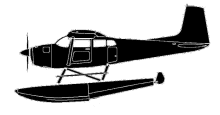
ASN Wikibase Occurrence # 296694
This information is added by users of ASN. Neither ASN nor the Flight Safety Foundation are responsible for the completeness or correctness of this information.
If you feel this information is incomplete or incorrect, you can submit corrected information.
| Date: | Sunday 1 September 2002 |
| Time: | 08:00 LT |
| Type: |  Cessna A185F |
| Owner/operator: | David Renkoski |
| Registration: | N185CF |
| MSN: | 18502676 |
| Year of manufacture: | 1975 |
| Total airframe hrs: | 2599 hours |
| Engine model: | CONTINENTAL IO-520-D |
| Fatalities: | Fatalities: 0 / Occupants: 3 |
| Aircraft damage: | Substantial |
| Category: | Accident |
| Location: | PORT ALSWORTH, Alaska -
 United States of America United States of America
|
| Phase: | Unknown |
| Nature: | Private |
| Departure airport: | PORT ALSWORTH, AK |
| Investigating agency: | NTSB |
| Confidence Rating: |
The private certificated pilot departed a remote lake in a float-equipped airplane, en route to another lake. The route of flight crossed a mountain saddle about 5 miles from the point of departure. After takeoff, the pilot reported that he gained sufficient altitude to clear the mountain saddle. The pilot said that as he crossed the saddle, the airplane encountered a violent downdraft that unexpectedly resulted in a loss of several hundred feet of altitude. He said he was unable to arrest the airplane's descent, and maneuvered the airplane to avoid a low hill. The airplane collided with tree-covered terrain on the side of the mountain, and then nosed over. The pilot indicated he did not obtain a weather briefing. He reported that the weather conditions included unlimited visibility, a temperature of 50 degrees F, a wind of 3 to 5 knots from the north, no precipitation, no turbulence, and little to no wind at the departure point. The area forecast indicated no significant turbulence. The closest official weather observation station was 14 miles away, and a METAR was reporting in part: Wind, calm; visibility, 20 statute miles in light rain; clouds and sky condition, 3,000 feet broken, 5,500 feet overcast; altimeter, 29.91 inHg.
Probable Cause: The pilot's inadequate evaluation of the area weather conditions, and his subsequent inability to maintain terrain clearance upon encountering a downdraft, which resulted in an in-flight collision with tree-covered mountainous terrain. A factor in the accident was a downdraft.
Accident investigation:
 |
|
Sources:
NTSB ANC02LA110
Revision history:
| Date/time | Contributor | Updates |
|---|---|---|
| 14-Oct-2022 09:39 | ASN Update Bot | Added |
Corrections or additions? ... Edit this accident description
The Aviation Safety Network is an exclusive service provided by:


 ©2024 Flight Safety Foundation