ASN Wikibase Occurrence # 308473
This information is added by users of ASN. Neither ASN nor the Flight Safety Foundation are responsible for the completeness or correctness of this information.
If you feel this information is incomplete or incorrect, you can submit corrected information.
| Date: | Sunday 19 February 2023 |
| Time: | 13:35 |
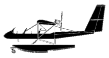
| Type: |  Lockwood AirCam |
| Owner/operator: | Private |
| Registration: | N420PF |
| MSN: | 001 |
| Year of manufacture: | 2022 |
| Fatalities: | Fatalities: 2 / Occupants: 2 |
| Aircraft damage: | Destroyed |
| Category: | Accident |
| Location: | Grass Valley, CA -
 United States of America United States of America
|
| Phase: | Manoeuvring (airshow, firefighting, ag.ops.) |
| Nature: | Private |
| Departure airport: | Grass Valley-Nevada County Air Park, CA (KGOO) |
| Grass Valley-Nevada County Air Park, CA (KGOO) | |
| Investigating agency: | NTSB |
| Confidence Rating: |
On February 19, 2023, about 1335 Pacific standard time, an experimental amateur built amphibious Lockwood Aircraft corporation AirCam, N420PF, was substantially damaged when it was involved in an accident near Grass Valley, California. The pilot and passenger were fatally injured. The airplane was operated as a Title 14 Code of Federal Regulation Part 91 personal flight.
A witness reported the pilot took him on a 25-minute flight and showed him areas of interest near the Nevada County Airport (GOO). The pilot then returned to the airport, dropped off his passenger and picked up the second passenger. The pilot then taxied to the refuel island where he spoke with a helicopter pilot. The helicopter pilot reported that he observed the accident pilot top off the airplane with 100 low lead aviation fuel, and during a conversation, the accident pilot told him that he never flew above 500 feet [above the ground].
Multiple witness reported observing the airplane operating at a low altitude about 150 to 200 feet above ground level (agl) at a speed of about 45 to 50 miles an hour. One witness reported seeing the airplane as it traveled in a straight line, over her house, just above the tree line. She saw the airplane’s wing tilt to the right then the airplane nose-dived straight down.
The airplane impacted terrain in a field surrounded by pine trees about 70 to 80 feet tall. The first point of probable impact was three gouges in the terrain about ten feet west of the main wreckage. The gouges were consistent with the contact made by the nose of the airplane, and the two engines.
The debris field was contained to an area of no more than 50 feet around the wreckage, with one propeller blade outside of that area. The pontoon floats remained attached to the undercarriage and the retractable wheels were found extended. Flight control continuity was confirmed from the control surfaces to the flight controls in the front cockpit.
The wreckage was recovered to a secure facility for further examination.
Sources:
https://www.cbsnews.com/sacramento/news/2-killed-in-plane-crash-west-of-colfax/
https://www.kcra.com/article/nevada-county-plane-crash-fatal-colfax/42980476#
NTSB
FAA
https://registry.faa.gov/AircraftInquiry/Search/NNumberResult?nNumberTxt=420PF
https://flightaware.com/live/flight/N420PF/history/20230219/2139Z/KGOO/L%2039.09354%20-120.99717
https://www.aircam.com/
Location
Media:
NTSB investigating the Feb. 19 crash of an experimental Aircam airplane near Grass Valley, California.
— NTSB Newsroom (@NTSB_Newsroom) February 20, 2023
Revision history:
| Date/time | Contributor | Updates |
|---|
Corrections or additions? ... Edit this accident description
The Aviation Safety Network is an exclusive service provided by:


 ©2024 Flight Safety Foundation