

ASN Wikibase Occurrence # 36866
This information is added by users of ASN. Neither ASN nor the Flight Safety Foundation are responsible for the completeness or correctness of this information.
If you feel this information is incomplete or incorrect, you can submit corrected information.
| Date: | Saturday 30 May 1998 |
| Time: | 16:11 |
| Type: |  Cessna 172RG Cutlass RG |
| Owner/operator: | Take Flight Alaska/Federal Aviation Administration |
| Registration: | N4948V |
| MSN: | 172RG0422 |
| Fatalities: | Fatalities: 2 / Occupants: 2 |
| Aircraft damage: | Destroyed |
| Category: | Accident |
| Location: | near Juneau, AK -
 United States of America United States of America
|
| Phase: | En route |
| Nature: | Training |
| Departure airport: | Petersburg James A. Johnson Airport, AK (PSG) |
| Juneau International Airport, AK (JNU) | |
| Investigating agency: | NTSB |
| Confidence Rating: |
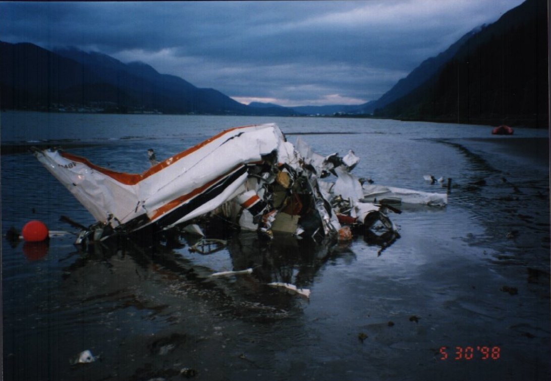
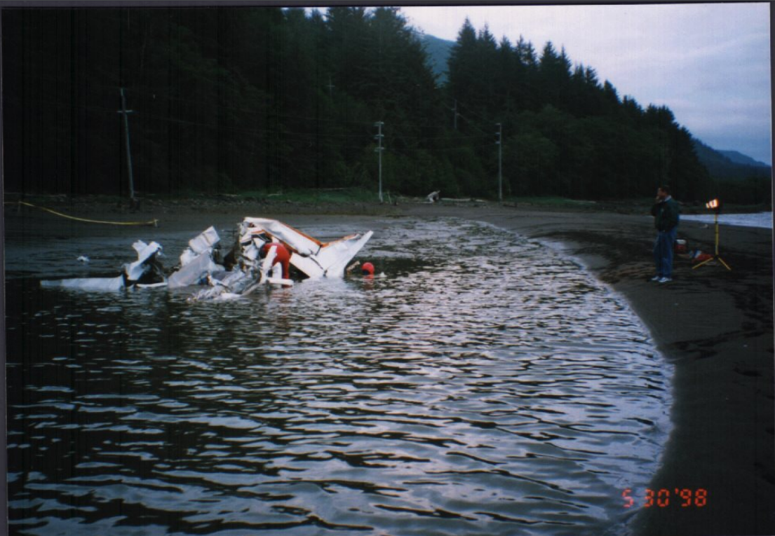
On May 30, 1998, at 1611 Alaska daylight time, an Aerospatiale AS-350-B2 helicopter, N187EH, and a Cessna 172RG airplane, N4948V, collided in midair, approximately four miles southeast of downtown Juneau, Alaska. The helicopter sustained substantial damage to the right-side doors and fuselage. The commercial pilot and four passengers were not injured. The remaining helicopter passenger sustained serious injuries. The helicopter made an emergency landing at a mine site about 1/2 mile north of the collision point. The airplane impacted the water in the Gastineau Channel, about one mile west of the collision point, and was destroyed. The airplane's private pilot, seated in the left seat, and the commercial pilot/flight instructor, who was seated in the right-front seat, both sustained fatal injuries. Visual meteorological conditions prevailed at the time of the accident. A company flight plan was on file for the helicopter, and a VFR flight plan had been filed by the airplane pilot.
The air tour helicopter was at 2,100 feet msl, and had just crossed a salt water channel when it collided with the airplane. The helicopter landed with substantial damage, and one injured passenger. The airplane was destroyed when it impacted water in the channel, and both pilotrated occupants were fatally injured. An 18-inch portion of the airplane's right wing remained attached to the helicopter. None of the occupants of the helicopter saw the airplane prior to collision. The helicopter was on a standard tour route utilized by the company, and published in an FAA advisory pamphlet which the airplane occupants also had on board. The collision occurred at a location where the advised traffic route inbound to the Juneau airport crossed the helicopter's air tour route. The helicopter had completed crossing the channel, and was 100 feet above the upper limit of the recommended altitude for the crossing. The airplane was 100 feet above the lower limit of the recommended altitude for aircraft traveling west. This area has a high volume of VFR air tour, air taxi, and general aviation traffic. The area is uncontrolled, Class G, airspace, with no radar coverage. The helicopter pilot described the visibility as good. The helicopter pilot made traffic advisory radio transmissions on the common traffic advisory frequency (CTAF) for the area of the collision. This frequency was published in the Alaska Supplement, the FAA advisory pamphlet for the area, and the VFR sectional aeronautical chart. The airplane's radios were not tuned to this frequency. The helicopter was illuminated with pulsating landing lights, and high visibility strobes. The airplane was configured with high visibility strobe lights on the wing tips, and two, nose-mounted landing/taxi lights, and a red anti-collision beacon on the tail. The control switches for the anti-collision beacon was found 'ON.' The control switch for the strobe lights was found in the 'OFF' position. The position of the landing/taxi lights could not be determined. Neither pilot in the airplane had any record of flight experience in the Juneau area.
Probable Cause: The failure of both command pilots to maintain an adequate lookout to see and avoid each other's aircraft. Factors associated with the accident were the other pilot's failure to follow published advisory procedures to monitor/issue position reports on the appropriate radio frequency, and his lack of familiarity with the geographic area.
Accident investigation:
 |
|
Sources:
NTSB
Images:
Photos: NTSB
Revision history:
| Date/time | Contributor | Updates |
|---|---|---|
| 24-Oct-2008 10:30 | ASN archive | Added |
| 21-Dec-2016 19:23 | ASN Update Bot | Updated [Time, Damage, Category, Investigating agency] |
| 13-Oct-2022 21:32 | Captain Adam | Updated [Aircraft type, Operator, Nature, Departure airport, Destination airport, Source, Narrative, Category, Accident report, Photo] |
| 13-Oct-2022 21:32 | Captain Adam | Updated [Photo] |
Corrections or additions? ... Edit this accident description
The Aviation Safety Network is an exclusive service provided by:
Quick Links:
| ASN Home | Send Correction / Feedback |
| FSF Home | Disclaimer | Copyright |
| Contact Us | Privacy Policy |
| Press / Media |
 ©2024 Flight Safety Foundation