

ASN Wikibase Occurrence # 45305
This information is added by users of ASN. Neither ASN nor the Flight Safety Foundation are responsible for the completeness or correctness of this information.
If you feel this information is incomplete or incorrect, you can submit corrected information.
| Date: | Thursday 23 January 2003 |
| Time: | 20:37 |
| Type: |  Piper PA-28R-200 Cherokee Arrow II |
| Owner/operator: | Air West Flight Center Inc |
| Registration: | N106AW |
| MSN: | 28R-7535202 |
| Year of manufacture: | 1975 |
| Total airframe hrs: | 6544 hours |
| Engine model: | Lycoming IO-360-C1C |
| Fatalities: | Fatalities: 4 / Occupants: 4 |
| Aircraft damage: | Destroyed |
| Category: | Accident |
| Location: | La Sal, UT -
 United States of America United States of America
|
| Phase: | En route |
| Nature: | Private |
| Departure airport: | Longmont Airport, CO (2V2) |
| Las Vegas-North Las Vegas Airport, NV (VGT/KVGT) | |
| Investigating agency: | NTSB |
| Confidence Rating: |
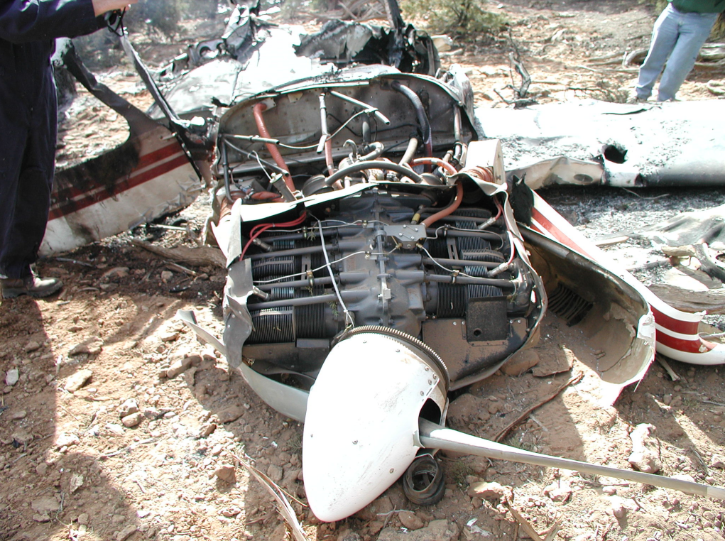
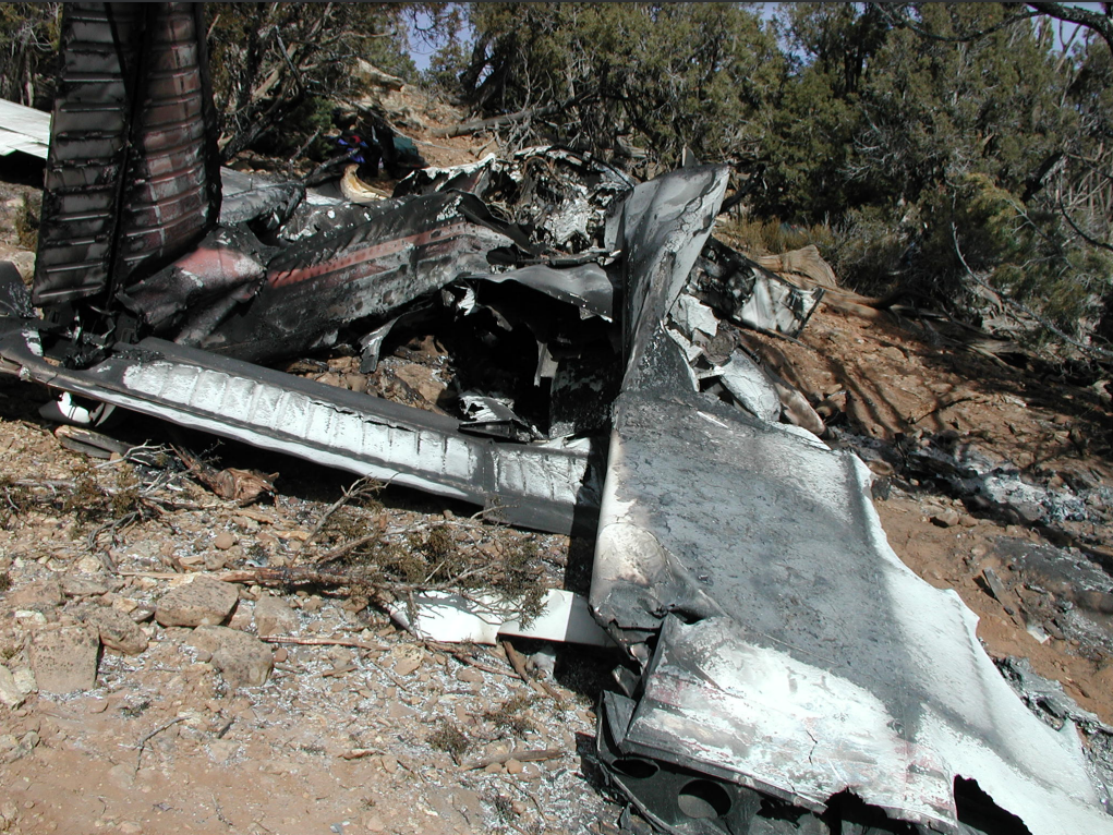
On January 23, 2003, at 2037 mountain standard time, a PA-28R-200, N106AW, was destroyed when it impacted terrain during a night forced landing attempt near La Sal, Utah. A postimpact fire ensued. The non-instrument rated private pilot and her three passengers were fatally injured. Air West Flight Center Inc., Longmont, Colorado, was operating the airplane under Title 14 CFR Part 91. Visual meteorological conditions prevailed for the personal, night, cross-country flight that originated from Longmont, Colorado, at 1657. The pilot had filed and opened a VFR flight plan with a destination of Las Vegas, Nevada (VGT).
The non-instrument rated private pilot (approximately 140 hours of flight experience) filed a night VFR flight plan [in a complex airplane] for 15,500 feet, a cruising airspeed of 140 knots, a time en route of 4 hours, and 8 hours of fuel onboard. The pilot did not have a complex airplane endorsement. The airplane was non pressurized, and no supplemental oxygen was onboard. The airplane manufacturer’s representative calculated the flight to require 5 hour, 25 minutes (with no wind), which was 25 minutes longer than the maximum estimated capability of the airplane. Radar data indicates that the pilot flew above 12,500 feet for 2 hours, 17 minutes, above 14,000 feet for 1 hours, 49 minutes, and at approximately 16,000 feet for an estimated 45 minutes. At approximately 3 hours and 40 minutes (352 nm) into the flight, the pilot declared a "Mayday." Radar data indicates that the airplane departed 14,800 feet, and descended through 9,800 feet at approximately 1,077 feet per minute. The radar data showed the airplane in a straight flight track until it descended below radar coverage; the airplane's impact ground scar of approximately 280 degrees was aligned with this flight track. The engine fuel burn calculations suggest that 10 to 15 gallons of fuel were in the airplane at the time of the accident. An examination of the wreckage showed the left wing attached to the fuselage and resting up hill. The cockpit area, forward fuselage, and right wing were broken, charred, and consumed by fire. The extent of thermal damage to the fuselage suggested that fuel assisted in the conflagration. An examination of the engine and other airplane systems revealed no anomalies.
Probable Cause: the loss of engine power (total) due to fuel starvation, the pilot not following procedures/directives (fuel management procedures), and the pilot's inadequate preflight planning/preparation for the flight. Contributing factors were the pilot's inadequately equipping the airplane (lack of supplemental oxygen), the pilot's hypoxic physical impairment, and the pilot's total lack of experience in type of operation.
Accident investigation:
 |
|
Sources:
NTSB: https://www.ntsb.gov/_layouts/ntsb.aviation/brief.aspx?ev_id=20030205X00165&key=1
Location
Images:
Revision history:
| Date/time | Contributor | Updates |
|---|---|---|
| 28-Oct-2008 00:45 | ASN archive | Added |
| 21-Dec-2016 19:24 | ASN Update Bot | Updated [Time, Damage, Category, Investigating agency] |
| 08-Dec-2017 18:01 | ASN Update Bot | Updated [Operator, Source, Narrative] |
| 26-Aug-2023 17:01 | Captain Adam | Updated [[Operator, Source, Narrative]] |
Corrections or additions? ... Edit this accident description
The Aviation Safety Network is an exclusive service provided by:
Quick Links:
| ASN Home | Send Correction / Feedback |
| FSF Home | Disclaimer | Copyright |
| Contact Us | Privacy Policy |
| Press / Media |
 ©2024 Flight Safety Foundation