

ASN Wikibase Occurrence # 45474
This information is added by users of ASN. Neither ASN nor the Flight Safety Foundation are responsible for the completeness or correctness of this information.
If you feel this information is incomplete or incorrect, you can submit corrected information.
| Date: | Thursday 1 August 2002 |
| Time: | 08:55 |
| Type: |  Piper PA-28-180 Cherokee |
| Owner/operator: | Glenwood Flyers LLC |
| Registration: | N6444J |
| MSN: | 28-4862 |
| Year of manufacture: | 1968 |
| Total airframe hrs: | 2755 hours |
| Engine model: | Lycoming O-360-A4A |
| Fatalities: | Fatalities: 2 / Occupants: 4 |
| Aircraft damage: | Destroyed |
| Category: | Accident |
| Location: | Gypsum, CO -
 United States of America United States of America
|
| Phase: | Manoeuvring (airshow, firefighting, ag.ops.) |
| Nature: | Private |
| Departure airport: | Vail-Eagle County Airport, CO (EGE/KEGE) |
| Idaho Falls-Fanning Field, ID (IDA/KIDA) | |
| Investigating agency: | NTSB |
| Confidence Rating: |
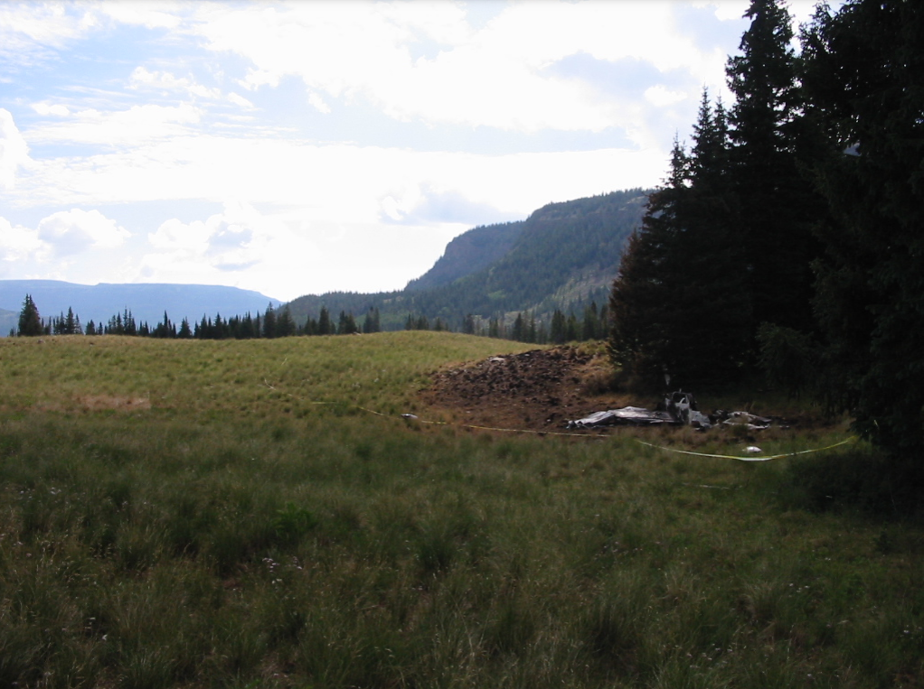
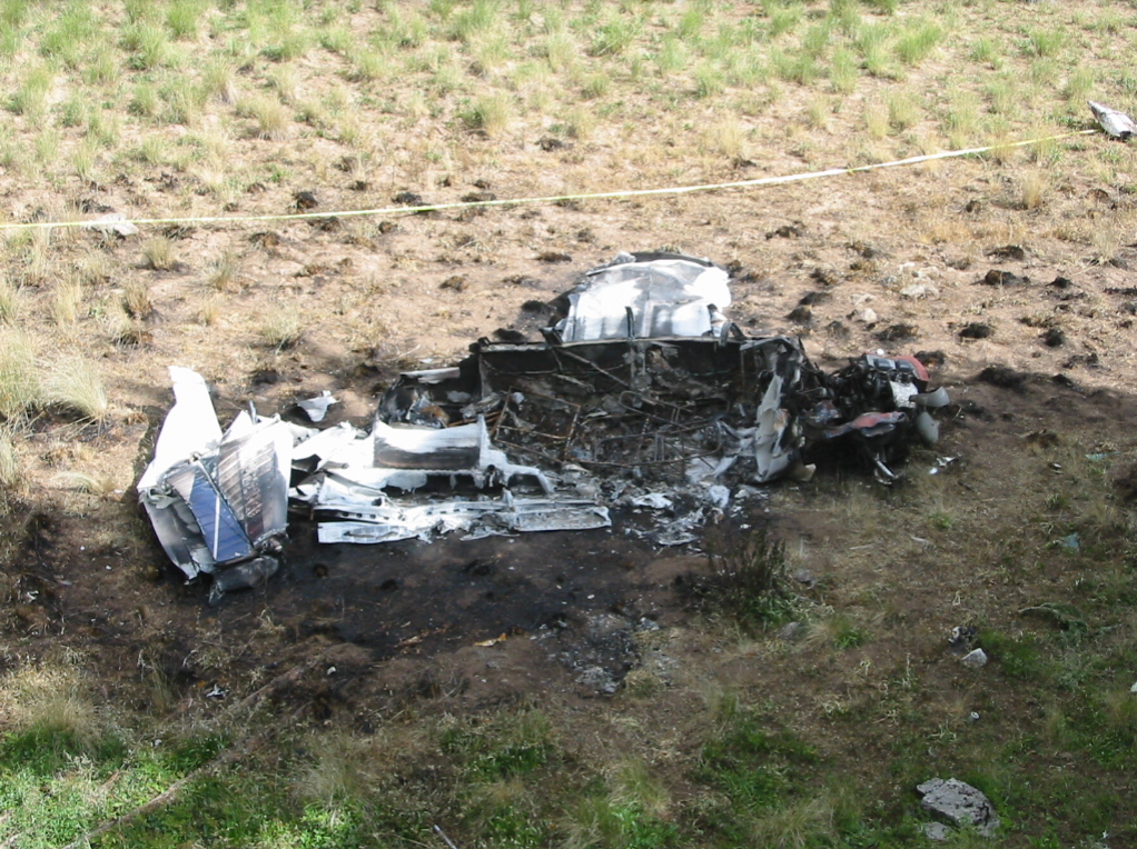
On August 1, 2002, approximately 0855 mountain daylight time, a Piper PA-28-180 airplane, N6444J, impacted the terrain while maneuvering near Gypsum, Colorado. The private pilot and one passenger sustained serious injuries and two passengers sustained fatal injuries. The airplane was registered to and operated by the Glenwood Flyers L.L.C. of Glenwood Springs, Colorado. Visual meteorological conditions prevailed, and a visual flight rules (VFR) flight plan was filed for the 14 Code of Federal Regulations Part 91 personal flight. The flight departed the Eagle Regional Airport (EGE), Eagle, Colorado, approximately 0840, and was destined for Idaho Falls, Idaho.
Approximately 19 nm northwest of the departure airport (elevation 6,535 feet), the airplane impacted the rising mountainous terrain at an elevation of 10,050 feet. Prior to departure, the pilot calculated the airplane's gross weight to be approximately 2,270 pounds (maximum gross weight 2,400). After a takeoff roll of approximately 5,000 feet, the airplane departed the runway, and the pilot executed a right turn toward the rising terrain. Approximately 5 minutes into the flight, the right front seat passenger commented to the pilot that "we're going kinda low." The pilot stated that after climbing about 10 to 15 minutes up a valley, he noticed that the vertical climb rate had decreased to about 100-200 feet per minute, which was half the climb rate that he expected at full throttle power. During the impact with the terrain, the fuel tanks ruptured and the airplane was destroyed by a post-impact fire. The engine was test run according to the manufacturer specifications. No discrepancies or anomalies were noted during the engine test run that would indicate the engine was not capable of operating and producing power prior to the accident. No anomalies or discrepancies were noted with the airframe. The density altitude at the accident site was calculated to be approximately 12,000 feet.
Probable Cause: The pilot's failure to perform remedial action and maintain clearance with the rising mountainous terrain. Contributing factors were the pilot's poor planning/decision, the rising terrain, and the high density altitude.
Accident investigation:
 |
|
Sources:
NTSB: https://www.ntsb.gov/_layouts/ntsb.aviation/brief.aspx?ev_id=20020808X01340&key=1
Location
Images:
Revision history:
| Date/time | Contributor | Updates |
|---|---|---|
| 28-Oct-2008 00:45 | ASN archive | Added |
| 21-Dec-2016 19:24 | ASN Update Bot | Updated [Time, Damage, Category, Investigating agency] |
| 09-Dec-2017 17:18 | ASN Update Bot | Updated [Source, Narrative] |
Corrections or additions? ... Edit this accident description
The Aviation Safety Network is an exclusive service provided by:
Quick Links:
| ASN Home | Send Correction / Feedback |
| FSF Home | Disclaimer | Copyright |
| Contact Us | Privacy Policy |
| Press / Media |
 ©2024 Flight Safety Foundation