

ASN Wikibase Occurrence # 45650
This information is added by users of ASN. Neither ASN nor the Flight Safety Foundation are responsible for the completeness or correctness of this information.
If you feel this information is incomplete or incorrect, you can submit corrected information.
| Date: | Friday 25 January 2002 |
| Time: | 17:10 |
| Type: |  Ted Smith Aerostar 601P |
| Owner/operator: | Private |
| Registration: | N104CS |
| MSN: | 61P-0404-141 |
| Total airframe hrs: | 1780 hours |
| Engine model: | Lycoming IO-540 |
| Fatalities: | Fatalities: 2 / Occupants: 2 |
| Aircraft damage: | Destroyed |
| Category: | Accident |
| Location: | Chittenden, VT -
 United States of America United States of America
|
| Phase: | En route |
| Nature: | Private |
| Departure airport: | Johnstown Airport, PA (JST/KJST) |
| Rutland Airport, VT (RUT/KRUT) | |
| Investigating agency: | NTSB |
| Confidence Rating: |
The airplane collided with mountainous terrain during approach to the destination airport. While approaching the airport, the pilot requested vectors for a localizer approach to runway 19. Due to traffic, air traffic control (ATC) issued the pilot a holding clearance. The airplane was approaching the holding fix about 8,000 feet, when the pilot advised ATC that the airplane was picking up a little ice. ATC initially offered an amended clearance of 9,000 feet, but the pilot declined. Subsequently, he accepted the clearance and climbed back to 9,000 feet. ATC then told the pilot that after one more airplane had landed, he would be issued an approach clearance. The airplane was about 9,200 feet when the pilot replied "thank you." Review of radar data revealed that the accident airplane made one complete 360-degree turn, and one 270-degree turn on the non-holding side of the published holding pattern. During the two turns, the airplane descended to approximately 8,400 feet, climbed to 8,900 feet, then descended again to 8,300 feet. The two turns were tighter than the expected standard 2-minute turns in a holding pattern, with radii ranging from 0.3 to 0.4 nautical miles and 0.1 to 0.2 nautical miles respectively. Following the two holding turns, no more radio transmissions or radar returns were received by ATC. Examination of the wreckage did not reveal any pre-impact mechanical malfunctions. Another pilot flying in the area reported moderate rime ice at 8,000 feet, but added that he climbed out of the ice and was between cloud layers at 9,000 to 10,000 feet.
Probable Cause: The pilot's failure to maintain aircraft control while holding.
Accident investigation:
 |
|
Sources:
NTSB: https://www.ntsb.gov/_layouts/ntsb.aviation/brief.aspx?ev_id=20020205X00188&key=1
Location
Images:
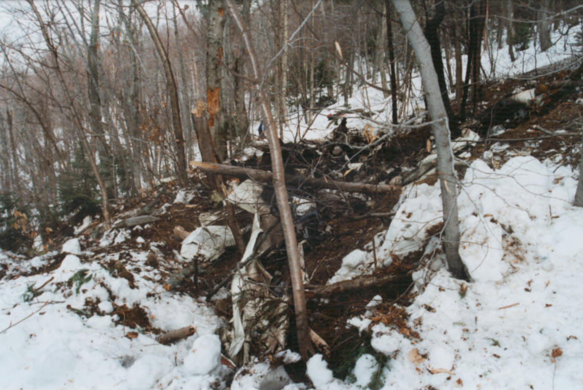
Photo: NTSB
Revision history:
| Date/time | Contributor | Updates |
|---|---|---|
| 28-Oct-2008 00:45 | ASN archive | Added |
| 21-Dec-2016 19:24 | ASN Update Bot | Updated [Time, Damage, Category, Investigating agency] |
| 09-Dec-2017 15:23 | ASN Update Bot | Updated [Operator, Source, Narrative] |
| 22-May-2022 21:35 | Captain Adam | Updated [Operator, Departure airport, Destination airport, Narrative, Category, Accident report, Photo] |
Corrections or additions? ... Edit this accident description
The Aviation Safety Network is an exclusive service provided by:
Quick Links:
| ASN Home | Send Correction / Feedback |
| FSF Home | Disclaimer | Copyright |
| Contact Us | Privacy Policy |
| Press / Media |
 ©2024 Flight Safety Foundation