ASN Wikibase Occurrence # 65473
| Date: | Tuesday 9 June 2009 |
| Time: | 16:32 |
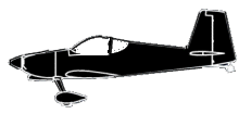
| Type: |  Van's RV-7 |
| Owner/operator: | Private |
| Registration: | N303BK |
| MSN: | 72753 |
| Total airframe hrs: | 147 hours |
| Engine model: | AMA/EXPR IO-360-M1 |
| Fatalities: | Fatalities: 2 / Occupants: 2 |
| Aircraft damage: | Substantial |
| Category: | Accident |
| Location: | near Elim, AK -
 United States of America United States of America
|
| Phase: | En route |
| Nature: | Private |
| Departure airport: | Galena, AK (GAL) |
| Nome, AK (OME) | |
| Investigating agency: | NTSB |
| Confidence Rating: |
The pilot departed on a visual flight rules cross-country flight on a route that passed near a small coastal town and uncontrolled airport. Witnesses at the coastal town reported low clouds, fog, and poor visibility in the area just before the accident. They also saw and heard an airplane flying very low over their town, which was at a lower elevation than the airport. One witness estimated that the airplane was only a few feet above power lines, or about 30 feet above ground level. The witnesses noted that the airplane flew over the airport and village twice and, during the last pass, turned north toward the top of a hill and the crash site. They indicated that the engine sound was steady.
Data from a global positioning system unit found in the wreckage depicted the airplane's track from departure to the accident site. Near the accident airport, the track was along a meandering path that crossed itself and had several course reversals. Images from weather cameras at the accident airport indicated that the visibility was less than 1 mile. The pilot did not have an instrument rating. No record was found that the pilot had received a weather briefing prior to the flight. A postaccident inspection of the airplane disclosed no evidence of any preaccident mechanical anomalies.
Given the poor weather conditions, witness reports, the meandering flight path near the airport, the pilot's lack of an instrument rating, and the absence of any mechanical problems with the airplane, it is likely the pilot flew into instrument meteorological weather conditions while attempting to locate the runway and collided with rising terrain near the airport.
Probable Cause: The pilot's continued visual flight into instrument meteorological conditions, which resulted in an in-flight collision with terrain.
Accident investigation:
 |
|
Sources:
NTSB
Location
Revision history:
| Date/time | Contributor | Updates |
|---|---|---|
| 11-Jun-2009 00:57 | slowkid | Added |
| 21-Dec-2016 19:25 | ASN Update Bot | Updated [Time, Damage, Category, Investigating agency] |
| 11-Sep-2017 05:32 | junior sjc | Updated [Location, Nature, Departure airport, Narrative] |
| 02-Dec-2017 15:36 | ASN Update Bot | Updated [Operator, Other fatalities, Nature, Departure airport, Destination airport, Source, Narrative] |
The Aviation Safety Network is an exclusive service provided by:


 ©2024 Flight Safety Foundation